Waterfall located in the Blue Ridge Mountains of North Carolina, the falls move in several distinct steps, beginning in a twin set of upper falls, moving down a small gorge, and culminating in a high-volume 45-foot (14 m) drop
General Information
March to April: 7am to 8pm
May to August: 7am to 10pm
September to October: 7am to 9pm
Closed Christmas Day
How to Get There
Overview
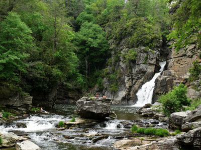
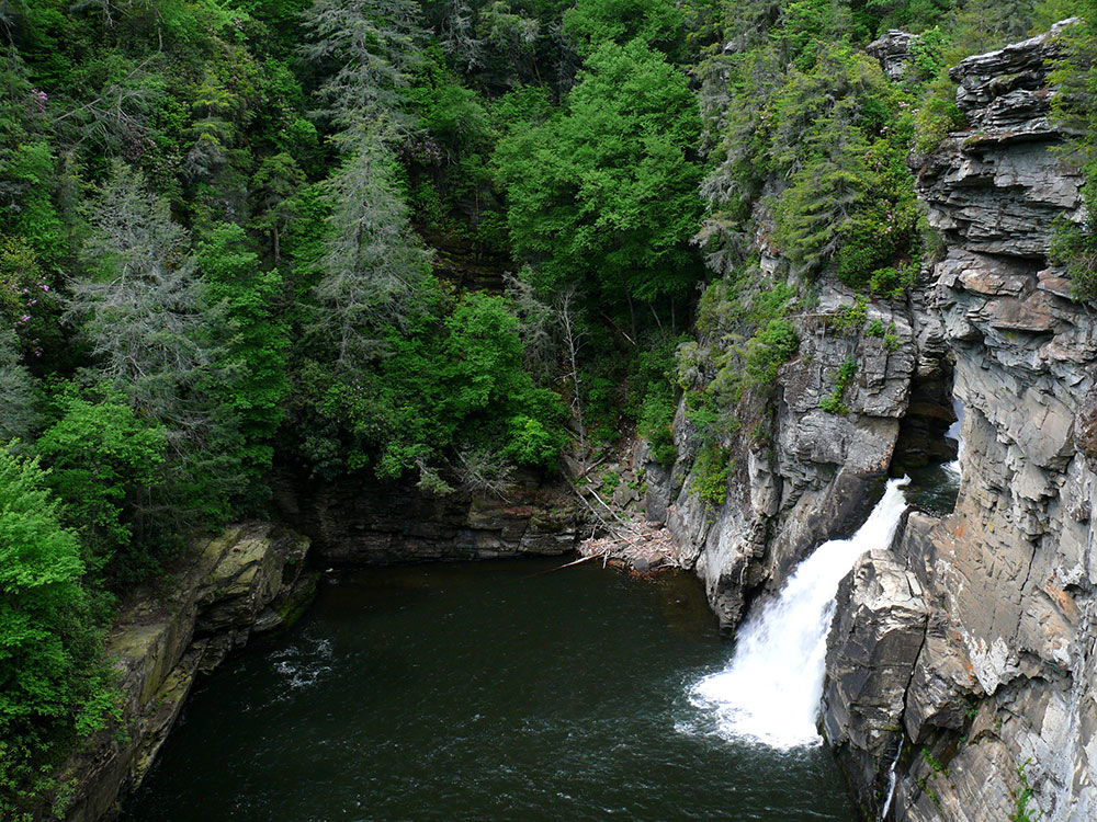
Linville Falls is a waterfall located in the Blue Ridge Mountains of North Carolina. The falls move in several distinct steps, beginning in a twin set of upper falls, moving down a small gorge, and culminating in a high-volume 45-foot (14 m) drop.
It is named for the Linville River, which goes over the falls. Linville Falls has the highest volume of any waterfall on the Northern Edge of the Blue Ridge Mountains.
Linville Falls marks the beginning of the Linville Gorge, which is formed by the Linville River, which continues on after the falls before finally ending near Lake James.
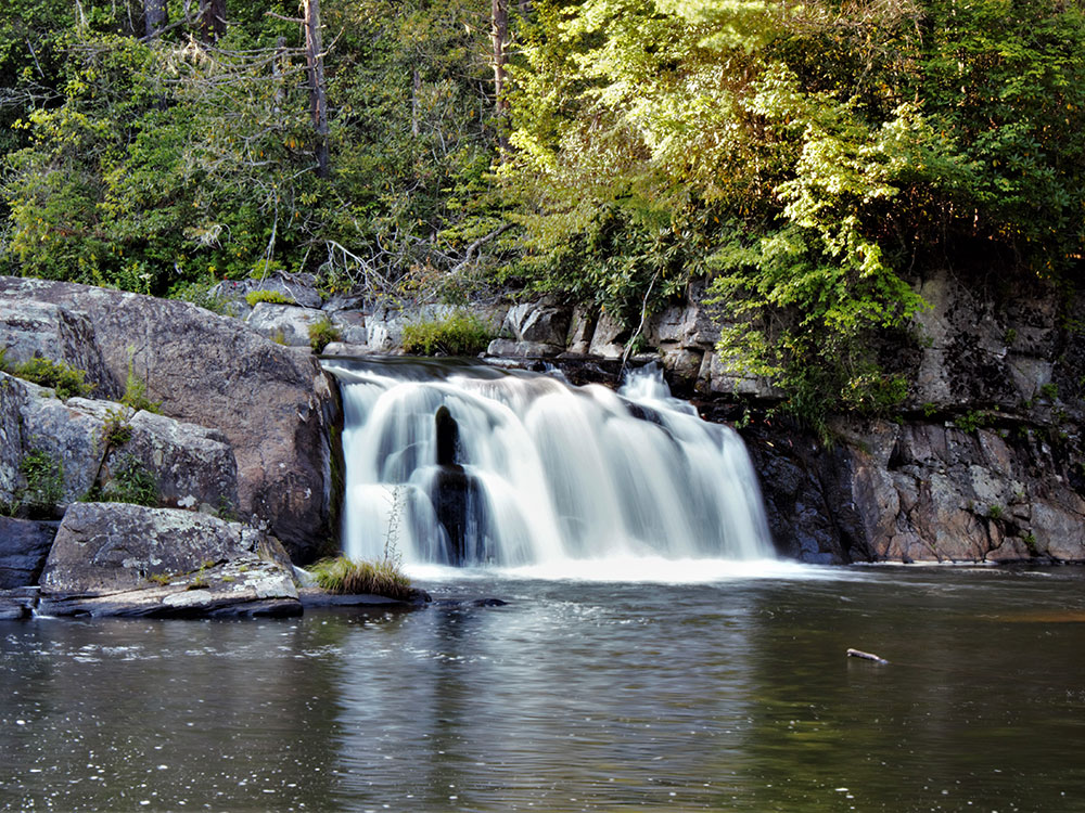
The falls is owned by the National Park Service, which operates a visitor center and several miles of non-handicapped accessible trails with 4 overlooks for the falls. The 0.5-mile (0.80 km) Upper Falls trail leads to the top of the falls, where visitors can see the small twin upper falls and the water spiraling through a small canyon on its way to the main falls.
The Erwin's View trail leads to 2 overlooks, the Chimney View overlook (0.7 miles) and the Erwin's View overlook (0.8 miles). The 0.5-mile (0.80 km) Plunge Basin Trail leads to the Plunge Basin Overlook, which provides a view of the falls from the other side of the river. Finally, the 0.7-mile (1.1 km) Gorge Trail, which branches off from the Plunge Basin trail, leads to an area near the foot of the falls.
Swimming is unsafe above the falls but is safe in the big pool below the falls
This article uses material from the Wikipedia article "Linville Falls", which is released under the Creative Commons Attribution-Share-Alike License 3.0
