National Parkway and All-American Road, noted for its scenic beauty, is America's longest linear park, running 469 miles (755 km) through 29 Virginia and North Carolina counties, linking Shenandoah National Park to Great Smoky Mountains National Park
General Information
March to April: 7am to 8pm
May to August: 7am to 10pm
September to October: 7am to 9pm
Closed Christmas Day
How to Get There
Head east on S Pack Square toward S Market St. Turn left onto S Market St. Turn right onto College St. At the traffic circle, continue straight to stay on College St. Turn left onto NC-694 N/Town Mountain Rd. Turn left onto Blue Ridge Pkwy. Turn left onto NC-128
Overview
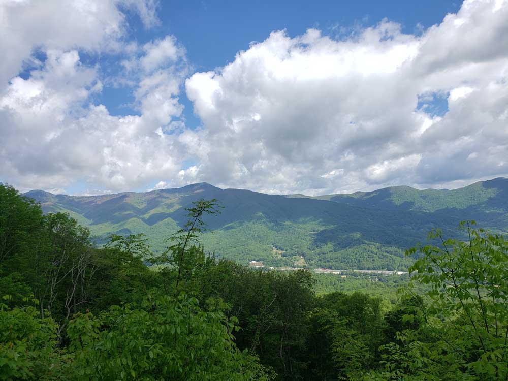
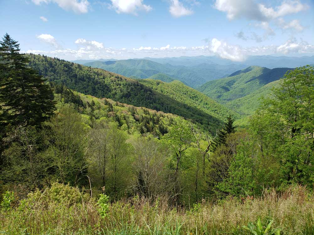
The Blue Ridge Parkway is a National Parkway and All-American Road, noted for its scenic beauty. The parkway, which is America's longest linear park, runs for 469 miles (755 km) through 29 Virginia and North Carolina counties, linking Shenandoah National Park to Great Smoky Mountains National Park. It runs mostly along the spine of the Blue Ridge, a major mountain chain that is part of the Appalachian Mountains. Its southern terminus is at U.S. Route 441 (US 441) on the boundary between Great Smoky Mountains National Park and the Qualla Boundary of the Eastern Band of Cherokee Indians in North Carolina, from which it travels north to Shenandoah National Park in Virginia. The roadway continues through Shenandoah as Skyline Drive, a similar scenic road which is managed by a different National Park Service unit. Both Skyline Drive and the Virginia portion of the Blue Ridge Parkway are part of Virginia State Route 48 (SR 48), though this designation is not signed.
The parkway has been the most visited unit of the National Park System every year since 1946 except four (1949, 2013, 2016 and 2019). Land on either side of the road is owned and maintained by the National Park Service, and in many places parkway land is bordered by United States Forest Service property. There is no fee for using the parkway. The roadway is not maintained in the winter, and sections that pass over especially high elevations and through tunnels are often impassable and therefore closed from late fall through early spring. Weather is extremely variable in the mountains, so conditions and closures often change rapidly. The speed limit is never higher than 45 mph (72 km/h) and lower in some sections.
In addition to the road, the parkway has a folk art center located at mile marker 382 and a visitor center located at mile marker 384, both near Asheville, North Carolina. There are also numerous parking areas at trailheads for the various hiking trails that intersect the parkway, and several campgrounds located along the parkway allow for overnight stays. The Blue Ridge Music Center (also part of the park) is located in Galax, and Mount Mitchell (the highest point in eastern North America) is only accessible via a state highway (NC 128) from the parkway at milepost 355.4.
The parkway runs from the southern terminus of Shenandoah National Park's Skyline Drive in Virginia at Rockfish Gap to U.S. Route 441 (US 441) at Oconaluftee in the Great Smoky Mountains National Park near Cherokee, North Carolina. In terms of design, the parkway is an undivided two-lane expressway for most of its route; access to the parkway is controlled via interchanges with local roads and state/US highways. It crosses (but does not interchange with) several interstate highways along its route and is carried across streams, railway ravines and cross roads by 168 bridges and six viaducts. Frequent pull-offs, rest areas, and scenic overlooks line the sides of the road. As it is rarely the fastest or most convenient route for travelers, and it avoids population centers, the road and its vistas is designed to be the attraction itself, rather than a merely a means of efficient travel. The use of interchanges and grade separation at cross roads is designed to allow for freer flowing traffic and better vistas than frequent intersections and stoplights would allow for.
The parkway uses short side roads to connect to other highways, and there are no direct interchanges with Interstate Highways, making it possible to enjoy wildlife and other scenery without stopping for cross-traffic. Mileposts along the parkway start at zero at the northeast end in Virginia and count to 469 at the southern end in North Carolina. The mileposts can be found on the right-hand side of the road while traveling southbound on the parkway. Major towns and cities along the way include Waynesboro, Roanoke, and Galax in Virginia; and in North Carolina, Boone and Asheville, where it runs across the property of the Biltmore Estate. The Blue Ridge Parkway tunnels were constructed through the rock—one in Virginia and 25 in North Carolina.
- Mile 0 Rockfish Gap near Waynesboro, Virginia, is the northern end of the Blue Ridge Parkway. To the north the parkway connects directly to Skyline Drive, which winds 105 miles (169 km) through Shenandoah National Park.
- 5 to 9.3 Humpback Rock has a self-guiding trail through a collection of old Appalachian farm buildings. A hiking trail from the parking area (at mile 6.1) leads 0.75 miles (1.21 km) to The Rocks, whose humped appearance gives the area its name. Greenstone self-guiding trail (8.8).
- 10.7 Ravens Roost offers vistas of Torry Mountain and the Shenandoah Valley to the west. The overlook is built above a cliff, so it is frequently used for rock climbing and hang gliding. There is also a single picnic table.
- 16 Sherando Lake is a recreation area in George Washington National Forest 4.5 miles (7.2 km) from the parkway via VA 814. Swimming, picnicking, and camping.
- 29 Whetstone Ridge provided many a mountain man with a fine-grained sharpening stone.
- 34.4 Yankee Horse Ridge supposedly is where a hard-riding Union soldier's horse fell and had to be shot. A reconstructed spur of an old logging railroad provides access to Wigwam Falls.
- 58 to 63.6 Otter Creek runs 10 miles (16 km) down the Blue Ridge to the James River. Otter Lake (63.1), fishing, trail.
- 63.8 The James River and Kanawha Canal is where a footbridge leads across the river to the restored canal locks and exhibits. A self-guiding trail follows the river bluff.
- 71 Onion Mountain's short loop trail leads through rhododendron and mountain laurel.
- 83.4 Fallingwater Cascades can be seen along a 1.6-mile (2.6 km) loop trail.
- 84 to 87 Peaks of Otter are three mountain peaks which have been popular viewing sites since the days of Thomas Jefferson. A shuttle bus provides service to Sharp Top.
- 114.9 The Roanoke River Gorge is visible after a short walk.
- 120.4 Roanoke Mountain is a 3.7-mile (6.0 km) side trip. A one-way loop road, with steep grades, crosses over the mountain. Towed vehicles are prohibited.
- 129.6 Roanoke Valley Overlook gives a view of the largest city along the parkway.
- 154.5 Smart View is named for having "a right smart view". A nearby cabin built in the 1890s is known as a spot for viewing dogwood blooms in early May.
- 167 to 174 Rocky Knob overlooks Rock Castle Gorge.
- 176.1 Mabry Mill was operated by E.B. Mabry from 1910 to 1935. A trail leads to his gristmill, sawmill, blacksmith shop, and other exhibits. Old-time skills are demonstrated in the summer and fall.
- 188.8 Groundhog Mountain has a variety of rural fences: snake, Post-and-rail, picket and buck. Picnic grounds and observation tower are also nearby.
- 189.1 Groundhog Mountain
- 189.9 Aunt Orelena Puckett Cabin Exhibit was the home of an area midwife.
- 213 Blue Ridge Music Center near the town of Galax with concerts, music demonstrations, and a 17,000-square-foot (1,600 m2) museum dedicated to anything musical, especially old-time music.
- Mile 217.5 Cumberland Knob, at 2,885 feet (879 m), is the centerpiece of a small parkway recreation area.
- 218.6 Fox Hunters Paradise, down a short walking path, is where hunters could listen to their hounds baying in the valley below.
- 238.5 Brinegar Cabin was built by Martin Brinegar about 1880 and lived in until the 1930s when the homestead was purchased from his widow for the parkway. The original cabin stands there today.
- 238.5 to 244.7 Doughton Park was named for Congressman Robert L. Doughton, a staunch supporter and neighbor of the parkway. The park has many miles of hiking trails, a lodge, dinner, picnic area and a campground.
- 258.6 Northwest Trading Post offers crafts from North Carolina's northwestern counties.
- 260.6 Jumpinoff Rock is at the end of a short woodland trail.
- 264.4 The Lump is a grassy knob that provides views of the forested foothills.
- 272 E. B. Jeffress Park has a self-guided trail to a waterfall known as the Cascades. Another trail goes to an old cabin and church.
- 285.1 Daniel Boone's Trace, which Boone blazed to the West, crosses near here.
- 292 to 295 Moses H. Cone Memorial Park has hiking, fishing and horse trails. Flat Top Manor, the former house of Moses H. Cone, is now used as the Parkway Craft Center.
- 295.1 to 298 Julian Price Memorial Park, the former retreat of the insurance executive Julian Price, offers a variety of hiking trails, campground, and 47-acre (190,000 m2) Price Lake. This is the only lake on the parkway on which paddling is allowed.
- 304.4 Linn Cove Viaduct, the last segment of the parkway built, skirts the side of Grandfather Mountain. A visitor center is located nearby and provides access to a trail under the viaduct.
- 308.3 Flat Rock provides views of Grandfather Mountain and Linville Valley.
- 316.3 Linville Falls Recreation Area provides trails with overlooks of Linville Falls and the Linville Gorge. A campground and picnic area are also provided.
- 331 The Museum of North Carolina Minerals interprets the state's mineral wealth.
- 339.5 Crabtree Meadows & Crabtree Falls is a parkway recreation area with a picnic area, campground, giftshop and hiking trails.
- 349.2 Laurel Knob provides views of Grandfather Mountain, Linville Mountain, Hawksbill Mountain, and Table Rock.
- 355.4 Mount Mitchell State Park, reached via NC 128, is the highest point east of the Mississippi River.
- 359.8 Walker Knob, formerly known as Balsam Gap, is located where the Black Mountains and the Great Craggy Mountains meet.
- 361.2 Glassmine Falls is an 800-foot (240 m) ephemeral waterfall visible from an overlook on the side of the parkway.
- 363.4 to 369.6 Craggy Gardens in the Great Craggy Mountains are covered with purple rhododendron in mid-to-late June. Craggy Pinnacle Trail and other trails (364.1 and 364.6); road to picnic area and trails (367.6).
- 382 The Folk Art Center is the flagship facility of the Southern Highland Craft Guild. It offers sales and exhibits of traditional and contemporary crafts of the Appalachian region. There are interpretive programs, three galleries, a library and a book store.
- 384 The Blue Ridge Parkway Visitor Center is the newest along the parkway. Exhibits focus on the history and heritage of the parkway and western North Carolina.
- 408.6 Mount Pisgah was part of the Biltmore Estate. The estate became home of the first forestry school in America and the nucleus of the Pisgah National Forest. Also located here is the Pisgah Inn resort, a park service concession.
- 417 Looking Glass Rock is visible from many spots on the parkway starting at Mount Pisgah.
- 418 East Fork Overlook. Located here are the headwaters of the Pigeon River. Yellowstone Falls is a short distance away and gets its name from the yellowish moss covering the rocks.
- 420.2 Shining Rock Wilderness is the largest wilderness area in North Carolina, covering 18,483 acres (74.80 km2), with 25 miles (40 km) of trails and peaks over 6,000 ft (1,800 m). The wilderness is named for Shining Rock.
- 420.2 Black Balsam Knob is a grassy bald with panoramic views just outside the Shining Rock Wilderness in Pisgah National Forest. The wilderness area also includes Cold Mountain.
- 422.4 Devil's Courthouse is a rugged exposed mountaintop rich in Cherokee traditions.
- 423.5 Herrin Knob Overlook. A hiking trail goes around Tanasee Bald and Herrin Knob. Tanasee Bald (423.7) is said to be the home of the mythical Cherokee giant Tsul 'Kalu.
- 431 Richland Balsam is the highest point on the parkway at 6,053 feet (1,845 m). There is a self-guiding trail that passes through a remnant spruce-fir forest.
- 435.7 Licklog Ridge once hosted cattlemen and their herds of cattle before it became part of the national forest. The area earns its name from the cattlemen who would place rocks of salt into logs and holes in the earth.
- 451.2 Waterrock Knob provides a panorama of the Great Smokies, visitor center, trail, comfort station, exhibits.
- 458.2 Heintooga Ridge Road runs north from the parkway 8.8 miles (14.2 km) to Heintooga Overlook in Great Smoky Mountains National Park.
- Mile 469 The southern end of the Blue Ridge Parkway intersects with U.S. 441 in Great Smoky Mountains National Park near Cherokee, North Carolina.
This article uses material from the Wikipedia article "Blue Ridge Parkway", which is released under the Creative Commons Attribution-Share-Alike License 3.0