State historic site protecting part of what was once the Wormsloe Plantation, a large estate established by one of Georgia's colonial founders.
General Information
8an to 5pm daily
How to Get There
Overview
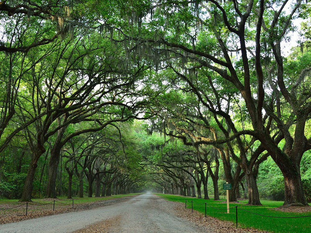
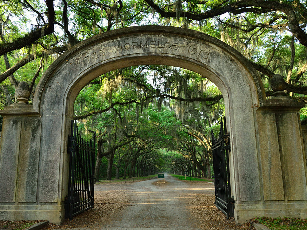
The Wormsloe Historic Site, informally known as Wormsloe Plantation, is a state historic site near Savannah, Georgia. The site consists of 822 acres (3.33 km2) protecting part of what was once the Wormsloe Plantation, a large estate established by one of Georgia's colonial founders, Noble Jones (c. 1700-1775). The site includes a picturesque 1.5 miles (2.4 km) oak avenue, the ruins of Jones' fortified house built of tabby, a museum, and a demonstration area interpreting colonial daily life.
In 1736, Noble Jones obtained a grant for 500 acres (2.0 km2) of land on the Isle of Hope that would form the core of Wormsloe. He constructed a fortified house on the southeastern tip of the island overlooking the Skidaway Narrows, a strategic section of the Skidaway River located along the Intracoastal Waterway roughly halfway between downtown Savannah and the Atlantic Ocean. The fortified house was part of a network of defensive structures established by James Oglethorpe, founder of Georgia, and early Georgia colonists to protect Savannah from a potential Spanish invasion. Jones subsequently developed Wormsloe into a small plantation, and his descendants built a large mansion at the site which they used as a country residence.
The State of Georgia acquired the bulk of the Wormsloe Plantation in 1973 and opened it to the public as a state historic site in 1979.
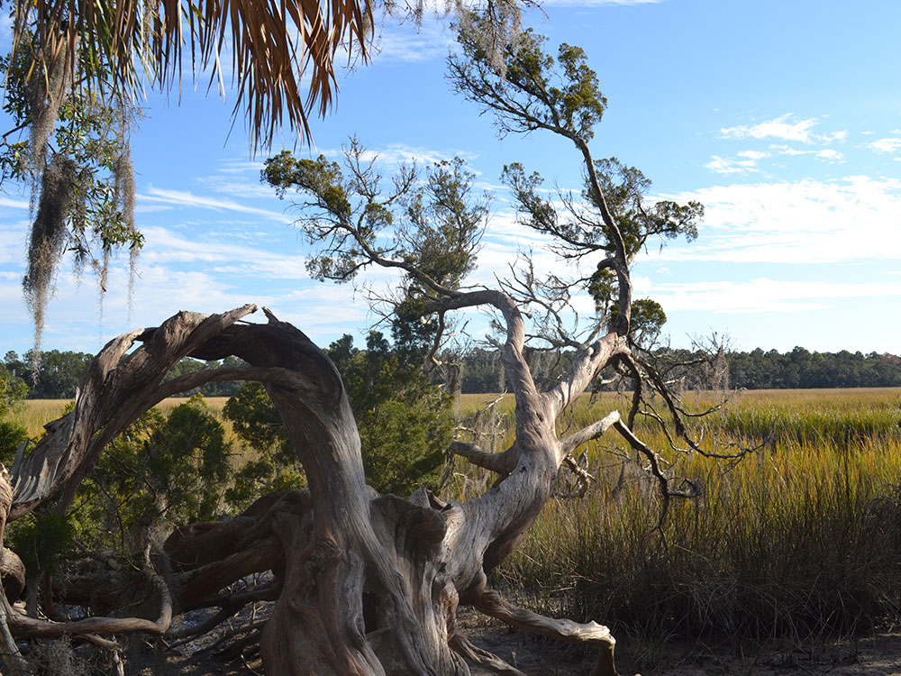
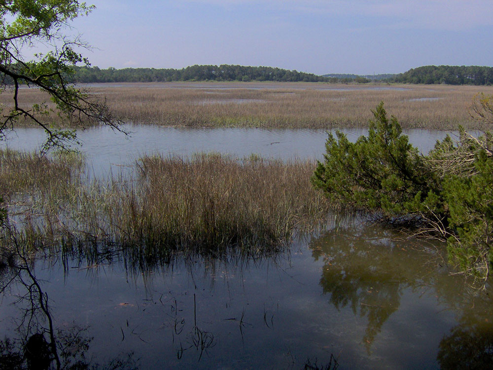
The Isle of Hope is an island (or peninsula, depending on marsh water levels) situated approximately 11 miles (18 km) southeast of downtown Savannah in Georgia's Lower Coastal Plain region. The island stretches for approximately 4 miles (6.4 km) from its northern tip to its southern tip and for roughly 2 miles (3.2 km) from its eastern shore to its western shore. The Skidaway River, which is part of the Atlantic Intracoastal Waterway, forms the island's eastern shore. The island's southwest shore is formed by the Moon River, and the island's northwest shore formed by the Herb River. Typical of Georgia's inshore coastal islands, the Isle of Hope is completely surrounded by a tidal salt marsh. Skidaway Island is located opposite the Skidaway River to the east and the Georgia mainland is located opposite the Moon River to the west. Wormsloe occupies most of the southern half of the Isle of Hope.
A small island known as Long Island lies between Skidaway Island and the Isle of Hope and splits the Skidaway River into two narrow channels, the main (navigable) channel of which is known as the Skidaway Narrows. The main channel of the Skidaway River presently flows between Long Island and Skidaway Island, although in colonial times the main channel flowed between Long Island and the Isle of Hope, giving Wormsloe its historically strategic importance. When traveling by water, the Isle of Hope is just over 10 miles (16 km) from the Atlantic Ocean (via the Skidaway, Vernon, and Ogeechee rivers) to the southeast and just over 10 miles (16 km) from the port of Savannah (via the Skidaway, Wilmington, and Savannah rivers) to the northwest.
Skidaway Road connects Wormsloe and the Isle of Hope to U.S. Route 80 near downtown Savannah. The Isle of Hope is located entirely within Chatham County. Wormsloe Historic Site is managed by the Georgia Department of Natural Resources.
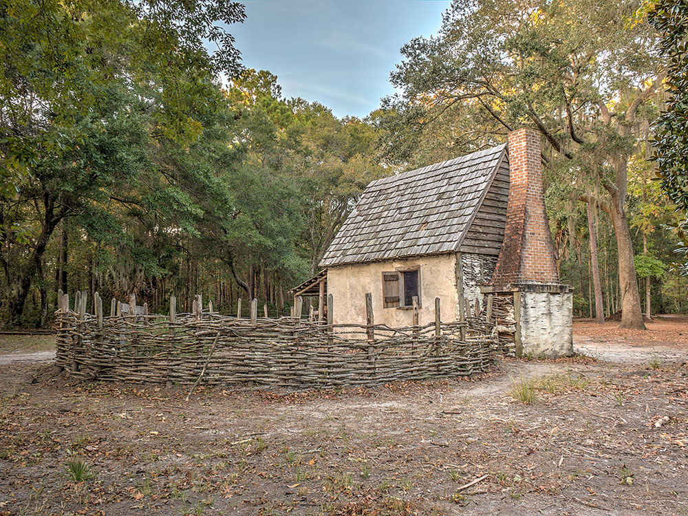
The arched entrance to Wormsloe is located just off Skidaway Road, near the Isle of Hope community. The state-controlled area includes the scenic oak-lined avenue, a museum, and a walking trail that leads through the dense maritime forest to the ruins of the tabby fort built by Jones in 1745. More recently, the park has established a colonial life demonstration area, which includes a replica wattle and daub hut and several small outbuildings that simulate a living area for Jones' marines and slaves.
The Wormsloe site is within a dense oak-pine maritime forest. Much of the forest originally pre-dated European settlement of the Isle of Hope, but a southern pine beetle infestation in the 1970s killed off most of the old-growth pines. A short interpretive trail near the museum displays prints of wildlife and birds by the 18th-century naturalist Mark Catesby.
This article uses material from the Wikipedia article "Wormsloe Historic Site" which is released under the Creative Commons Attribution-Share-Alike License 3.0
 Minipaula, CC BY-SA 3.0, via Wikimedia Commons ; Image Size Adjusted
-1000.jpg) Judson McCranie, CC BY-SA 3.0, via Wikimedia Commons ; Image Size Adjusted
Judson McCranie, CC BY-SA 3.0, via Wikimedia Commons ; Image Size Adjusted.jpg)
 Minipaula, CC BY-SA 3.0, via Wikimedia Commons ; Image Size Adjusted