Largest freshwater lake in the state of Florida and the second largest natural freshwater lake contained entirely within the contiguous 48 states
General Information
Open 6am to 9pm daily
How to Get There
Lake Okeechobee also known as Florida's Inland Sea, is the largest freshwater lake in the state of Florida. It is the eighth largest natural freshwater lake among the 50 states of the United States and the second largest natural freshwater lake contained entirely within the contiguous 48 states.
Okeechobee covers 730 square miles (1,900 km2) and is exceptionally shallow for a lake of its size, with an average depth of only 9 feet (2.7 metres). The Kissimmee River, located directly north of Lake Okeechobee, is the lake's primary source. The lake is divided between Glades, Okeechobee, Martin, Palm Beach, and Hendry counties. All five counties meet at one point near the center of the lake.
Lake Okeechobee sits in a shallow geological trough that also underlies the Kissimmee River Valley and the Everglades. The trough is underlain by clay deposits that compacted more than the limestone and sand deposits did along both coasts of peninsular Florida. Until about 6,000 years ago, the trough was dry land. As the sea level rose, the water table in Florida also rose and rainfall increased. From 6,000 to 4,000 years ago, wetlands formed building up peat deposits. Eventually the water flow into the area created a lake, drowning the wetlands. Along what is now the southern edge of the lake, the wetlands built up the layers of peat rapidly enough (reaching 13-to-14-foot or 4-to-4.3-metre thick) to form a dam, until the lake overflowed into the Everglades. At its capacity, the lake holds 1 trillion US gallons (3.8x10⁹ m3) of water and is the headwaters of the Everglades.
-1000.jpg)
.jpg)
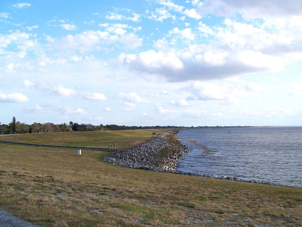
The floor of the lake is a limestone basin, with a maximum depth of 13 feet (4 m). Its water is somewhat murky from runoff from surrounding farmlands. The Army Corps of Engineers targets keeping the surface of the lake between 12.5 and 15.5 feet (4 and 5 m) above sea level. The lake is enclosed by a 40 feet (12 m) high Herbert Hoover Dike built by the U.S. Army Corps of Engineers after a hurricane in 1928 breached the old dike, flooding surrounding communities and claiming at least 2,500 lives. Water flows into Lake Okeechobee from several sources, including the Kissimmee River, Fisheating Creek, Lake Istokpoga, Taylor Creek, and smaller sources such as Nubbin Slough and Nicodemus Slough. The Kissimmee River is the largest source, providing more than 60% of the water flowing into Lake Okeechobee. Fisheating Creek is the second largest source for the lake, with about 9% of the total inflow. Prior to the 20th century, Lake Istokpoga was connected to the Kissimmee River by Istokpoga Creek, but during the rainy season Lake Istokpoga overflowed, with the water flowing in a 40 km wide sheet across the Indian Prairie into Lake Okeechobee. Today Lake Istokpoga drains into Lake Okeechobee through several canals that drain the Indian Prairie, and into the Kissimmee River through a canal that has replaced Istokpoga Creek. Historically, outflow from the lake was by sheet flow over the Everglades, but most of the outflow has been diverted to dredged canals connecting to coastal rivers, such as the Miami Canal to the Miami River, the New River on the east, and the Caloosahatchee River (via the Caloosahatchee Canal and Lake Hicpochee) on the southwest.
Florida National Scenic Trail
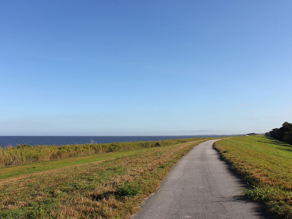
The 30-metre (100 ft) wide dike surrounding Lake Okeechobee is the basis for the Lake Okeechobee Scenic Trail (LOST), a part of the Florida National Scenic Trail, a 1,300-mile-long (2,100 km) trail. There is a well-maintained paved pathway along the majority of the perimeter, although with significant breaks. It is used by hikers and bicyclists, and is wide enough to accommodate vehicles.
Fishing
The most common fish in this lake are largemouth bass, crappie, and bluegill. Pickerel have been less commonly caught.
Lake Okeechobee Scenic Trail
The Lake Okeechobee Scenic Trail (LOST) is a 109-mile multi-use path around Lake Okeechobee, the seventh largest lake in the United States and the largest in the state of Florida. The trail began as the Okeechobee Segment of the Florida National Scenic Trail (FNST), a 1,000 mile trail that runs from Miami to Pensacola. The USDA and National Forest Service dedicated the Okeechobee Segment as part of the FNST in 1993. Most of the trail is atop the 35-feet tall Herbert Hoover Dike. The trail crosses five counties, Hendry, Glades, Okeechobee, Martin and Palm Beach. Many stretches run along state and county highways, including Florida State Road 78.
Facilities
There are 13 camping areas around the trail, most of which have no water or sanitation facilities. While the trail circumnavigates the entire lake, there are portions in which the traveler must come down from the levee. In these areas, they may encounter heavy traffic and/or alligators. Because most of the trail runs atop a levee, there is very little shelter from the Florida sun, and running off the edge may result in a dangerous, rapid descent.
Because of the age of the dike and the instability of the terrain, there are frequent partial closures of the trail. The US Army Corps of Engineers maintains the trail and posts information about trail conditions on their website.
According to the Corps of Engineers, the following access points are available:
- Nubbin Slough
- Belle Glade
- Fisheating Creek South
- Henry Creek
- South Bay
- Fisheating Creek North
- Chancy Bay
- John Stretch Park
- Bare Beach
- Port Mayaca North
- Clewiston East
- Harney Pond Canal
- Port Mayaca South
- Clewiston West
- Indian Prairie Canal
- Canal Point
- Liberty Point
- Kissimmee River
- Pahokee
- Moore Haven East
- Okeechobee
- Rardin Park
- Moore Haven West
This article uses material from the Wikipedia article "Lake Okeechobee", and "Lake Okeechobee Scenic Trail", which is released under the Creative Commons Attribution-Share-Alike License 3.0