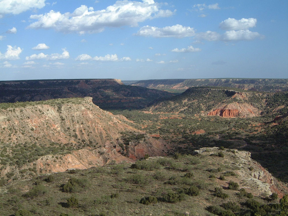
Second-largest canyon in the United States has been named "The Grand Canyon of Texas" both for its size and for its multicolored layers of rock and steep mesa walls
General Information
Last updated 9/11/2022
Reservations are highly recommended for both camping and day use online, or by calling the customer service center
Child 12 Years and Under: Free
From Amarillo (30 miles): Head east on E Amarillo Blvd/U.S. Rte 66 toward N Pierce St. Turn right onto N Pierce St. Use the right 2 lanes to take the ramp to I-27/I-40. Continue onto US-287 S/US-60 W/US-87 S. Continue straight onto I-27 S. Take exit 122B for Farm to Market Rd 1541 toward Washington St. Merge onto Canyon Dr. Turn left onto S Washington St
Palo Duro Canyon is a canyon system of the Caprock Escarpment located in the Texas Panhandle near the cities of Amarillo and Canyon. As the second-largest canyon in the United States, it is roughly 120 mi long and has an average width of 6 mi, but reaches a width of 20 mi at places. Its depth is around 820 ft, but in some locations, it increases to 1,000 ft. Palo Duro Canyon (from the Spanish meaning "hard stick") has been named "The Grand Canyon of Texas" both for its size and for its dramatic geological features, including the multicolored layers of rock and steep mesa walls, which are similar to those in the Grand Canyon.
The canyon was formed by the Prairie Dog Town Fork Red River, which initially winds along the level surface of the Llano Estacado of West Texas, then suddenly and dramatically runs off the Caprock Escarpment. Water erosion over the millennia has shaped the canyon's geological formations.
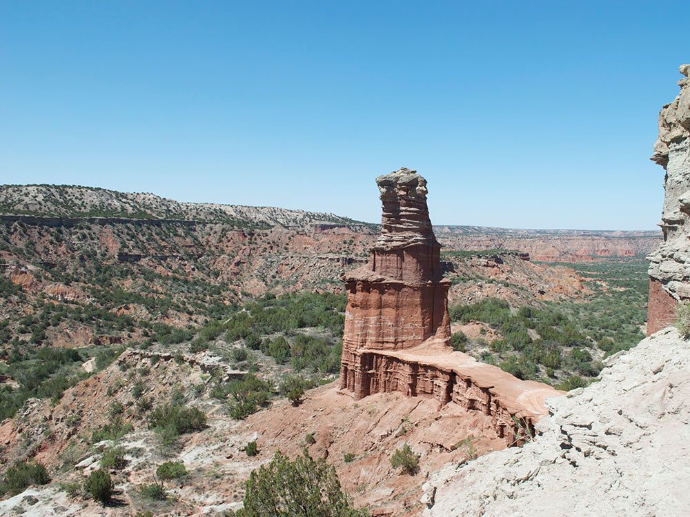
Notable canyon formations include caves and hoodoos. One of the best-known and the major signature feature of the canyon is the Lighthouse Rock. A multiple-use, 6 mi round-trip loop trail is dedicated to the formation.
Seven units of the Civilian Conservation Corps developed the park from 1933 until 1937.
Palo Duro Canyon hosts a number of activites throughout the park. There are 16 trails for hiking, biking, and horseback riding, ranging in length from .05 miles to 4.4 miles. There are options for camping, with sites for tents with water access and RV campers alike. There are also sites for keeping horses available to campers planning to horseback ride in the canyon. In addition, lodging cabins are available for rent that sit on the outer rim of the canyon, providing an impressive view of both the canyon and the sunrise.
Things to Do
Drive Through the Canyon
Follow the scenic paved park road from the canyon rim to the floor, passing colorful cliffs, rock formations, and panoramic overlooks throughout the second-largest canyon in the United States.
Hike More Than 30 Miles of Trails
Explore a diverse network of trails that wind through red rock canyons, mesas, grasslands, and dramatic geological formations.
Visit the Lighthouse Rock Formation
Hike to the park's most famous landmark, a towering rock spire known as the Lighthouse that has become the symbol of Palo Duro Canyon.
Explore the Visitor Center
Learn about the canyon's geology, wildlife, Indigenous cultures, and history through exhibits, displays, and interpretive information.
See Historic Civilian Conservation Corps Structures
Discover stone buildings and infrastructure constructed during the 1930s by the CCC that continue to serve park visitors today.
Watch the TEXAS Outdoor Musical
During summer months, enjoy a family-friendly outdoor production featuring music, storytelling, dance, and special effects that celebrate Texas history.
Explore Geological Formations
View colorful layers of rock, hoodoos, mesas, cliffs, and other features created by millions of years of erosion.
Visit Historic Sites
Learn about the area's Indigenous history, ranching heritage, and the events of the Red River War that took place within the canyon.
Enjoy Scenic Overlooks
Several viewpoints provide spectacular vistas across the canyon's colorful landscape and immense scale.
Top Trails
Lighthouse Trail
Distance: 5.3 miles round trip
Difficulty: Easy to Moderate
Highlights: The park's most famous hike leading to the iconic Lighthouse rock formation and some of the canyon's best scenery.
Rock Garden Trail
Distance: Approximately 8 miles round trip
Difficulty: Challenging
Highlights: Steep sections, dramatic rock formations, and elevated views across the canyon.
Upper Comanche and Kiowa Trail Loop
Distance: Approximately 6.6 miles
Difficulty: Moderate
Highlights: Colorful canyon walls, diverse terrain, and expansive views of the surrounding landscape.
CCC Trail
Distance: Approximately 0.9 miles
Difficulty: Easy
Highlights: Historic Civilian Conservation Corps features and beautiful canyon overlooks.
Juniper, Sunflower, and Rojo Grande Loop
Distance: Approximately 3.1 miles
Difficulty: Easy
Highlights: Family-friendly hiking with excellent views of canyon formations and native vegetation.
Highlights
Second-Largest Canyon in the United States
Known as the "Grand Canyon of Texas," Palo Duro Canyon stretches approximately 120 miles long, up to 20 miles wide, and reaches depths of about 800 feet.
The painter Georgia O'Keeffe, who lived in nearby Amarillo and Canyon in the early 20th century, wrote of the Palo Duro: "It is a burning, seething cauldron, filled with dramatic light and color." She made paintings of Palo Duro Canyon between 1916 and 1918, when she was an instructor and head of the art department at West Texas State Normal College.
Palo Duro Canyon is the site of an outdoor historical and musical drama, titled Texas, presented annually each summer by actors, singers, dancers, and artists of the Texas Panhandle region. The spectacle, created by playwright Paul Eliot Green, premiered on July 1, 1966, at the newly constructed Pioneer Amphitheatre in Palo Duro Canyon State Park. It has continued each summer through the present, making Texas "the best-attended outdoor history drama in the nation."
This article uses material from the Wikipedia article "Palo Duro Canyon", which is released under the Creative Commons Attribution-Share-Alike License 3.0
Featured Trails

Jllm06, CC BY-SA 4.0, via Wikimedia Commons; Image Size Adjusted
Lighthouse Trail
Park's most popular trail leading to the well known Lighthouse rock formation