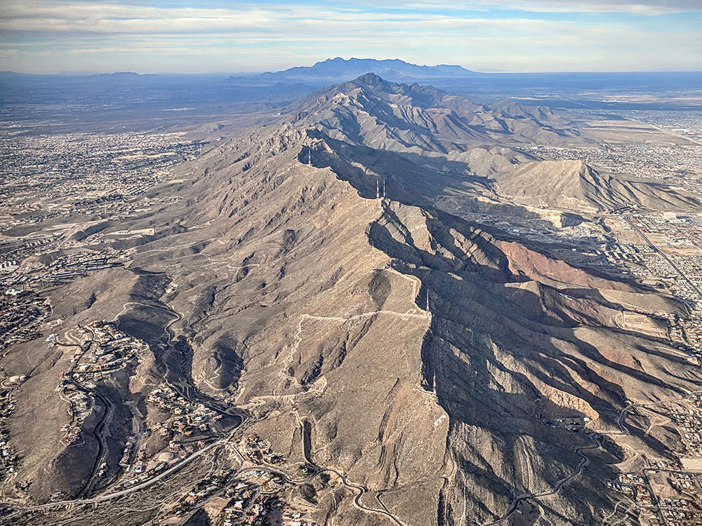
One of the largest urban parks in the nation lying completely within city limits, and open year-round for recreational hiking, mountain biking, picnicking and scenic driving and vistas
General Information
Franklin Mountains State Park is one of the largest urban parks in the nation lying completely within city limits, covering 24,247.56 acres (9,813 ha). Park headquarters are located at an elevation of 5,426 feet (1,654 m) with the highest peak reaching 7,192 feet (2,192 m). Franklin Mountains State Park is open year-round for recreational hiking, mountain biking, picnicking and scenic driving and vistas.
Things to Do
Hike More Than 100 Miles of Trails
Explore one of the largest urban wilderness parks in the United States, featuring trails that range from easy nature walks to challenging mountain summits.
Summit North Franklin Peak
Tackle one of the park's most demanding hikes and reach the highest point in the Franklin Mountains at approximately 7,192 feet.
Visit Aztec Cave
Take a family-friendly hike to a unique cave and enjoy scenic desert views along the way.
Explore the Tin Mines
Hike to historic tin mine shafts and smelter ruins that provide a glimpse into the area's mining history.
Rock Climbing
Challenge yourself on the park's rugged cliffs and rock formations, which attract climbers from across the Southwest.
Enjoy Scenic Desert Views
Experience sweeping panoramas of El Paso, the surrounding desert, and distant mountain ranges from numerous overlooks throughout the park.
Visit Ranger Peak Overlooks
Take in spectacular views extending across Texas, New Mexico, Mexico, and surrounding desert landscapes.
Top Trails
North Franklin Mountain Summit Trail
Distance: 8 miles
Difficulty: Hard
Highlights: Highest peak in the park, panoramic 360-degree views, and challenging desert terrain.
Aztec Cave Trail
Distance: 1.6 miles
Difficulty: Moderate
Highlights: Scenic cave, desert landscapes, and family-friendly adventure.
El Paso Tin Mines Trail
Distance: 6.8 miles
Difficulty: Moderate
Highlights: Historic mine shafts, smelter ruins, and mountain scenery.
Mundy's Gap Overlook Trail
Distance: 4.1–4.2 miles
Difficulty: Moderate
Highlights: Scenic overlook, mountain vistas, and excellent photography opportunities.
Maze–Cardiac Hill Loop
Distance: 4.9 miles
Difficulty: Moderate
Highlights: Desert vegetation, ridgeline views, and varied terrain.
Nature Walk Trail
Distance: 0.75 miles
Difficulty: Easy
Highlights: Desert plant interpretation, wildlife viewing, and bird blind access.
This article uses material from the Wikipedia article "Franklin Mountains State Park", which is released under the Creative Commons Attribution-Share-Alike License 3.0 Sources: Texas Parks & Wildlife Department trail recommendations, visitor information, Ranger Peak, birding opportunities, and park features. [1](https://tpwd.texas.gov/state-parks/franklin-mountains/plan-your-visit)[5](https://tpwd.texas.gov/state-parks/wyler-aerial-tramway/) Trail distances, difficulty ratings, mountain biking, climbing, wildlife, and hiking information. [2](https://www.alltrails.com/parks/us/texas/franklin-mountains-state-park)[3](https://www.alltrails.com/parks/us/texas/franklin-mountains-state-park/walking) Additional information on recreation opportunities, scenic highlights, and park characteristics. [4](https://www.touristsecrets.com/destinations/united-states/texas/hidden-treasures-of-texas-franklin-mountains/)[6](https://www.rosct.com/texas/el-paso/franklin-mountains-state-park/2099/)