State park centered on a peninsula created by the Collins River confluence and Great Falls Dam and extends downstream to the headwaters of Center Hill Lake
General Information
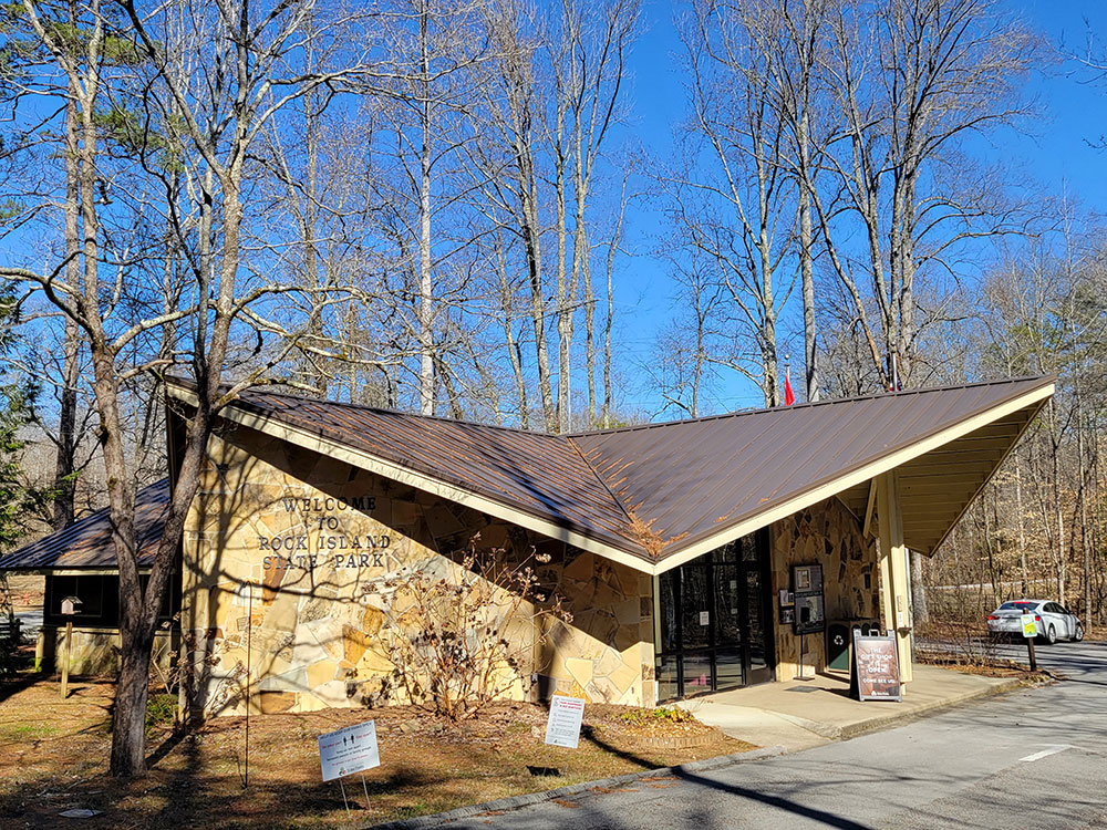
Park office hours are typically 8:00am to 4:00pm daily
Some areas may close temporarily due to TVA water releases and safety conditions
No admission fee required
Summer: Popular for waterfall viewing and outdoor recreation
Fall: Comfortable temperatures and colorful foliage
Winter: Excellent waterfall views and reduced crowds
How to Get There
From McMinnville (15 mi): Take US-70S E from McMinnville, turn right onto TN-287 S, and follow the signs into Rock Island State Park to reach the visitor area, overlooks, and waterfall access points.
Overview
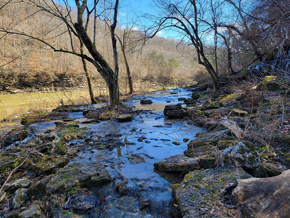
Rock Island State Park is a state park in Warren County and White County, Tennessee. The park is named after the community of Rock Island, Tennessee, which in turn received its name from an island on the Caney Fork upstream from the Collins River confluence and Great Falls Dam. Rock Island State Park is centered on a peninsula created by the confluence of these two rivers and extends downstream to the headwaters of Center Hill Lake.
The Caney Fork winds its way westward from its source atop the Cumberland Plateau and drops down to the Highland Rim at Scott's Gulf, where it enters White County. Just past Scott's Gulf, the river gains strength, absorbing Cane Creek and the Calfkiller River as it winds along the base of the plateau. At the community of Walling, the river briefly turns southward and absorbs the Rocky River before turning westward again. Two miles beyond its Rocky River confluence, the Caney Fork absorbs the Collins and enters the Great Falls Gorge. Beyond the gorge, the river enters the upper extremes of its Center Hill Lake impoundment and begins winding its way northward toward its mouth along the Cumberland River, near Carthage.
The Collins River rises atop the Cumberland Plateau several miles south of Rock Island State Park at the head of a canyon known as Savage Gulf. The river winds its way northward through a section of the Highland Rim known as "the Barrens," and steadies as it enters the eastern section of McMinnville. The river almost joins the Caney Fork at a point just opposite the Great Falls Dam power plant, but instead bends southward to create the peninsula where the present park is located.
Rock Island, the park's namesake, is an island located in the Caney Fork, approximately 1 mile (1.6 km) upstream from the present site of Great Falls Dam. The community of Rock Island is located along Great Falls Lake east of the state park.
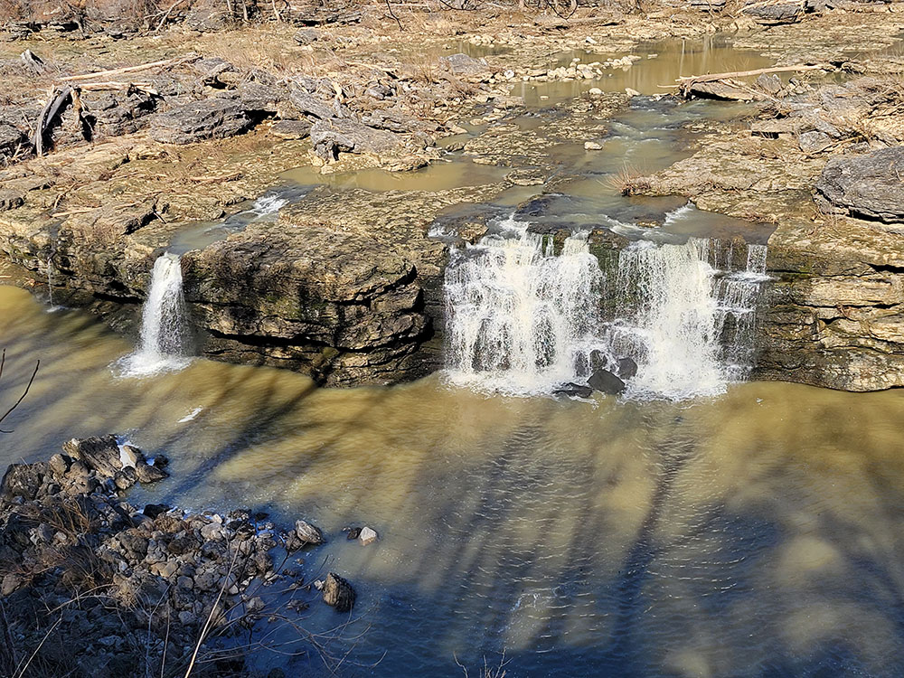
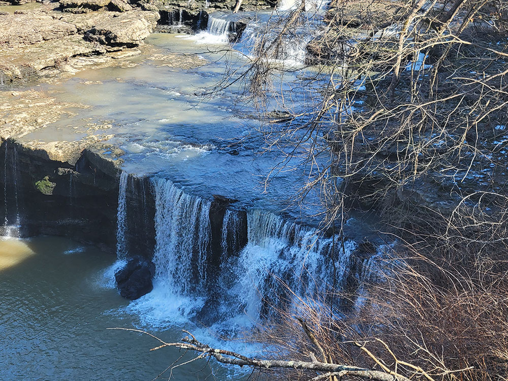
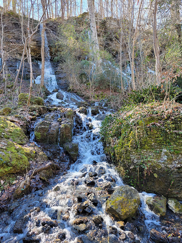
The gorge includes Great Falls, a series of plunge and cascade waterfalls that spill into the Caney Fork when the river's water levels are low. When water levels are high, the gorge completely fills up, submerging the waterfalls. A short trail leads from the parking lot to the base of the gorge.
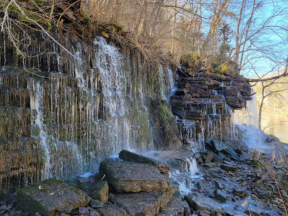
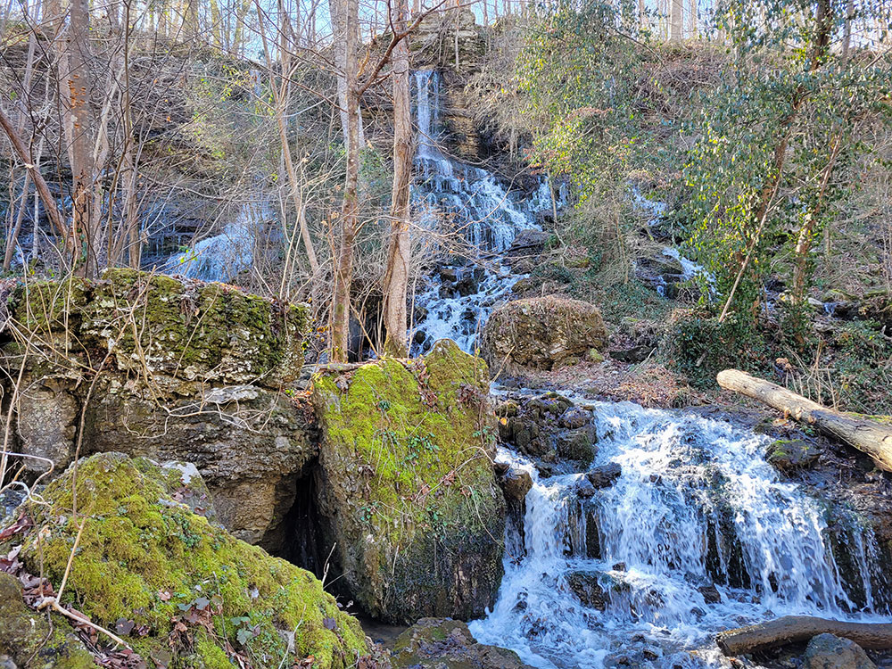
Twin Falls, a cascade waterfall that spills down from a cavern into the Caney Fork, just beyond the powerhouse. The waterfall was created by the Great Falls Dam, which caused the Collins River to rise. The rising waters began seeping into caverns on Rock Island's south shore and exiting at the falls on the north shore.
The Great Falls Cotton Mill (also called the Falls City Cotton Mill), located on the bluffs above Great Falls. The mill was built in 1892 and operated until 1902. In 1982 it was added to the National Register of Historic Places.
The Spring castle, located adjacent to the cotton mill. The "castle," which is essentially a larger version of a spring house, was used by the cotton mill's workers for refrigeration. It was probably built in the 1890s.
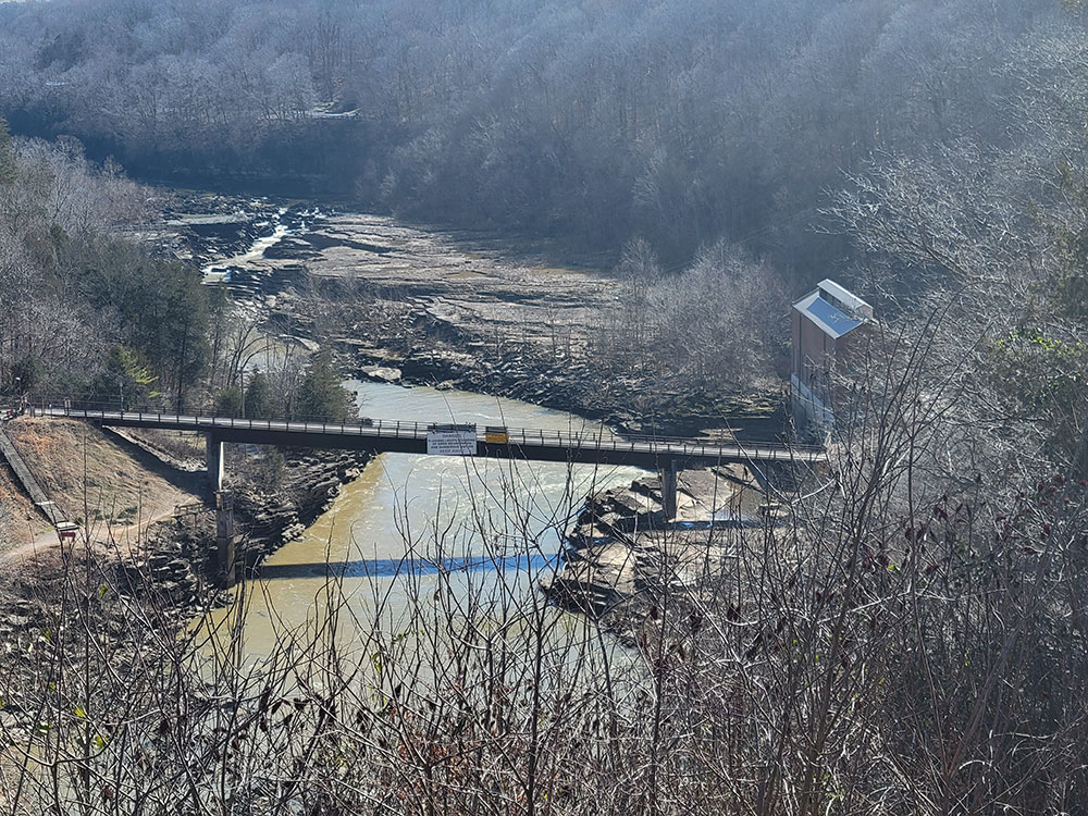
The Great Falls Dam, located along the Caney Fork near the park's TN-136 entrance. The dam was built 1915-1916. In 1990 it was added to the National Register of Historic Places.
This article uses material from the Wikipedia article "Rock Island State Park (Tennessee)", which is released under the Creative Commons Attribution-Share-Alike License 3.0