282-acre (1.14 km2) state park featuring Cummins Falls, a 75-foot (23 m) waterfall, which is located on the Blackburn Fork State Scenic River
General Information
Off Season (typically November–March): 8:00am to 4:30pm
The gorge area closes at 5:00pm during the main season
Gorge Access Permit: Required to access the base of the waterfall and gorge area; permit fees vary by date and availability
Summer: Popular for waterfall viewing and river activities
Fall: Pleasant temperatures and colorful foliage
Winter: Smaller crowds and excellent waterfall visibility
How to Get There
From Cookeville (9 mi): Take TN-56 N/Gainesboro Grade north from Cookeville, follow signs for Cummins Falls State Park, turn onto Cummins Falls Lane, and continue to the park entrance and visitor area.
Overview
Cummins Falls State Park is a 282-acre (1.14 km2) state park located northwest of Cookeville, Tennessee. Its namesake, Cummins Falls, is a 75-foot (23 m) waterfall, which is located on the Blackburn Fork State Scenic River. The park was purchased and created by the Tennessee Parks and Greenways Foundation in 2011.
Activities
Picnicking, hiking, and fishing may be done at Cummins Falls State Park.
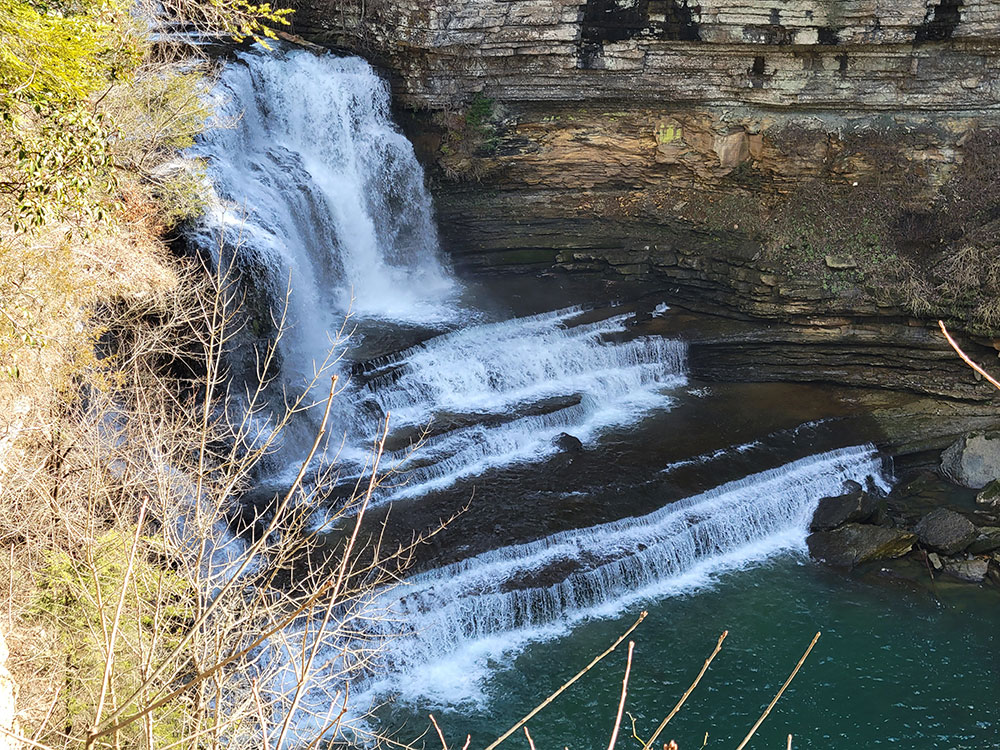
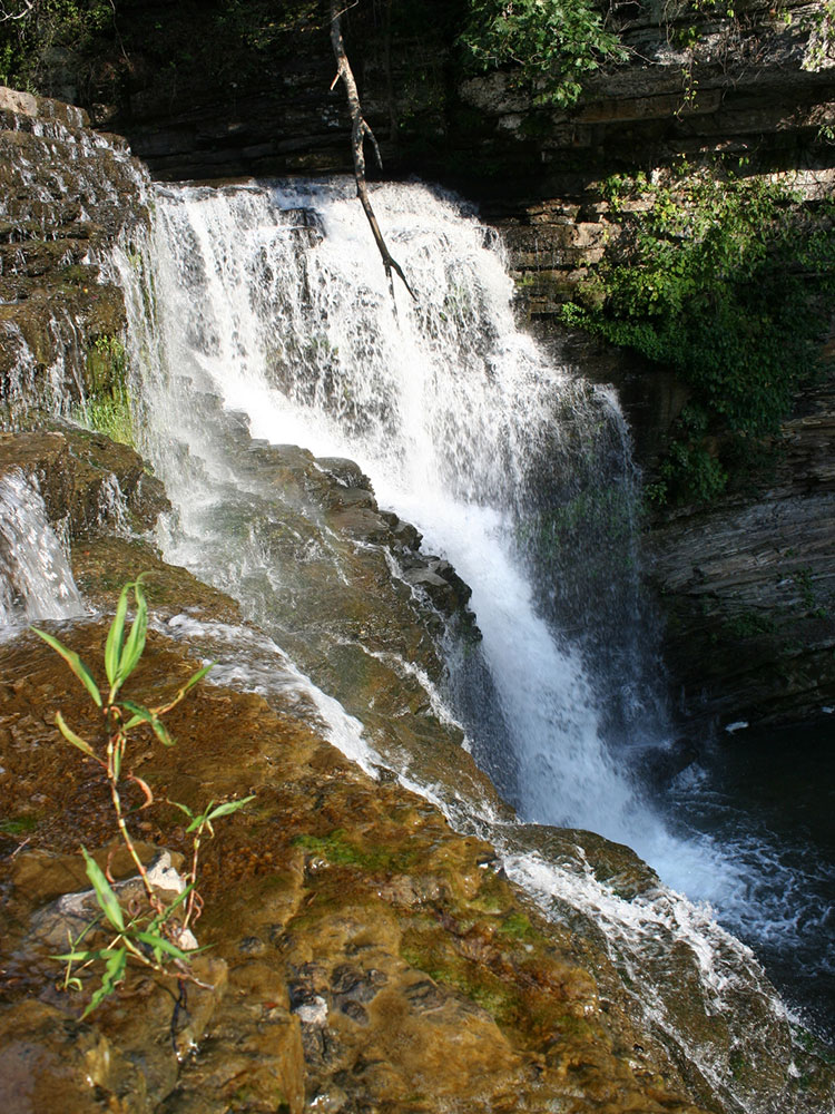
Cummins Falls is a waterfall on the Blackburn Fork River in southern Jackson County, Tennessee. By volume, it is the eighth largest waterfall in Tennessee. The falls, with a total height of seventy-five feet, consist of two drops. The first has a plunge drop of fifty feet, ending in a shallow pool. The second has a cascade drop of twenty-five feet into a larger, deeper pool, or "swimming hole". In 2010, Cummins Falls was named "Tenth Best Swimming Hole in America" by Travel + Leisure magazine.
The falls, on land owned continuously by the Cummins family since 1825, was purchased by the Tennessee Parks and Greenways Foundation and designated a public park in 2011.
Things to Do
See Cummins Falls
The park's main attraction is the impressive 75-foot waterfall, one of the largest by volume in Tennessee. The falls plunge into a deep gorge surrounded by towering rock walls and lush forest, creating one of the state's most iconic natural scenes.
Visit the Waterfall Overlook
Visitors can enjoy excellent views of the waterfall from designated overlooks without entering the gorge. These viewpoints provide a safe and accessible way to experience the beauty of Cummins Falls and the surrounding landscape.
Explore the Gorge
A trip into the gorge offers a more adventurous experience. Visitors descend into the river corridor, crossing rocky terrain and sections of the stream before reaching the waterfall. A Gorge Access Permit is required for entry into the gorge area.
Swim and Wade Beneath the Falls
The natural plunge pool at the base of Cummins Falls is one of Tennessee's most famous swimming holes. Visitors can cool off in the water or wade through the river while enjoying views of the waterfall and surrounding cliffs.
Experience Unique Geology
The park features dramatic rock formations, river-carved limestone features, boulder fields, and a gorge that showcases the natural forces that shaped the Cumberland Plateau region over thousands of years.
Enjoy Scenic River Views
Blackburn Fork State Scenic River flows through the heart of the park, creating numerous opportunities to enjoy rushing water, rocky streambeds, and peaceful riverside scenery.
Top Trails
Cummins Falls Base Route via Falls Overlook Trail and Blackburn Fork
Length: 2.5 miles round trip
Elevation Gain: Approximately 400 feet
Difficulty: Moderate to Difficult
This is the park's signature hike and the only route that reaches the base of the waterfall. The trail descends steeply into the gorge and requires stream crossings, rock hopping, and hiking across uneven terrain. A Gorge Access Permit is required.
Falls Overlook Trail
Length: 1.0 mile round trip
Elevation Gain: Approximately 100 feet
Difficulty: Easy
A short, family-friendly hike leading to the primary waterfall overlook. This trail provides spectacular views of Cummins Falls without requiring visitors to descend into the gorge.
Falls Overlook and John Cummins Loop
Length: 1.0 mile loop
Elevation Gain: Approximately 100 feet
Difficulty: Easy
This scenic loop combines forest walking with views of the waterfall overlook. It is a great option for visitors looking for a short hike that showcases the park's highlights.
Blackburn Fork River, Cummins Falls Overlook, and John Cummins Loop
Length: 1.0 mile loop
Elevation Gain: Approximately 150 feet
Difficulty: Moderate
This route combines river scenery, wooded terrain, and views of Cummins Falls. Rocky sections and exposed roots make it slightly more challenging than the standard overlook trail.
This article uses material from the Wikipedia article "Cummins Falls State Park", and "Cummins Falls", which is released under the Creative Commons Attribution-Share-Alike License 3.0 Sources: Tennessee State Parks official Cummins Falls State Park information, safety guidance, permits, and visitor resources. [1](https://tnstateparks.com/parks/cummins-falls)[2](https://reserve.tnstateparks.com/cummins-falls/permits) Additional trail information and park details verified through hiking guides, visitor resources, and trail databases. [3](https://takemetotn.com/cummins-falls-state-park/)[4](https://alexysabroad.com/cummins-falls-state-park-guide/)[5](https://www.tripadvisor.com/Attraction_Review-g54971-d3427574-Reviews-Cummins_Falls_State_Park-Cookeville_Tennessee.html)[6](https://www.alltrails.com/parks/us/tennessee/cummins-falls-state-park/waterfall)
