1,300 acres Oklahoma state park offering a variety of individual and group activities including trout fishing, fly fishing clinics, guided horseback rides, and hayrides throughout the park
General Information
How to Get There
Overview
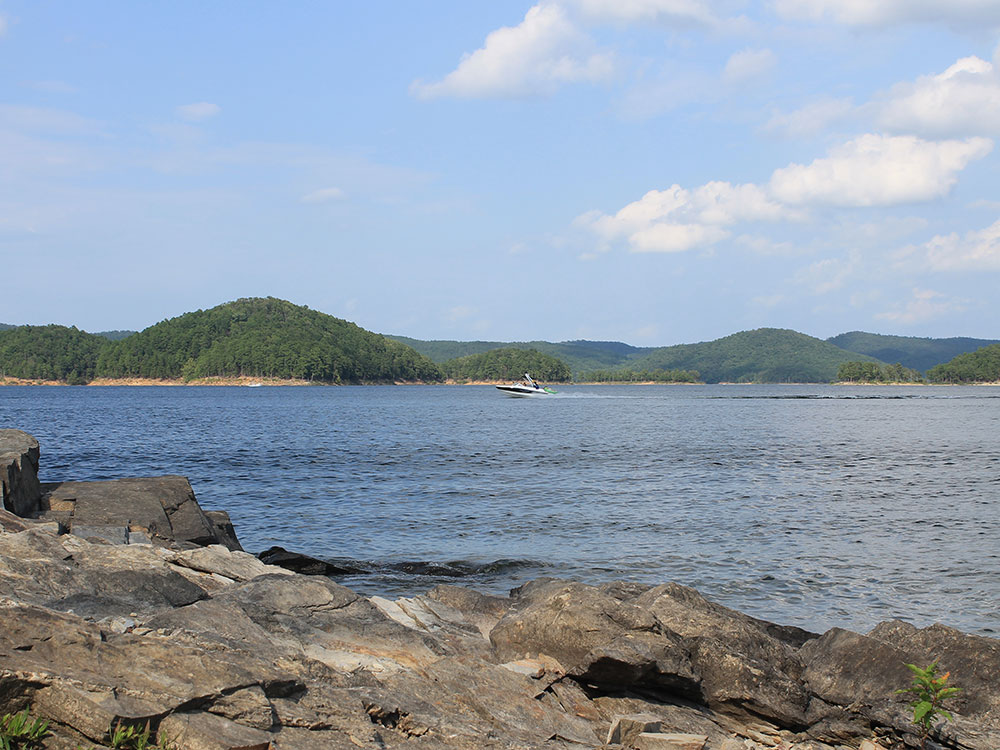
Beavers Bend State Park is a 1,300 acres (5.3 km2) Oklahoma state park located in McCurtain County, 10.5 miles (16.9 km) north of Broken Bow on SH-259A. It was established in 1937 and contains Broken Bow Lake.
Attractions
Beavers Bend State Park offers a variety of individual and group activities including trout fishing, fly fishing clinics, guided horseback rides, and hayrides throughout the park.
The David L. Boren Trail offers 16 miles (26 km) of hiking trails with 4 miles (6 km) of multi-purpose trails that wander along ridge tops, over creek bottoms, and through tall stands of timber. The same trail can also be divided into a variety of short and long hikes for those not wishing to make the entire trek.
The Forest Heritage Center's museum contains historical documents, antique forestry tools, wood art, homestead memorabilia, and a research library filled with books, periodicals, and other materials pertaining to forestry, the primary industry of the area.
The Center is also home to 14 dioramas (painted by Harry Rossoll of Atlanta, Georgia, the artist who created Smokey Bear) that cover prehistoric forests, Caddo Indians, Papermaking in the South, 1940s lumbering, and forest appreciation. Each diorama is accompanied by a taped narration.
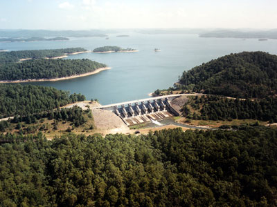
Built on the site of an old Choctaw settlement, Beavers Bend State Park was named after John T. Beavers, a Choctaw intermarried citizen. The "bend" in the park's name refers to an area of the park where a portion of Mountain Fork River meanders sharply, making an almost 180-degree turn. This area is commonly known as the River Bend, and is a popular area for trout fishing, canoe rentals, and swimming. Also in the River Bend area is the Broken Bow Hydroelectric Plant, which generates energy from the waters of Broken Bow Lake.
The local rock formations are some of the most distinctive in the state. Just north of Broken Bow, sedimentary rock has been thrust upward due to an ancient collision of the North American and South American Plates, forming what is now the Ouachita Mountains. Evidence of what is called the Ouachita orogeny can be seen all over the park, where some layers of rock can be seen tilted up at angles of about sixty-degrees. These geologic features can be easily viewed around Broken Bow Lake and Mountain Fork River, where erosion has left much of the rock exposed.
This article uses material from the Wikipedia article "Beavers Bend Resort Park", which is released under the Creative Commons Attribution-Share-Alike License 3.0
-1000.jpg)
.jpg)
-1000.jpg)
.jpg)