Canyon system on the Red River in east-central Kentucky featuring an abundance of high sandstone cliffs, rock shelters, waterfalls, and natural bridges with more than 100 natural sandstone arches
General Information
Visitor Center (Gladie): Typically open Wednesday to Sunday, 10am – 4pm (seasonal hours may vary)
$5/day
$7/3-day
$50 annual per vehicle
Interagency Senior/Access Passes: 50% discount when purchased from Forest offices
How to Get There
From Lexington, KY (65 mi): Take I-64 E to exit 98 for KY-11 toward Mt Sterling. Follow KY-11 S and KY-15 S to KY-77 N, then turn onto Skybridge Rd to reach Red River Gorge Geological Area.
The Red River Gorge is a canyon system on the Red River in east-central Kentucky. The gorge lies within the Daniel Boone National Forest and has been subsequently designated as the Red River Gorge Geological Area, an area of around 29,000 acres (120 km2; 45 sq mi). It has been designated a National Natural Landmark and National Archaeological District, and it is listed on the National Register of Historic Places. The 13,379-acre (54.14 km2; 20.905 sq mi) Clifty Wilderness Area lies entirely within the geological area in the Red River Gorge.
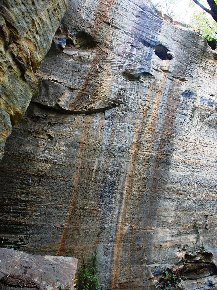
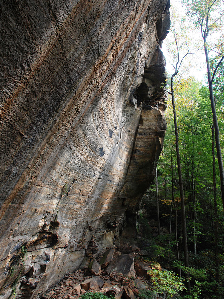
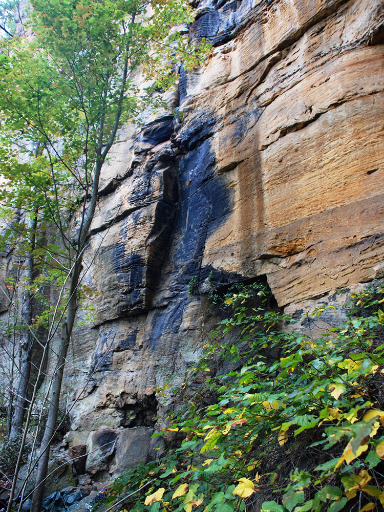
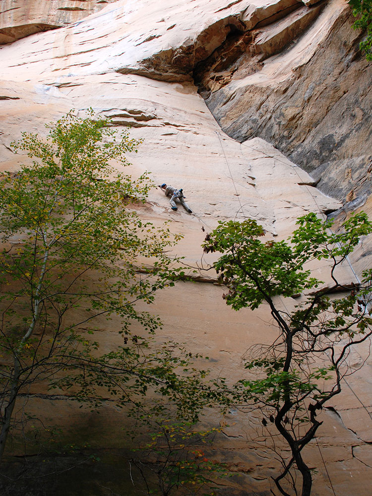
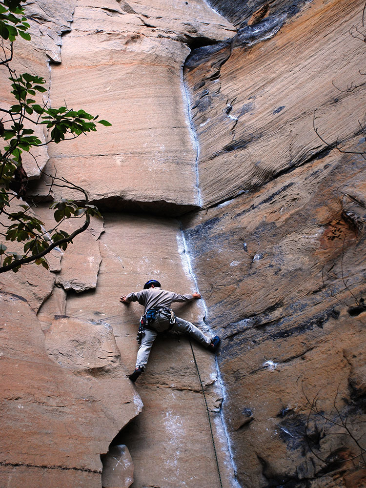
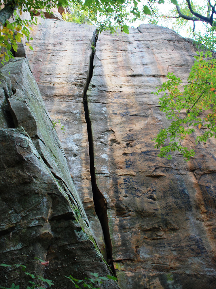
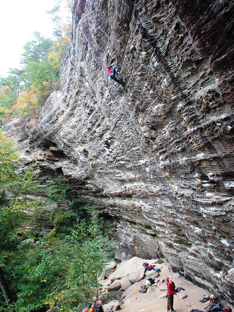
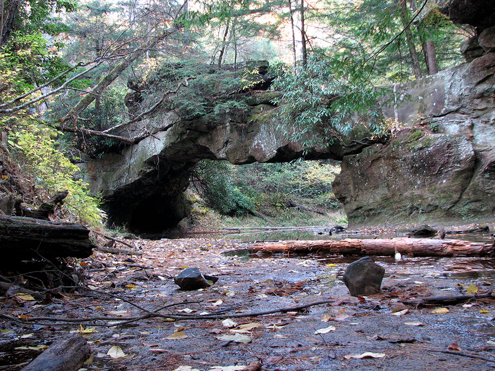
This intricate canyon system features an abundance of high sandstone cliffs, rock shelters, waterfalls, and natural bridges. There are more than 100 natural sandstone arches in the Red River Gorge Geological Area. The multitude of sandstone and cliff-lines have helped this area become one of the world's top rock climbing destinations and is home to the Red River Gorge Climbers' Coalition. The area is nicknamed the Red by climbers.
Kentucky's Natural Bridge State Park is immediately adjacent to this area, featuring one of the largest natural bridges in the Red River Gorge.
The section of the Red River in the upper gorge is also a legally designated Kentucky Wild River by the Kentucky General Assembly through the Office of Kentucky Nature Preserves' Wild Rivers Program.
Because of its unusual and rugged nature, the Red River Gorge features a remarkable variety of ecological zones.
Nada Tunnel is a 900-foot-long (270 m), 12-foot-wide (3.7 m), and 13-foot-high (4.0 m) logging tunnel built between 1910 and 1912. Rock and dirt were removed by dynamite, steam drills, and hand tools.
The tunnel has often been described as the "Gateway to Red River Gorge" for the shortcut it now provides motorists.
The Red River Gorge is also known for its numerous hiking trails that range in difficulty from beginner to advanced. Over 60 miles of trails, open only to hiking, are maintained by the Forest Service and are located throughout the park (some trails are designated for horses).
One of the most popular destinations is Gray's Arch, one of the many natural arches in the park.
The Daniel Boone National Forest Gladie Visitor Center is located in the Red River Gorge in Slade, Kentucky. The center features interpretive exhibits about the area's geology, natural history and cultural history. Visitors can get maps, information about trails, camping and other activities.
This article uses material from the Wikipedia article "Red River Gorge" which is released under the Creative Commons Attribution-Share-Alike License 3.0
| Trail Name | Length (miles) | Elevation Gain | Trail Type | Notes |
|---|---|---|---|---|
| Rock Bridge Trail | 1.4 | ~300 ft | Loop | Creekside hike to a natural bridge and waterfall |
| Sky Bridge Trail | 0.7 | ~150 ft | Loop | Short stair trail to a walk‑through sandstone arch |
| Gray’s Arch Trail | 2.5 | ~350 ft | Out and back | Moderate forest trail to one of the largest arches in the gorge |
| Auxier Ridge Trail | 4.2 | ~700 ft | Out and back | Exposed ridge with panoramic clifftop views |
| Auxier Ridge Loop (via Courthouse Rock) | 5.0 | ~860 ft | Loop | Signature loop featuring Courthouse Rock and sweeping vistas |
| Double Arch Trail | 2.2 | ~350 ft | Out and back | Leads to two impressive sandstone arches |
| Princess Arch Trail | 0.3 | ~50 ft | Out and back | Very short trail to a freestanding arch atop a ridge |
| Chimney Top Trail | 0.3 | ~100 ft | Out and back | Clifftop overlook directly above the Red River |
| Rough Trail and Gray’s Arch Loop | 4.7 | ~400 ft | Loop | Backcountry route with varied terrain and arch access |
| Rough Trail (Full Section) | 7.1–7.7 | ~1,400–1,500 ft | Point to point / Loop options | Challenging backcountry trail with repeated ridge climbs |
-1000.jpg)
.jpg)
-1000.jpg)
.jpg)