Kentucky state park located along the Middle Fork of the Red River, featuring ts namesake natural bridge as the centerpiece of the park
General Information
Restaurant: Daily 11am – 3pm and 4pm – 8pm
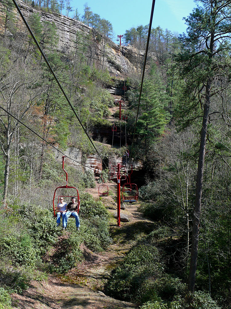
Sky Lift: Open daily April through October
Pool: Lodge/cottage guests Mon–Fri 11am–7pm; public access Sat–Sun 11am–7pm
Pool: $6 (ages 13+), $5 (12 and under), free for lodge/cottage guests
Sky Lift: Call (606) 663-2922 for pricing
Lodging and camping: Prices vary by season and accommodation
Pets not allowed on most trails due to nature preserve rules, except Whittleton Trail
How to Get There
From Lexington, KY (52 mi): Take I-64 E to the Mountain Parkway. Exit at 33, turn south on KY-11, and continue 2 miles to reach Natural Bridge State Resort Park.
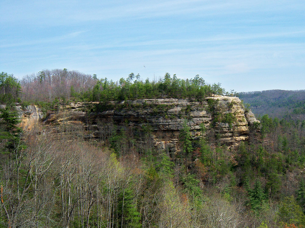
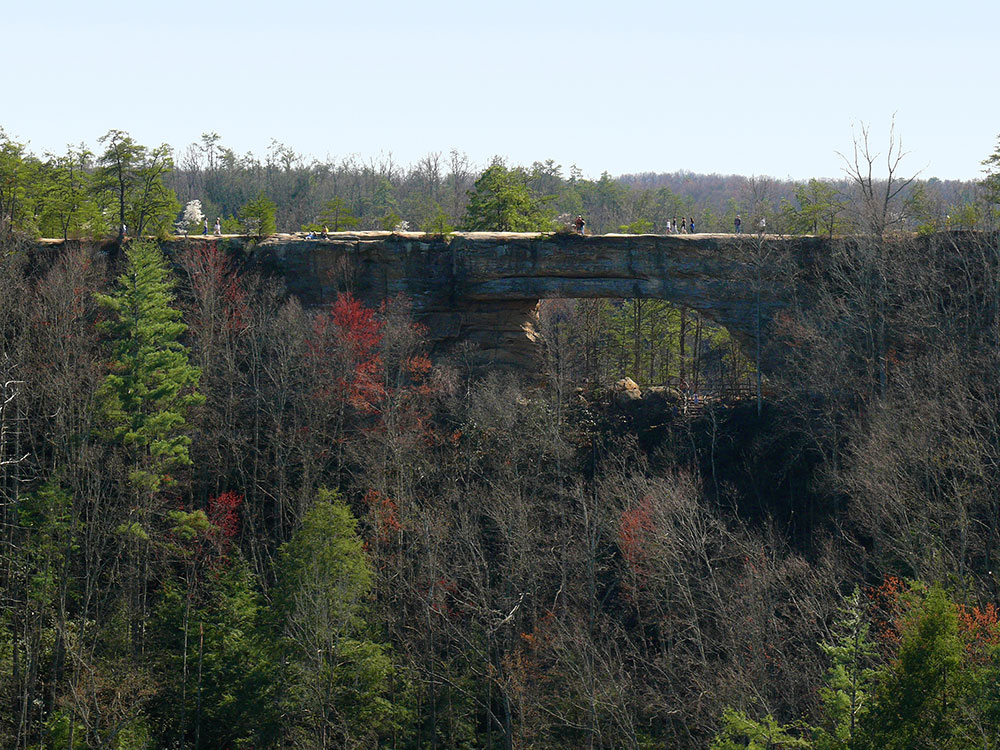
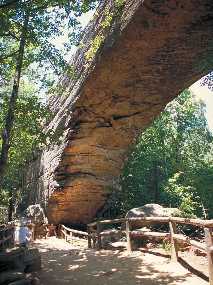
Natural Bridge State Resort Park is a Kentucky state park located in Powell and Wolfe Counties along the Middle Fork of the Red River, adjacent to the Red River Gorge Geologic Area and surrounded by the Daniel Boone National Forest. Its namesake natural bridge is the centerpiece of the park. The natural sandstone arch spans 78 ft (24 m) and is 65 ft (20 m) high. The natural process of weathering formed the arch over millions of years. The park is approximately 2,300 acres (9 km2) of which approximately 1,200 acres (5 km2) is dedicated by the Office of Kentucky Nature Preserves as a nature preserve. In 1981 the land was dedicated into the nature preserves system to protect the ecological communities and rare species habitat. The first federally endangered Virginia big eared bats, Corynorhinus townsendii virginianus, recorded in Kentucky were found at Natural Bridge State Resort Park in the 1950s.
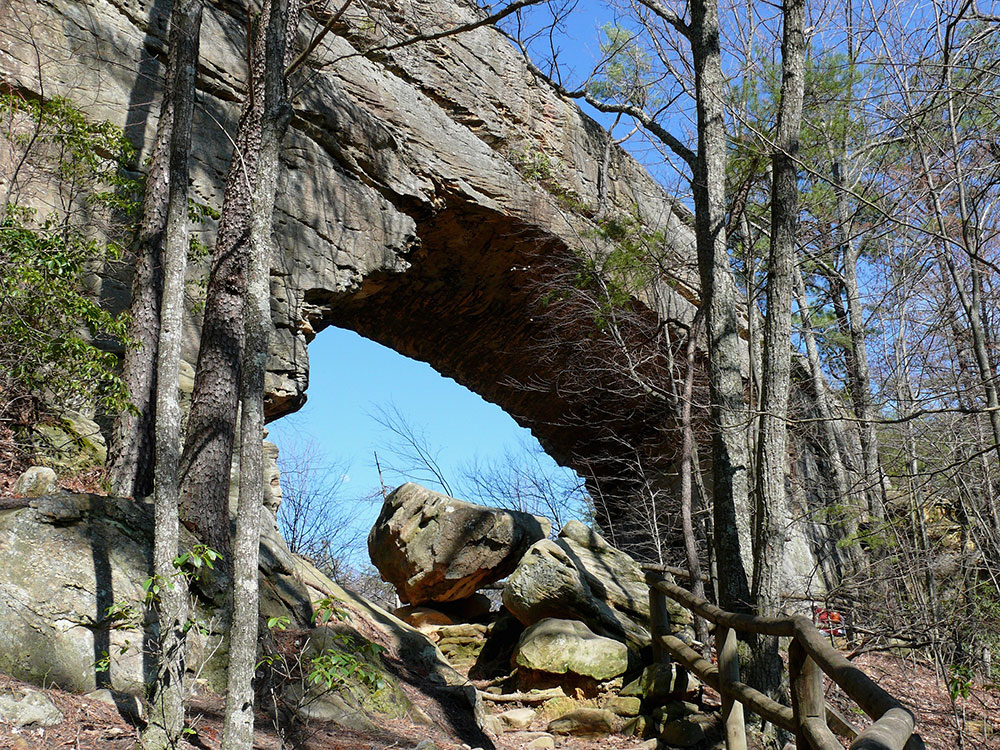
The park was founded as a private tourist attraction in 1895 by the Lexington and Eastern Railroad. In 1910, Louisville and Nashville Railroad acquired the land when it purchased the Lexington and Eastern Railroad. In 1926, L&N's President Wible L. Mapother turned over its approximately 137 acres to the Kentucky State Park Commission, making the park one of Kentucky's original four state parks when that system was established the same year. There are over 20 miles (32 km) of trails over uneven terrain from moderate to strenuous difficulty, including trails to White's Branch Arch, Henson's Cave Arch, and other scenic areas. Some of the most famous sites are the arch itself, "Lovers Leap", and "Fat Man's Squeeze". The park's 0.5-mile (0.8 km) "Original Trail" to the natural bridge dates from the 1890s. Other trails include the 7.5-mile (12.1 km) Sand Gap Trail and the 0.75-mile (1.21 km) Balanced Rock Trail. Five miles (8 km) of the 307-mile (494 km) Sheltowee Trace National Recreation Trail run through the park, including the Whittleton Trail which connects the park to the Red River Gorge Geologic Area. "Fat Man's Squeeze", a narrow passage in the rock formation, leads to the bottom of the arch.
Natural Bridge has several unique sandstone rock formations, including the Balanced Rock. This is a huge block of sandstone balanced on the edge of a cliff near the Natural Bridge. The "Balanced Rock", is located on Trail #2, not far above Hemlock Lodge.
This article uses material from the Wikipedia article "Natural Bridge State Resort Park" which is released under the Creative Commons Attribution-Share-Alike License 3.0