Distinct geographic region of the northwestern US defined as the fertile hills and prairies north of the Snake River featuring peculiar and picturesque loess hills
General Information
How to Get There
Overview
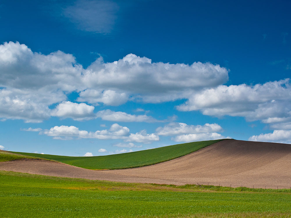
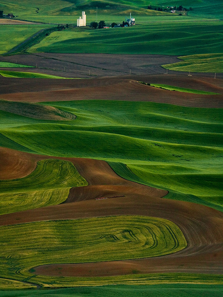
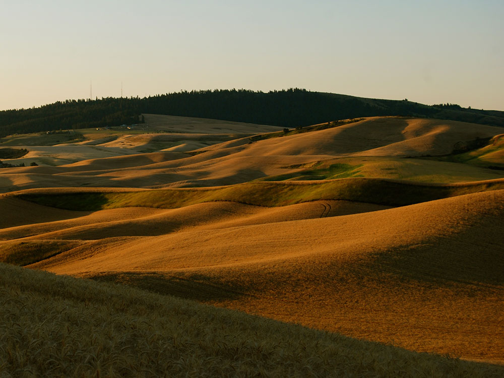
The Palouse is a distinct geographic region of the northwestern United States, encompassing parts of north central Idaho, southeastern Washington, and, by some definitions, parts of northeast Oregon. It is a major agricultural area, primarily producing wheat and legumes. Situated about 160 miles (260 km) north of the Oregon Trail, the region experienced rapid growth in the late 19th century.
Traditionally, the Palouse region was defined as the fertile hills and prairies north of the Snake River, which separated it from Walla Walla County, and north of the Clearwater River, which separated it from the Camas Prairie, extending north along the Washington and Idaho border, south of Spokane, centered on the Palouse River. This region underwent a settlement and wheat-growing boom during the 1880s, part of a larger process of growing wheat in southeast Washington, originally pioneered in Walla Walla County south of the Snake River.
Geology
The peculiar and picturesque loess hills which characterize the Palouse Prairie are underlain by wind-blown sediments of the Palouse Loess that covers the surface of over 50,000 km2 (19,000 sq mi) on the Columbia Plateau in southeastern Washington, western Idaho, and northeastern Oregon. The Palouse Loess forms a fine-grained mantle of variable thickness that lies upon either the Miocene Columbia River Basalt Group, non-glacial Pliocene fluvial sediments of the Ringold Formation, or Pleistocene glacial outburst flood sediments that are known informally as the Hanford formation. At its thickest, the Palouse Loess is up to 75 meters (246 ft) thick. It consists of multiple layers of loess separated by multiple well-defined calcrete paleosols and erosional unconformities. The degree of development of individual layers of calcrete together with thermoluminescence and optically stimulated luminescence dating of the loess indicate that each calcrete layer represents a period of thousands to tens of thousands of years of nondeposition, weathering, and soil development that occurred between episodic periods of loess deposition. A consistent sequence of normal-reverse-normal polarity signatures demonstrates that the older layers of loess accumulated between 2 and 1 million years ago. Detailed optically stimulated luminescence dating has shown that the uppermost layer of Palouse Loess accumulated between 15,000 years ago and modern times and the layer of loess underlying it accumulated episodically between about 77,000 and 16,000 years ago. Regional trends in the distribution, thickness, texture, and overall composition of the Palouse Loess indicate that it largely consists of the wind-blown sediments eroded from fine-grained deposits of the Hanford formation that were periodically deposited by repeated Missoula Floods within the Eureka Flats area.
Although superficially resembling sand or other types of dunes, the loess hills of the Palouse are of far different origin. Internally, they lack any evidence of cross-bedding or erosion of interbedded layers of loess and calcrete that characterize dunes formed by moving currents. Instead, these hills consist of alternating layers of loess and calcrete that are more or less concordant with the modern surface of these hills. This layering demonstrates that the Palouse hills loess accumulated from the airfall of wind-silt from suspension. In addition, the ubiquitous homogenization of the loess by innumerable plant roots and insect burrows as it accumulated further supports the conclusion drawn from numerous thermoluminescence and optically stimulated luminescence dates that individual layers of loess accumulated over an extended period of time in terms of thousands of years. Finally, the calcrete horizons are paleosols that represent the periodic cessation of loess accumulation for periods of thousands of years during which they formed within the surface of a loess layer.
This article uses material from the Wikipedia article "Palouse", which is released under the Creative Commons Attribution-Share-Alike License 3.0
-1000.jpg)
.jpg)
-1000.jpg)
.jpg)