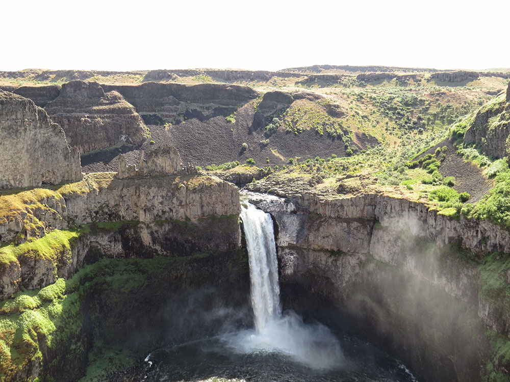
Waterfall on the Palouse River, about 4 mi (6 km) upstream of the confluence with the Snake River in southeast Washington
General Information
How to Get There
Overview
Palouse Falls is a waterfall on the Palouse River, about 4 mi (6 km) upstream of the confluence with the Snake River in southeast Washington. The falls are 200 ft (61 m) in height. The falls consist of an upper fall with a drop around 20 ft (6.1 m), which lies 1,000 ft (305 m) north-northwest of the main drop, and a lower fall, with a drop of 200 ft (61 m). It is in the 94-acre (38 ha) Palouse Falls State Park.
The canyon at the falls is 115 m (377 ft) deep, exposing a large cross-section of the Columbia River Basalt Group.
Palouse Falls State Park
The falls are included in Washington's Palouse Falls State Park, which provides access to the falls and has displays explaining the region's unique geology, as well as its historical ties (the Palouse Indians and the Mullan Road both took advantage of the easy access to the plateau in the vicinity of the falls). The park provides a viewpoint facing Palouse Falls that is a short walk from the parking area, campground, and picnic area. The state park was created in 1951 following the contribution of several parcels of land by multiple donors.
This article uses material from the Wikipedia article "Palouse Falls", which is released under the Creative Commons Attribution-Share-Alike License 3.0
-750.jpg)
.jpg)
-1000.jpg)
.jpg)