Largest state park in Oregon with an area of more than 9,000 acres, and includes more than 24 miles of walking trails, 14 miles of horse trails, and a 4-mile bike path
General Information
Silver Falls State Park is a state park in Oregon, located near Silverton, about 20 miles (32 km) east-southeast of Salem. It is the largest state park in Oregon with an area of more than 9,000 acres (36 km2), and it includes more than 24 miles (39 km) of walking trails, 14 miles (23 km) of horse trails, and a 4-mile (6.4 km) bike path. Its 8.7-mile (14.0 km) Canyon Trail/Trail of Ten Falls runs along the banks of Silver Creek and by ten waterfalls, from which the park received its name. Four of the ten falls have an amphitheater-like surrounding that allows the trail to pass behind the flow of the falls. The Silver Falls State Park Concession Building Area and the Silver Creek Youth Camp-Silver Falls State Park are separately listed on the U.S. National Register of Historic Places.
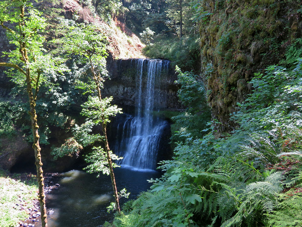
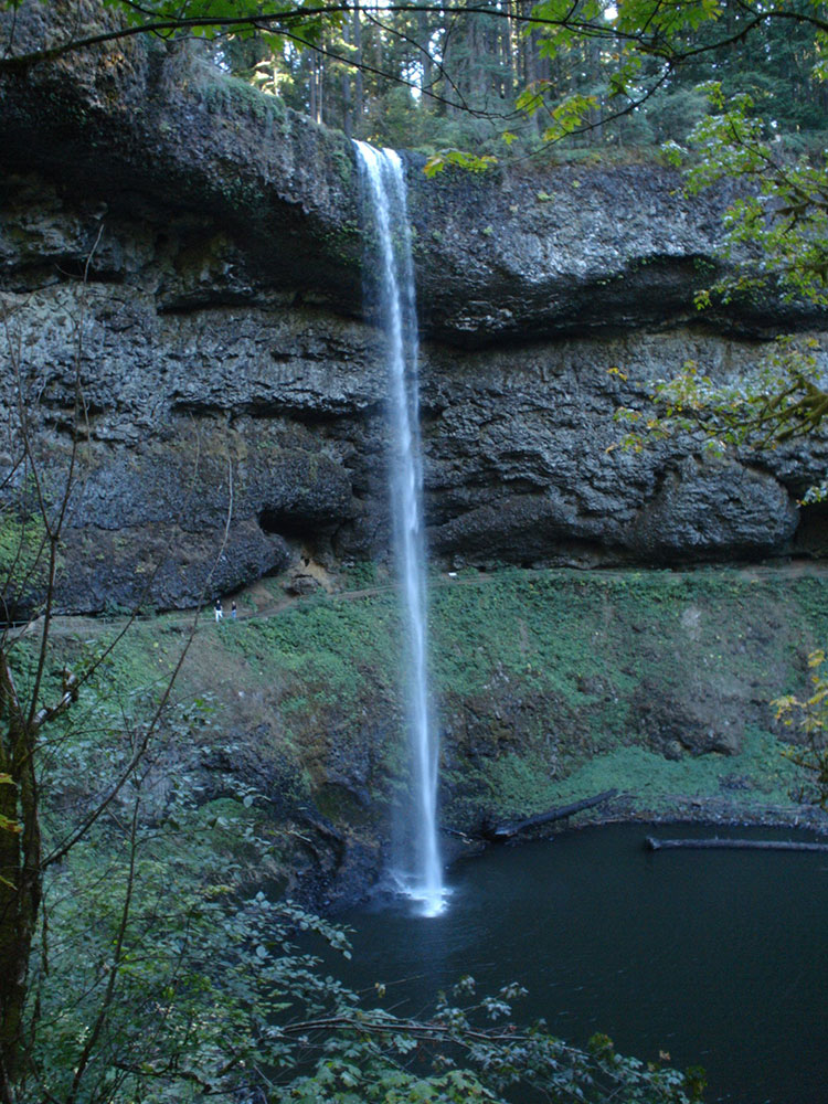
The park's most visited waterfall is South Falls, a 177-foot (54 m) cascade. Remote Double Falls, however, is listed as the highest waterfall in the park, plunging 178 feet (54 m) in a small tributary side canyon deep within the Silver Creek Canyon.
Silver Falls City formed in 1888 and was primarily a logging community with a few homesteaders, and the area was extensively logged. The small lumber town of Silver Falls City sat atop the South Falls, and as the land was cleared, a local entrepreneur sold admission to the Falls area, with attractions such as pushing cars over the falls and even hosting a stunt with a daredevil riding over in a canoe.
By 1900 a Silverton photographer, June D. Drake, began to campaign for park status, using his photographs of the falls to gain support. (Drake Falls was later named for him.) In 1926, however, an inspector for the National Park Service rejected the area for park status because of a proliferation of unattractive stumps after years of logging.
In 1935 President Franklin D. Roosevelt announced that the Silver Falls area would be turned into a Recreational Demonstration Area. Private land that had been logged was purchased, and workers in the Civilian Conservation Corps were employed to develop park facilities, including the historic South Falls Lodge, completed in the late 1930s. It was used as a restaurant from 1946 until the late 1950s and was listed on the National Register of Historic Places as the Silver Falls State Park Concession Building Area in 1983. The Silver Creek Youth Camp—Silver Falls State Park was also added to the National Register at this time.
The history of the canyon's formation begins about 26 million years ago to the Oligocene period, when most of Oregon was covered by ocean. After the waters of the ocean receded about 15 million years ago, the flood basalt flows of the Columbia River Basalt Group covered the sandstone that had been the ocean floor. The softer layers of sandstone beneath the basalt sheet eroded over time, creating pathways behind some of the waterfalls that Civilian Conservation Corps workers widened to make safe for public use. Another geologic feature are many tree "chimneys" or casts, formed when hot lava engulfed living trees and disintegrated them.
Within the park are many waterfalls, including ten along the Trail of Ten Falls and five more below the confluence of the North and South forks of Silver Creek. The South Fork has an average flow rate of 75 cu ft/s (2.1 m3/s), and the North Fork has an average flow rate of 100 cu ft/s (2.8 m3/s). The Trail of Ten Falls passes behind the falls of South Falls, Lower South Falls, Middle North Falls, and North Falls.
This article uses material from the Wikipedia article "Silver Falls State Park", which is released under the Creative Commons Attribution-Share-Alike License 3.0
.jpg)