Aerial tramway in Portland, Oregon, that connects the city's South Waterfront district and the main Oregon Health & Science University campus, and is one of only two commuter aerial tramways in the US
General Information
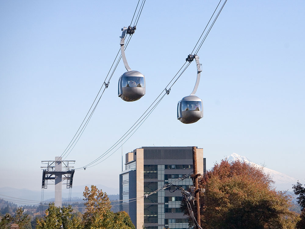
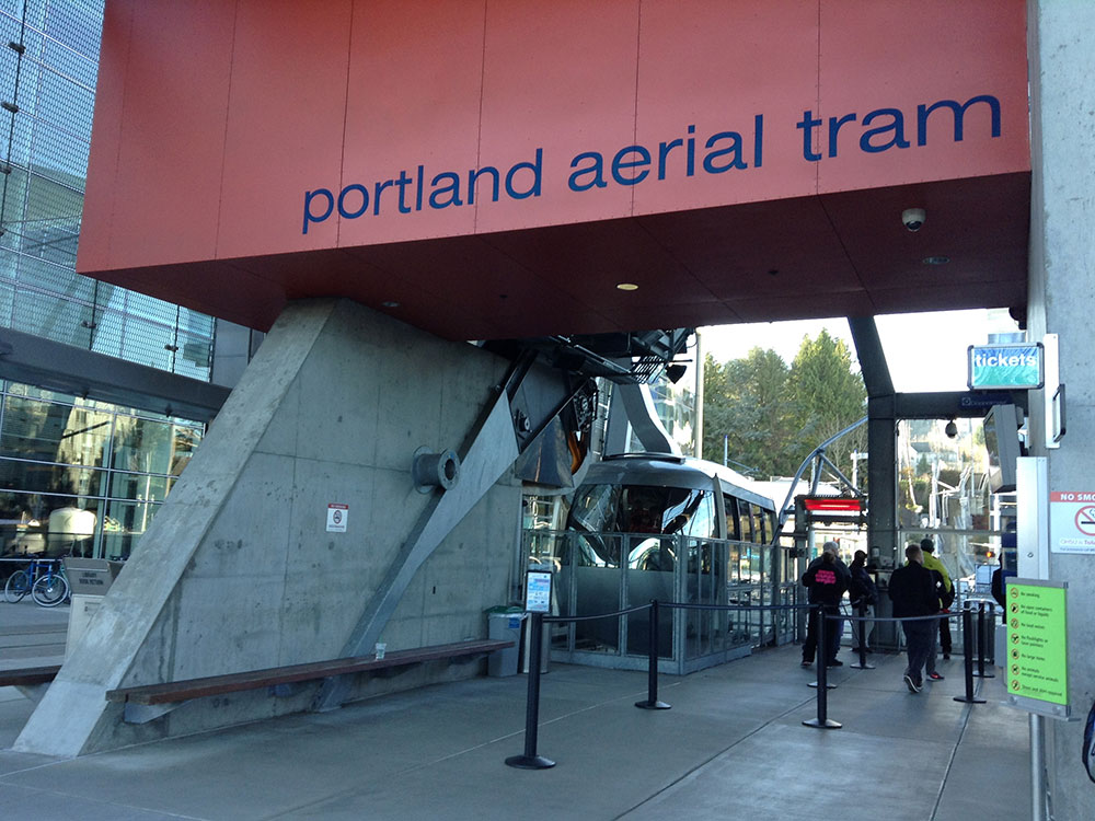
The Portland Aerial Tram or OHSU Tram is an aerial tramway in Portland, Oregon, that connects the city's South Waterfront district and the main Oregon Health & Science University (OHSU) campus, located in the Marquam Hill neighborhood. It is one of only two commuter aerial tramways in the United States, the other being New York City's Roosevelt Island Tramway. The tram travels a horizontal distance of 3,300 feet (1,000 m) and a vertical distance of 500 feet (152 m) in a ride that lasts three minutes.
.jpg)
The tram was jointly funded by OHSU, the City of Portland, and by South Waterfront property owners, with most of the funding coming from OHSU. It is owned by the city and operated by OHSU. While most passengers are affiliated with OHSU, it is open to the public and operated as part of Portland's public transportation network that includes the Portland Streetcar, MAX Light Rail, and TriMet buses. After opening in December 2006, the tram carried its one millionth passenger on October 17, 2007 and its ten millionth rider on January 8, 2014.
The tram consists of two stations and a single intermediate tower. Two tram cars operate in a pendular mode on parallel track ropes and are pulled in unison by a haul rope which is driven by an engine at the lower terminal; when one car is at the upper terminal, the other is at the lower terminal, and vice versa. The lower station is located beside an OHSU facility in the South Waterfront neighborhood, adjacent to a stop on the Portland Streetcar line, which connects the South Waterfront neighborhood with downtown Portland. The upper station is located adjacent to OHSU Hospital, on the university's Marquam Hill campus. The two stations are exactly east and west of each other separated by a horizontal distance of 3,300 feet (5/8 mi; 1.0 km) and a vertical distance of 500 feet (152.4 m). The maximum vertical clearance between the tram and the ground is 175 feet (53.3 m).
The tram route crosses over Interstate 5 as well as major thoroughfares such as Barbur Boulevard, Oregon Route 10 (Naito Parkway), and Oregon Route 43 (Macadam Avenue). The intermediate tower is located east of Interstate 5 close to the South Waterfront station. As a result of this configuration, much of the journey is significantly elevated above the ground, making the tram easily visible for some distance, and providing tram riders with good views of the eastern metropolitan area and the Cascade Mountains of Oregon and Washington. The alternative to riding the tram is via public roadways which require a 1.9-mile (3.1 km) route with numerous stoplights and intersections. This route includes a short stretch of busy U.S. Route 26, as well as twisty Sam Jackson Park Road which ascends the side of the Tualatin Mountains to the hospital campus.
This article uses material from the Wikipedia articles "Portland Aerial Tram", which are released under the Creative Commons Attribution-Share-Alike License 3.0
-1000.jpg)
-750.jpg)
-750.jpg)
-1000.jpg)
-1000.jpg)
-750.jpg)