Stratovolcano in the Cascade Volcanic Arc is second highest mountain in Oregon, and is also a popular tourist destination with hiking, backpacking, and mountaineering
General Information
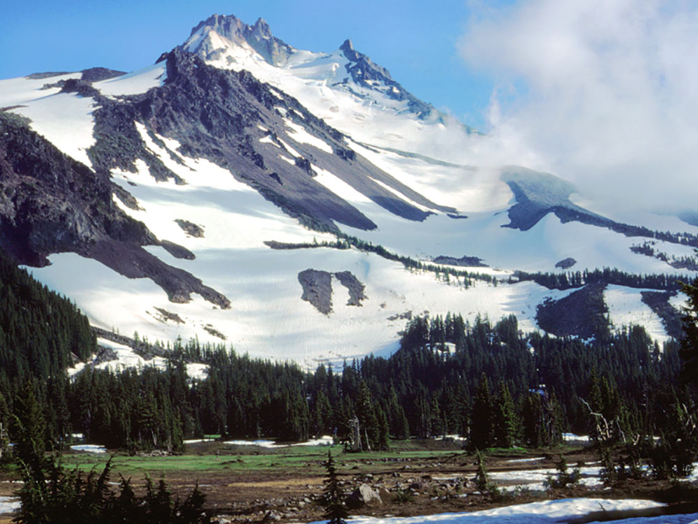
Mount Jefferson is a stratovolcano in the Cascade Volcanic Arc, part of the Cascade Range in Oregon. The second highest mountain in Oregon, it is situated within Linn County, Jefferson County, and Marion County and forms part of the Mount Jefferson Wilderness. Due to the ruggedness of its surroundings, the mountain is one of the hardest volcanoes to reach in the Cascades. It is also a popular tourist destination despite its remoteness, with recreational activities including hiking, backpacking, mountaineering, and photography. Vegetation at Mount Jefferson is dominated by Douglas fir, silver fir, mountain hemlock, ponderosa pine, lodgepole pine, and several cedar species. Carnivores, insectivores, bats, rodents, deer, birds, and various other species inhabit the area.
Also known as Seekseekqua by Native American populations, the volcano was named after United States President Thomas Jefferson, and was first ascended by E. C. Cross and R. L. Farmer in 1888. It sits atop an area of crustal melting, and was produced by the subduction of the oceanic Juan de Fuca tectonic plate under the continental North American tectonic plate, forming about 730,000 years ago. Consisting of basaltic andesite, andesite, and dacite, the mountain has been extensively altered by glacial erosion. The surrounding area contains a number of other volcanic features like cinder cones, shield volcanoes, and tuyas (flat-topped, steep-sided volcanoes formed when lava erupts through a thick glacier or ice sheet). It is considered a low threat by the United States Geological Survey. Despite the low chance of future eruptions, many scientists still consider mudflows a major threat at Mount Jefferson.
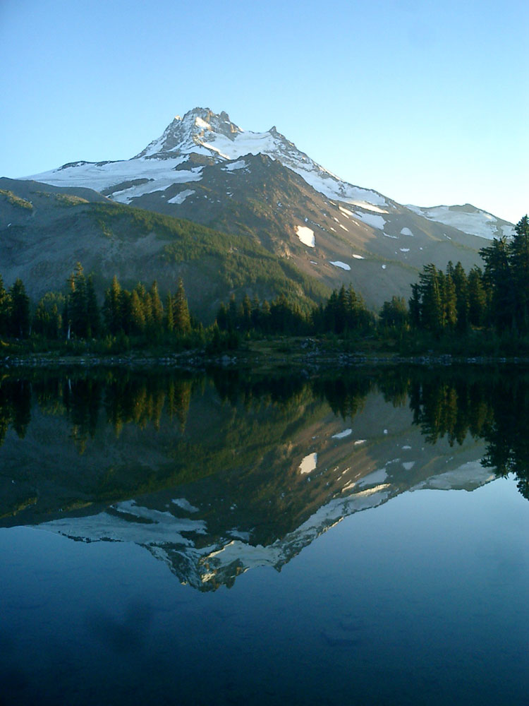
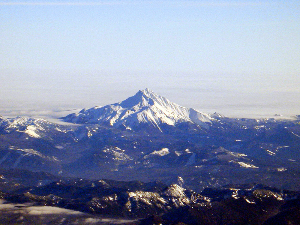
Reaching an elevation of 10,497 feet (3,199 m), the volcano has a proximal relief of 4,890 feet (1,490 m). It is not usually visible from the city of Portland, though it is visible on clear days from Salem and can be noticed from highways to both the east and the west of the Cascade Range. The average elevation of the terrain around Jefferson is 5,500 to 6,500 feet (1,700 to 2,000 m), meaning that Jefferson's cone rises nearly 1 mile (1.6 km) above its surroundings.
Mount Jefferson's eastern segment lies within the Warm Springs Indian Reservation, and its western portion within the Mount Jefferson Wilderness, of the Willamette National Forest and Deschutes National Forests. The wilderness area covers 111,177 acres (449.92 km2), with more than 150 lakes. It also has 190 miles (310 km) of trails, including 40 miles (64 km) of the Pacific Crest National Scenic Trail. Mount Jefferson is the major feature of the wilderness, along with the nearby Three Fingered Jack volcano.
Mount Jefferson has 35 snow and ice features, including four named glaciers: Whitewater, Jefferson Park, Russell, and Waldo. These features, for the most part on the northern, eastern, and southeastern parts of Mount Jefferson, span elevations from 6,158 to 8,189 feet (1,877 to 2,496 m) and cover an area of 2.1 square miles (5.5 km2). The volcano, like much of the Oregon Cascades, was likely covered by an ice cap during the Pleistocene, with the glaciers at their peak size between 25,000 and 20,000 years ago. In recent years, the glaciers have retreated to form lateral moraines; Whitewater Glacier, for example, shrunk from 5 miles (8.0 km) in width and 1 to 2 miles (1.6 to 3.2 km) in length to 1.9 miles (3.1 km) in width and a length of 0.62 miles (1 km). During the 20th century, scientists thought they had identified a new glacier, which they named Milk Creek Glacier, but later studies established that it was an artifact of stagnant ice that had been hidden by debris, and it is no longer considered its own distinct feature.
Other geographic features at Jefferson include rock outcrops, steep talus slopes, conifer forests, and alpine meadows. Additionally, a number of rivers drain Mount Jefferson. The northern and northwestern slopes feed the South Fork Breitenbush River, which flows into Detroit Lake, and the eastern side of Detroit Lake also receives water from Whitewater Creek, Russell Creek, and Milk Creek, which flow from the western flank of Mount Jefferson.The Whitewater Glacier and the northeastern side of the volcano drain into the Whitewater River, and Shitike Creek flows between Mount Jefferson and Olallie Butte before reaching the Deschutes River. Both Jefferson and Parker Creeks receive water from Jefferson's southeastern slopes, then join the Metolius River.
Mount Jefferson is remote, and can usually only be reached on foot or by horse. There are no paved roads within 4 miles (6.4 km) of the mountain, and it is relatively little-known compared to other features near the Willamette Valley. Still, the mountain and its surrounding wilderness are visited by so many hikers, backpackers, and climbers each year, especially during the summer, that they face threats to their ecological well-being. The Warm Springs Tribal Council does not permit access to the volcano's eastern side, so only the western flanks can be used by the public. The western side can be reached from the Oregon Route 22 highway.
Jefferson Park, on the northern slope of the mountain, can be reached on foot by taking the Whitewater Trail and following the Pacific Crest Trail for 1 mile (1.6 km). Located within the Mount Jefferson Wilderness, it represents a popular tourist destination for its views, lakes, and meadows, with activities including backpacking, climbing, and hiking during the summer, as well as nature photography.
The Jefferson Lake Trail runs for 4.2 miles (6.8 km) round trip, with an elevation gain of 400 feet (120 m). Parts of the Trail were destroyed by a fire in the wilderness area in 2003, but the surviving remnants of the trail reopened after maintenance work was completed. At Marion Lake, there are several trails, including a 6 miles (9.7 km) long route and a hike to Marion Mountain that lasts 11.2 miles (18.0 km) round-trip. These and other trails through the region offer views of the devastation of fires in the wilderness area in 2003 and 2006. The Whitewater Trail runs north through the wilderness area for 1.5 miles (2.4 km) before reaching a junction, with the right path moving 2.5 miles (4.0 km) to the Pacific Crest Trail. In the Maxwell trail area, hikes of all difficulty levels can be found, including the challenging Maxwell Butte Trail 3391, the 9-mile (14 km) round trip at Santiam Lake Trail 3491, and the slightly less demanding 6.6-mile (10.6 km) Duffy Lake Trail 3427. At the Pamelia Lake trail area, there are streams, lakes, and springs, as well as bathrooms, parking areas, and picnic tables.
Trails at Pamelia Lake include the Hunts Creek Trail 3440 and a segment of the Pacific Crest Trail, in addition to the Pamelia Lake Trail 3439, which rises 800 feet (240 m) before meeting the Hunts Creek Trail. The area is popular for backpacking, mountaineering, horseback riding, and day hiking. Other popular trails include the Firecamp Lakes Trail and Canyon Creek Meadows trails. In addition to the trails, some of the most popular areas around Mount Jefferson Wilderness include Eight Lakes Basin, Pamelia Lake, Jack Lake, Duffy Lake, Russell Lake, Santiam Lake and Wasco Lake.
Mount Jefferson can be climbed, but the route is challenging, especially the pinnacle of the summit.
This article uses material from the Wikipedia article "Mount Jefferson (Oregon)", which is released under the Creative Commons Attribution-Share-Alike License 3.0
-1000.jpg)
.jpg)