National recreation area on the borders of states of Oregon and Idaho protects the historic and archaeological values of the Hells Canyon area and the area of the Snake River between Hells Canyon Dam and the Oregon-Washington border
General Information
Hells Canyon National Recreation Area is a national recreation area on the borders of states of Oregon and Idaho. Managed by the U.S. Forest Service as part of the Wallowa-Whitman National Forest, the recreation area was established by Congress and signed by President Gerald Ford in late 1975 to protect the historic and archaeological values of the Hells Canyon area and the area of the Snake River between Hells Canyon Dam and the Oregon-Washington border.
-1000.jpg)
Roughly 215,000 acres (335 sq mi; 870 km2) of the recreation area are designated the Hells Canyon Wilderness. There are nearly 900 miles (1,400 km) of hiking trails in the recreation area. The largest portion of the area lies in eastern Wallowa County, Oregon. Smaller portions lie in southwestern Idaho County, Idaho, northwestern Adams County, Idaho, and northeastern Baker County, Oregon.
All or partly included in the HCNRA is the Hells Canyon Archeological District, a 12,000-acre (19 sq mi; 49 km2) historic district listed on the U.S. National Register of Historic Places. It includes 536 contributing sites, 23 contributing buildings, and 58 other contributing structures.
-1000.jpg)
There are many sites with pictographs, the largest of which are Buffalo Eddy, with more than five hundred pictographs, and Pittsburg Landing, where nearly thirty boulders are covered with them. An interpretive site has a short trail to interpretive panels displaying petroglyphs and pictographs.
There are 17 campgrounds in the national recreation area. Pittsburg Landing, with a river boat launch is the only area with RV camping on the Idaho side, and there are seven on the Oregon side.
The Snake River National Recreation Trail #102(SRNRT) lies within the Hells Canyon National Recreation Area and along the Idaho side of the Snake River, from near Lamont Springs, downstream, to Pittsburg Landing. The SRNRT was designated in 1980 under the National Trails System Act. It was constructed during the period of the late 1800s to about the 1930s. Access to the SRNRT can be gained via road to the trailhead at Pittsburg Landing on the north end of the trail, or, by boat access near Hells Canyon Dam on the south end of the trail. Access can also be gained via trails leading from Seven Devils Wilderness Area trail head at Windy Saddle (elevation 7200') via either the Granite Creek trails or Sheep Creek trails.
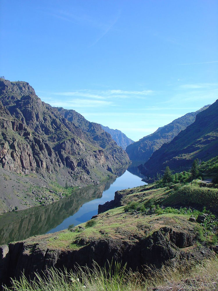
Hells Canyon is a ten-mile-wide (16 km) canyon in the western United States, located along the border of eastern Oregon, a small section of eastern Washington and western Idaho. It is part of the Hells Canyon National Recreation Area which is also located in part of the Wallowa-Whitman National Forest. It is North America's deepest river gorge at 7,993 feet (2,436 m). Notably, Hells Canyon runs deeper than the better-known Grand Canyon in Arizona.
The canyon was carved by the waters of the Snake River, which flows more than one mile (1.6 km) below the canyon's west rim on the Oregon side and 7,400 feet (2,300 m) below the peaks of Idaho's Seven Devils Mountains range to the east. This area includes 214,000 acres of wilderness. Most of the area is inaccessible by road.
The geologic history of the rocks of Hells Canyon began 300 million years ago with an arc of volcanoes that emerged from the waters of the Pacific Ocean. Over millions of years, the volcanoes subsided and limestone built up on the underwater platforms. The basins between them were filled with sedimentary rock. Between 130 and 17 million years ago, the ocean plate carrying the volcanoes collided with and became part of the North American continent. A period of volcanic activity followed, and much of the area was covered with floods of basalt lava, which smoothed the topography into a high plateau. The Snake River began carving Hells Canyon out of the plateau about 6 million years ago. Significant canyon-shaping events occurred as recently as 15,000 years ago during a massive outburst flood from Glacial Lake Bonneville in Utah. The canyon contains dense forests, scenic overlooks and mountain peaks. At the bottom of the canyon, the area is a dry, desert environment.
In 1975, Congress had declared 652,000 acres to be the recreational area for the Hells Canyon National Forest. There are many recreational activities available within the canyon. Activities in Hells Canyon include fishing, jet boat tours, hunting, hiking, camping, and whitewater sports (mainly rafting and kayaking). Much of these activities rely on the Snake River, which is the main factor in the creation of Hells Canyon. The Snake River is home to numerous fish species, an abundance of class I-IV rapids (some of largest in the Pacific Northwest), diverse wildlife and miles of systems. There is one boat ramp that is located at the upper end of the Snake River. The wildlife is made up of over 350 species and this includes big game, small game, bird, and waterfowl hunting. Trophy hunting in this area consists of Elk, Mountain Goats, Mountain Lions, Mule Deer, Whitetail Deer, and Black Bears. These key components make Hells Canyon an outdoor recreation mecca that brings in tourists from around the world. Hells canyon offers tours year round, while most of the whitewater activities peak in summer months. To participate in these recreational activities one can utilize commercial charters or private trips.
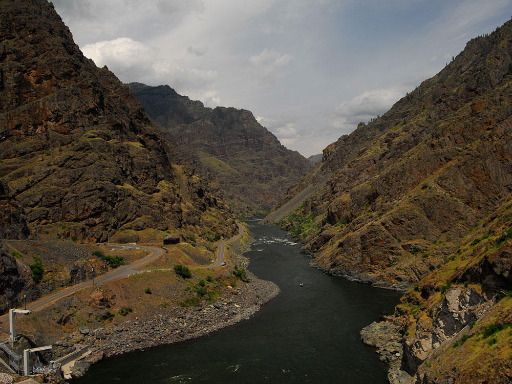
There are three roads that lead to Snake River and they are located between Hells Canyon Dam and the Oregon-Washington state line. There are no roads that cross Hells Canyon. From Oxbow Bridge near Copperfield, Oregon, Hells Canyon Road follows the Idaho side of the river 22 miles (35 km) downstream to the Hells Canyon Dam. The road crosses the dam and continues another mile to the Hells Canyon Visitor Center on the Oregon side.
Farther north on the Idaho side, Deer Creek Road connects White Bird, Idaho, to the river at Pittsburg Landing. Near the northern end of the canyon, Forest Road 4260 (Lower Imnaha Road), the last part of which is too rough for most cars, reaches the river at Dug Bar, 21 miles (34 km) from Imnaha, Oregon. On the canyon rims, viewpoints accessible by road include Hat Point and Buckhorn in Oregon and Heavens Gate in Idaho.
- Dug Bar
- Pittsburg Landing
- Lower End
- Hells Canyon Dam
- Upper End
- Oxbow Dam
- Brownlee Dam
- Hat Point Lookout
- Buckhorn Lookout
- Kinney Point
The Hells Canyon Wilderness is a wilderness area in the western United States, in Idaho and Oregon. Created 46 years ago in 1975, the Wilderness is managed by both the U.S. Bureau of Land Management and the U.S. Forest Service and contains some of the most spectacular sections of the Snake River as it winds its way through Hells Canyon, North America's deepest river gorge and one of the deepest gorges on Earth. The Oregon Wilderness Act of 1984 added additional acreage and currently the area protects a total area of 217,927 acres (88,192 ha). It lies entirely within the Hells Canyon National Recreation Area except for a small 946-acre (383 ha) plot in southeastern Wallowa County, Oregon which is administered by the Bureau of Land Management. The area that is administered by the Forest Service consists of portions of (in descending order of acreage) the Wallowa, Nez Perce, Payette, and Whitman National Forests.
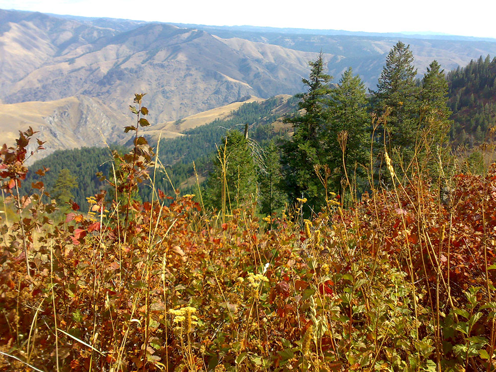
The Oregon portion of Hells Canyon Wilderness is characterized by two steep breakland areas in excess of 60 percent paralleling the Snake River. These are separated by a benchland at mid-elevation between the river and canyon rim between Saddle Creek and Dug Bar. The dominant vegetation is native bunchgrasses and shrubs. Trees are scattered throughout the Oregon side of the Wilderness, but concentrated on north-facing slopes and in stream bottoms - primarily ponderosa pine and Douglas fir. The three topographic provinces are dissected by many drainages including Saddle, Temperance, Salt, and Sluice Creeks.
The Idaho portion of Hells Canyon Wilderness is characterized by three geologic-vegetative regions. The upper areas are alpine and subalpine with several lakes and geologic formations of glacial origin. Vegetation is sparse and broken by large areas of rock. The middle portions contain dense forests of larch, lodgepole pine, and true firs. Lower elevations are characterized by dry, rocky, barren, steep slopes breaking into the Snake River and its major tributaries. Trees are sparse, consisting mostly of ponderosa pine and Douglas fir. This entire area is dissected by several major drainages including Sheep Creek, Granite Creek, and Deep Creek. The highest peaks are the Seven Devils Mountains, the tallest is "He Devil" at 9,393 feet (2,863 m) above sea level.
Wildlife is abundant in Hells Canyon Wilderness. Black bear, cougar, elk, deer, mountain goat, chukar, and bighorn sheep are common. There have been reports, documented as recently as the late 1970s by local Forest Service and agriculture workers, of grizzly bears in the Wilderness. Wolves have established small packs in the area, and moose, peregrine falcon, bald and golden eagles can also be seen. Recent research has photodocumented the presence of wolverines.
Three National Wild and Scenic Rivers run through the Wilderness - the Snake, Imnaha, and Rapid rivers.
66.9 miles (108 km) of the Snake River, from Hells Canyon Dam 35 miles (56 km) downstream, are designated Wild and Scenic. 32.5 miles (52 km) are designated "wild" and 34.4 miles (55 km) are designated "scenic."
77 miles (124 km) of the Imnaha River from its headwaters are designated Wild and Scenic. The designation comprises the main stem from the confluence of the North and South Forks of the Imnaha River to its mouth, and the South Fork from its headwaters to the confluence with the main stem. In 1988, 15 miles (24 km) were designated "wild," 4 miles (6 km) were designated "scenic," and 58 miles (93 km) were designated "recreational," though only a portion of the Wild and Scenic Imnaha is located within Hells Canyon Wilderness.
26.8 miles (43 km) of Idaho's Rapid River from the headwaters of the main stem to the National Forest boundary, and the segment of the West Fork from the wilderness boundary to the confluence with the main stem, are designated "wild." The river contains three threatened fish species - chinook salmon, steelhead, and bull trout.
There are approximately 360 miles (580 km) of trails crossing Hells Canyon Wilderness. The extensive trail system mostly follows old Forest Service access routes to fires, and stock trails used by ranchers to move livestock to remote salting areas and watering holes. Many routes follow ridges and traverse moderate slopes and benchlands, while others climb steep slopes.
This article uses material from the Wikipedia article "Hells Canyon National Recreation Area", "Hells Canyon", and "Hells Canyon Wilderness (Oregon and Idaho)", which is released under the Creative Commons Attribution-Share-Alike License 3.0


-1000.jpg)
