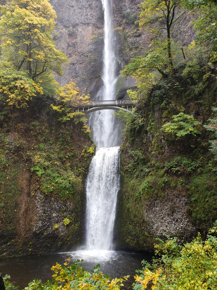
Falls spanning two tiers on basalt cliffs, is the tallest waterfall in Oregon at 620 ft
General Information
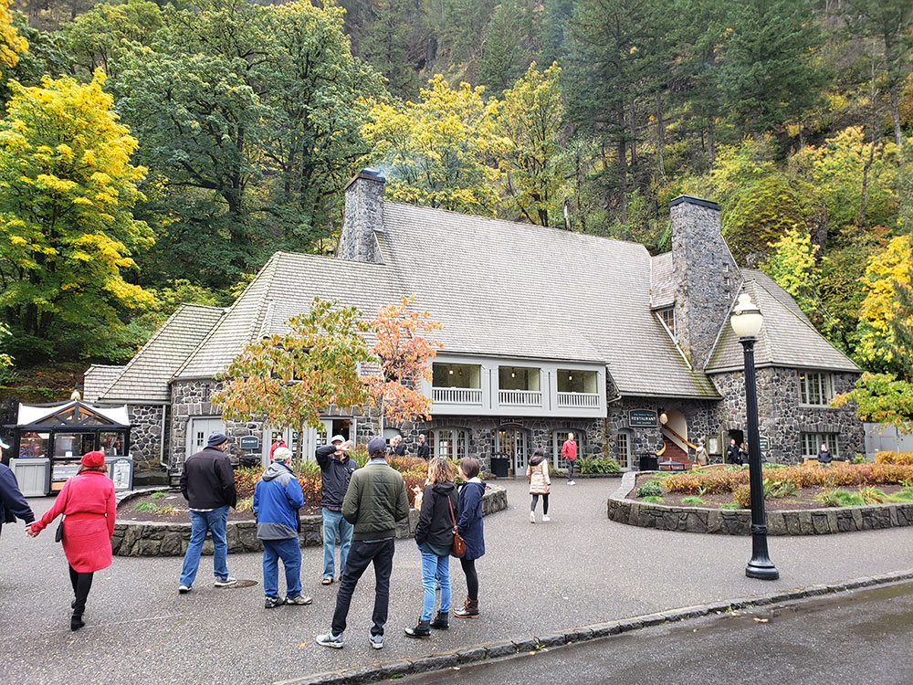
The Multnomah Lodge restaurant, gift shop, snack bar and restrooms are open to the public. The Visitor Center is temporarily closed.
Head east toward I-5 N. Merge onto I-5 N. Use the right 2 lanes to take exit 300 for I-84 E/US-30 E toward Portland Airport/The Dalles. Continue onto I-84 E/US-30 E. Use the left lane to take exit 31 toward Multnomah Falls
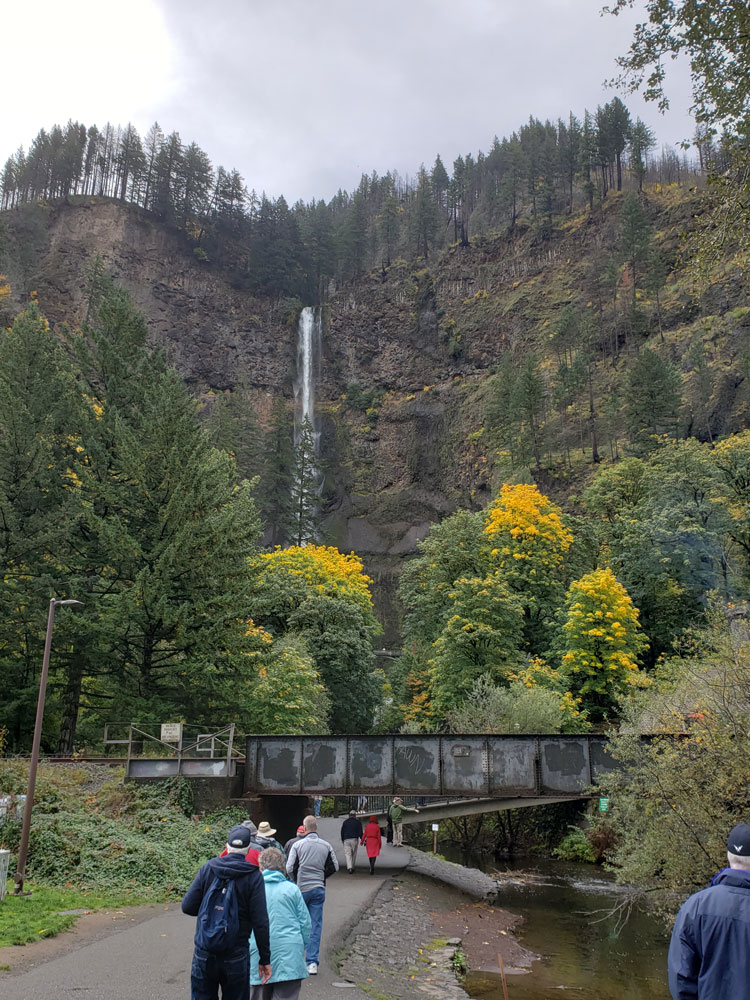
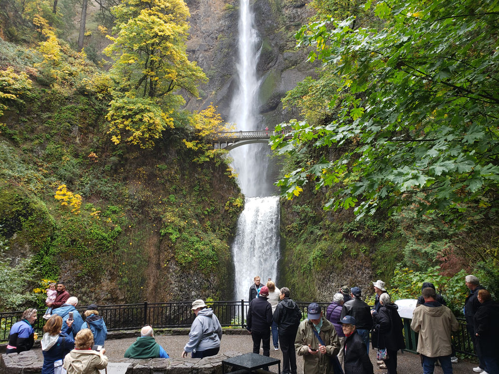
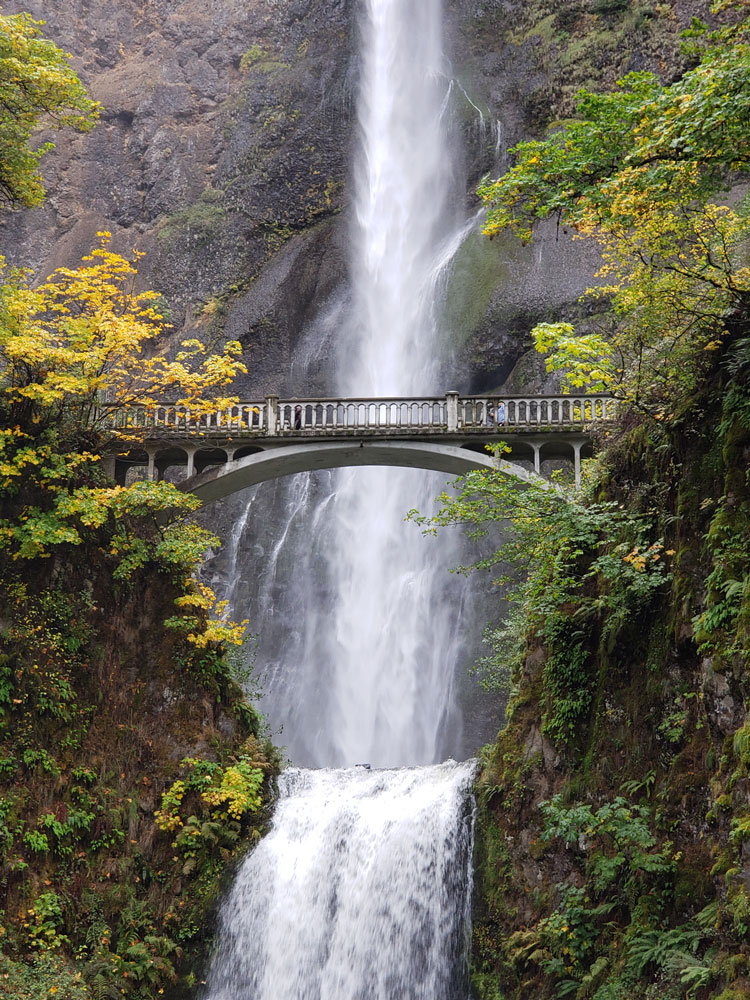
Multnomah Falls is a waterfall located on Multnomah Creek in the Columbia River Gorge, east of Troutdale, between Corbett and Dodson, Oregon. The waterfall is accessible from the Historic Columbia River Highway and Interstate 84. Spanning two tiers on basalt cliffs, it is the tallest waterfall in the state of Oregon at 620 ft (189 m) in height.
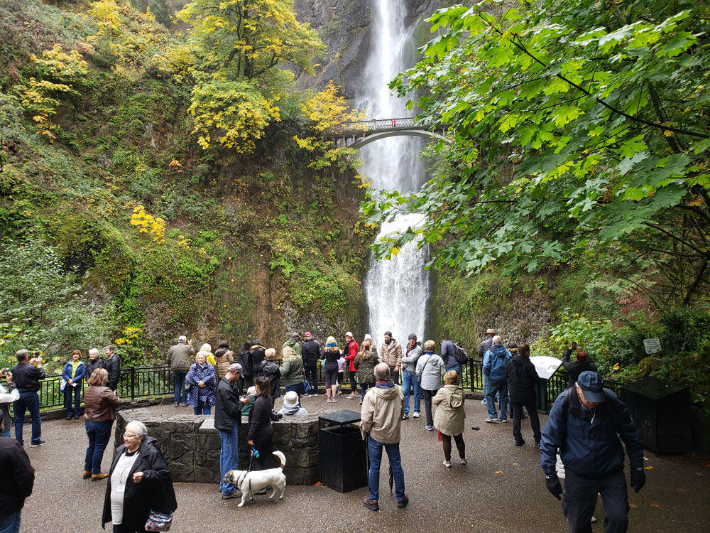
The land surrounding the falls was developed by Simon Benson in the early-twentieth century, with a pathway, viewing bridge, and adjacent lodge being constructed in 1925. The Multnomah Falls Lodge and the surrounding footpaths at the falls were added to the National Register of Historic Places in 1981. Contemporarily, the state of Oregon maintains a switchback trail that ascends to a talus slope 100 feet (30 m) above the falls, and descends to an observation deck that overlooks the falls' edge. The falls attract over two million visitors each year, making it the most-visited natural recreation site in the U.S. Pacific Northwest.
The falls drops in two major steps, split into an upper falls of 542 feet (165 m) and a lower falls of 69 feet (21 m), with a gradual 9 foot (3 m) drop in elevation between the two, so the total height of the waterfall is conventionally given as 620 feet (189 m). The two drops are due to a zone of more easily eroded basalt at the base of the upper falls.
Underground springs from Larch Mountain are the year-round source of water for the waterfall, augmented by spring runoff from the mountain's snowpack and rainwater during the other seasons. This spring is the source of Multnomah Creek.
The waterfall formed around 15,000 years ago at the end of a hanging valley, and was created by the Missoula Floods. According to legend from the Multnomah tribe (from whom the falls take their name), the waterfall was formed after a young woman sacrificed herself to the Great Spirit to save Multnomah village from a plague by jumping from the cliff, and the Multnomah peoples were saved. After her death, water began to flow from above the cliff, creating the waterfall.
The origin of the falls' naming is unclear; scholar Lewis A. McArthur, in Oregon Geographic Names, suggested that S. G. Reed, a prominent mercantile clerk in Portland and native of Massachusetts, may have been the first to apply the name with the idea of popularizing sites along the Columbia River for steamboat excursions.
Onlookers on the north bank of the Columbia River in Washington view Multnomah Falls to the south. In contrast to other falls along the Gorge, the Multnomah Falls area is accessible via Interstate 84 east of Troutdale, Oregon, and is a "designated scenic area" by the state of Oregon. The rest area and tunnel under the road (as well as the Union Pacific Railroad tracks) allow Interstate travelers from either direction to stop and visit the falls.
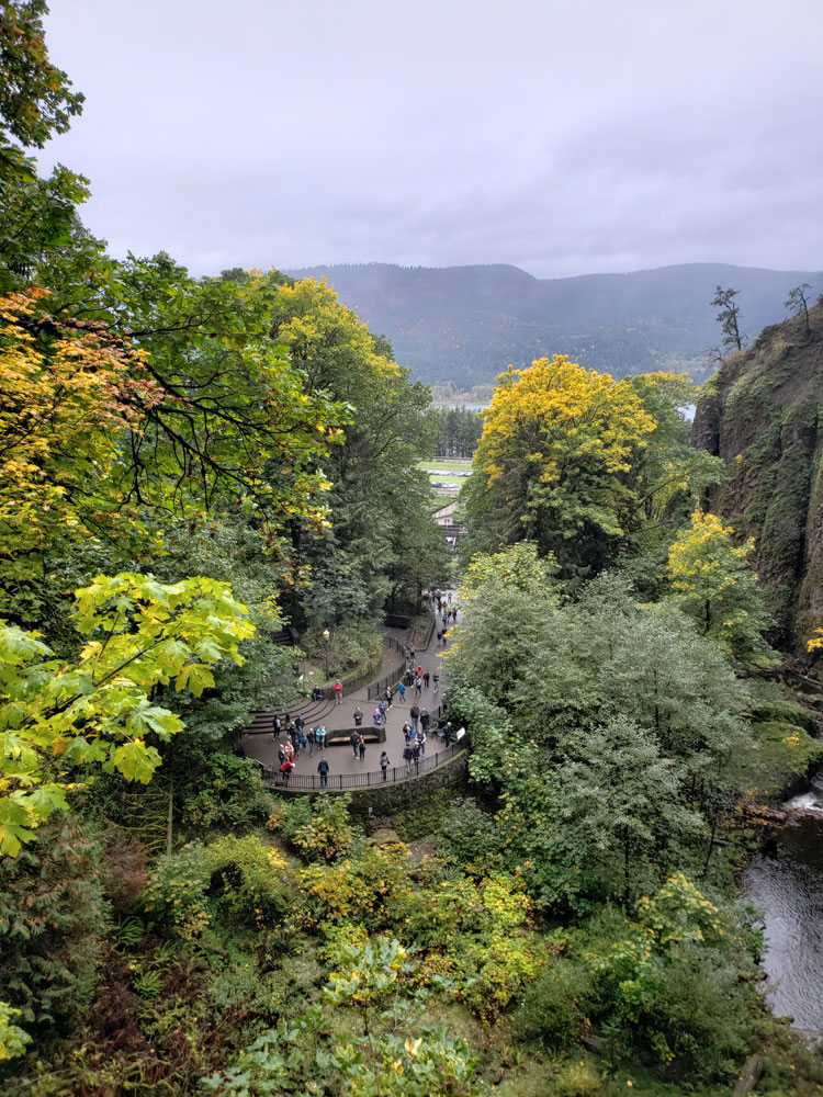
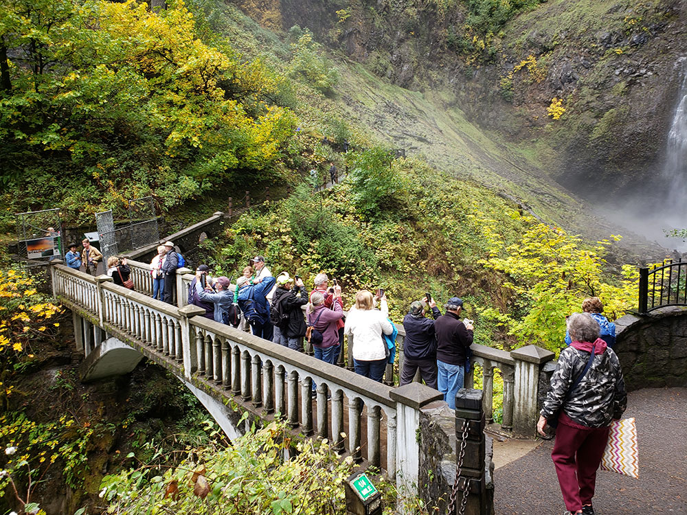
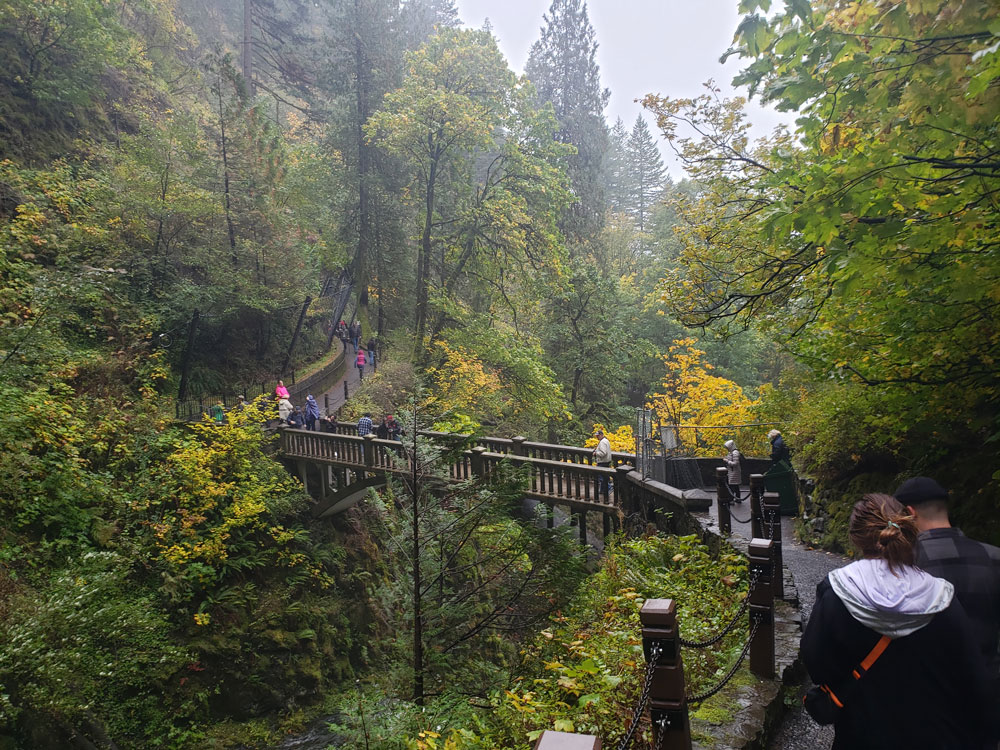
A paved foot trail leads to Benson Footbridge, a 45-foot (14 m)-long footbridge that allows visitors to cross 105 feet (32 m) above the lower cascade. After a viewpoint of the upper falls, the trail continues to ascend to an elevation of 785 feet (239 m); it consists of eleven switchbacks which reach a forested talus slope 100 feet (30 m) above the falls. The trail then descends to an observation deck (elevation 660 feet (200 m)) overlooking the falls' edge, providing visitors a bird's-eye view of the Columbia Gorge and also of "Little Multnomah", a small cascade slightly upstream from the "upper" falls, which is not visible from ground level.
There are a number of trail junctions along the footpaths ascending to the falls' observation deck, which allow access to a 5.4 miles (8.7 km) trail loop to other nearby waterfalls. The Mark O. Hatfield Memorial Trail, one of several, starts at the falls and continues through the Oregon side of the Columbia River Gorge to Starvation Creek.
This article uses material from the Wikipedia article "Multnomah Falls", which is released under the Creative Commons Attribution-Share-Alike License 3.0