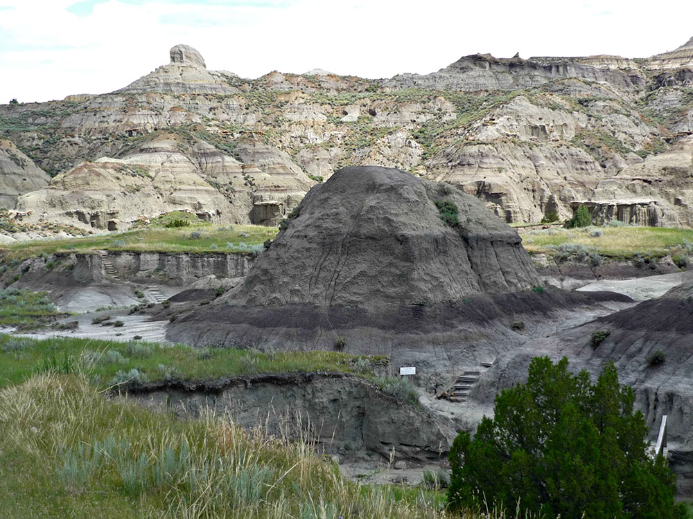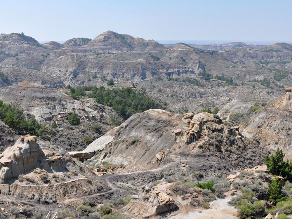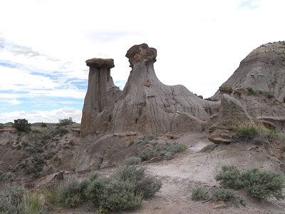

Encompasses badlands containing dinosaur fossils and rock from the Hell Creek Formation
General Information
Visitor Center
Summer Hours June 3 to 3rd Sunday of Sept:
Open daily, 10am to 4 pm, closed for cleaning noon to 1pm.
Winter Hours 3rd Monday of Sept to 3rd Thursday of May:
Open Wednesday to Sunday, 10 am to 4pm.
Closed all federal and state holidays except Memorial Day, Fourth of July, and Labor Day.
Non-Residents: Day use entrance fee with a vehicle: $8
From Medora, ND (63 miles): Get on I-94 W in North Billings. Follow I-94 W to I-94BL W/N Merrill Ave in Dawson County. Take exit 215 from I-94 W. Continue on N Merrill Ave. Take S Taylor Ave to Makoshika State Park Rd.
From Billings, MT (219 miles): Get on I-90 E/US-87 S in Lockwood from Box Elder Creek Rd, Cedar Canyon Rd and Rosebud Ln. Follow I-94 E to I-94BL E/W Towne St in Dawson County. Take exit 210 from I-94 E. Continue on I-94BL E/W Towne St. Drive to Makoshika State Park Rd.
Makoshika State Park from the Lakota Maco sica, meaning 'bad land' or 'land of bad spirits' is a nature preserve and public recreation area located on the southeast side of Glendive in Dawson County, Montana. The state park encompasses badlands containing dinosaur fossils and rock from the Hell Creek Formation. It is the largest of Montana's state parks at more than 11,000 acres (45 km²).
Dinosaur fossils discovered in and near the park include examples of Triceratops and Thescelosaurus. A 600-pound juvenile female triceratops skull measuring 5.5 feet long was unearthed in 1991. The skull is displayed in the park's visitor center. In 1997, a fossil thescelosaurus considered to be the largest and most complete skeleton of its kind was found by an expedition led by Jack Horner and Bob Harmon.
Turkey vultures, prairie falcons, and golden eagles make a home in the park.
The park features a visitors center with geology and fossil displays, scenic drives, nature trails, campground, archery area, amphitheater, and picnicking facilities. Events include the annual "Buzzard Day" celebration.
Things to Do
Explore Montana's Largest State Park
Makoshika State Park, located near Glendive in eastern Montana, is the largest state park in Montana. Known for its dramatic badlands landscape, colorful rock formations, deep canyons, and rich fossil resources, the park offers visitors a unique opportunity to experience one of the most spectacular and geologically significant areas of the Northern Great Plains.
Discover Dinosaur Fossils and Ancient History
Makoshika is internationally recognized for its dinosaur fossils and prehistoric discoveries. Fossils of Tyrannosaurus rex, Triceratops, Edmontosaurus, and several other prehistoric species have been found within the park. Exhibits and interpretive displays help visitors learn about the area's ancient ecosystems and paleontological significance.
Visit the Visitor Center and Museum Exhibits
The visitor center features fossil displays, educational exhibits, interpretive information, and orientation materials that introduce visitors to the park's geology, wildlife, and prehistoric history.
Drive the Scenic Park Road
A scenic road winds through the badlands, providing access to overlooks, trailheads, picnic areas, and some of the park's most spectacular viewpoints. Visitors can enjoy dramatic views of eroded rock formations and expansive prairie landscapes.
Experience Hiking Through the Badlands
The park offers a variety of hiking opportunities through rugged canyons, ridgelines, and rock formations. Trails provide access to fossil-bearing formations, scenic overlooks, and remote sections of the badlands landscape.
Enjoy Wildlife Viewing and Photography
Visitors frequently see mule deer, pronghorn, prairie dogs, coyotes, hawks, eagles, and numerous songbirds throughout the park. The colorful badlands and striking sunset light make Makoshika a favorite destination for landscape photographers.
Camp Beneath the Big Sky
Campgrounds within the park provide opportunities to experience eastern Montana's unique landscapes after dark. Clear skies and minimal light pollution make the park a popular location for stargazing and night photography.
Top Trails
Cap Rock Nature Trail
Length: Approximately 0.5 miles loop
Elevation Gain: Minimal
Difficulty: Easy
This short interpretive trail is one of the park's most popular walks. It features informational displays about geology, fossils, and wildlife while providing excellent views of the surrounding badlands and the iconic Cap Rock formation.
Diane Gabriel Trail
Length: Approximately 1 mile loop
Elevation Gain: Moderate
Difficulty: Easy to Moderate
A scenic trail that travels through badlands terrain and offers opportunities to observe unique geological formations, native plants, and wildlife while enjoying panoramic views of the park.
Vista Trail
Length: Approximately 2.5 miles round trip
Elevation Gain: Moderate
Difficulty: Moderate
This trail leads to elevated viewpoints overlooking the badlands and surrounding prairie. It is popular among hikers seeking some of the park's best scenic vistas and photography locations.
Kinney Coulee Trail
Length: Approximately 1.5 miles round trip
Elevation Gain: Moderate
Difficulty: Moderate
Following a picturesque coulee through the heart of the badlands, this trail allows visitors to experience the rugged terrain and unique geological features that define Makoshika State Park.
Ridgeline Trail
Length: Varies depending on route
Elevation Gain: Moderate to Significant
Difficulty: Moderate to Challenging
This route follows elevated ridges and provides expansive views of eroded rock formations, prairie landscapes, and the dramatic terrain that makes Makoshika one of Montana's most distinctive parks.
Sources: Montana Fish, Wildlife & Parks official Makoshika State Park information covering geologic formations, dinosaur fossils, interpretive exhibits, camping, scenic drives, wildlife viewing, and hiking opportunities.
https://fwp.mt.gov/stateparks/makoshikaMakoshika State Park - Montana FWP
Additional visitor information regarding park history, fossils, badlands geology, recreation opportunities, scenic overlooks, and educational programs.
https://www.visitmt.com/listing/makoshika-state-park-3074Visit Montana - Makoshika State Park
Supplemental trail and hiking information covering Cap Rock Nature Trail, Diane Gabriel Trail, Vista Trail, Kinney Coulee Trail, and other routes throughout the park.
https://www.alltrails.com/parks/us/montana/makoshika-state-parkMakoshika State Park Trails
This article uses material from the Wikipedia article "Makoshika State Park", which is released under the Creative Commons Attribution-Share-Alike License 3.0
-1000.jpg)
.jpg)