.jpg)
Series of badland areas characterized by rock outcroppings, steep bluffs, and grassy plains
General Information
Multiple Day: Per person, per day, no additional boat fee
$4.00 Adults (16 years and older)
$2.00 Children (7-15 years)
Free Children (under 7 years)
From Billings (223 miles): Follow Montana Ave and I-90BL E/1st Ave N to US-87 N/Hwy 312/Main St. Follow US-87 N to MT-19 N in Fergus County. Continue straight onto MT-19 N. Continue onto US-191 N. Continue on MT-66 N. Take Cow Island Trail to Ervine Ridge Rd in Blaine County.
From Great Falls (148 miles): Take 4th St N and River Dr N to US-87 N. Turn left onto US-87 N. Continue on State Hwy 236/Judith Landing Rd. Take Cow Island Trail to Ervine Ridge Rd in Blaine County.
The Upper Missouri River Breaks National Monument is a monument protecting the Missouri Breaks of north central Montana. Managed by the Bureau of Land Management (BLM), it is a series of badland areas characterized by rock outcroppings, steep bluffs, and grassy plains; a topography referred to as "The Breaks" by locals (as the land appears to "break away" to the river).
-1000.jpg)
.jpg)
Created by proclamation in 2001 by President Bill Clinton on January 17, it encompasses 377,000 acres (589 sq mi; 1,526 km2), of public lands, most of which were already managed by the federal government. The adjacent Missouri River was designated a Wild and Scenic River in 1976 and forms a western boundary while the Charles M. Russell National Wildlife Refuge is to the east. The Breaks country was a model for many of the paintings done by painter Charles M. Russell.
Bighorn Canyon National Recreation Area has four historic ranches within its boundaries:
French trappers found the area in the late 18th century peopled by Native American tribes such as the Blackfoot, Northern Cheyenne, Sioux, Assiniboine, Gros Ventre (Atsina), Crow, Plains Cree, and Plains Ojibwa. (The Crow name is Xuáhcheesh Annáppiio, "Where the Crow warrior Skunk was killed.")
-1000.jpg)
.jpg)
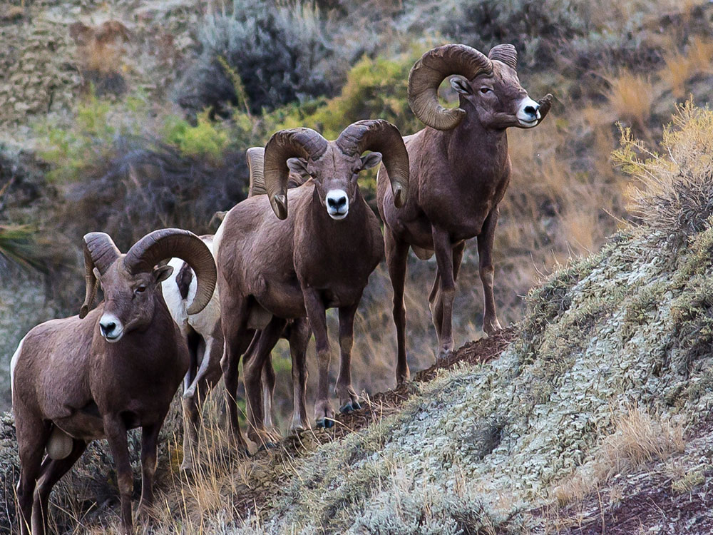
The Lewis and Clark Expedition passed through the Breaks in 1805 and were the first to document the region through notes and drawings, and their sighting and documentation of bighorn sheep in the Breaks region was the first time this species was recorded in North America by white explorers. Much of the Breaks region has remained as it was when Lewis and Clark's party first saw it. The confluence of the Judith and Missouri Rivers was the setting for important peace councils in 1846 and 1855.
In 1877, the eastbound Nez Perce crossed the Missouri and entered the Breaks country in their attempt to escape to Canada. The Cow Island Skirmish occurred in the Breaks and was the last encounter prior to the Nez Perce's surrender to the U.S. Army at the Battle of Bear Paw, just north of the monument.
The Breaks is home to at least sixty mammal species and hundreds of bird species. Willows and shrubs are found along the Missouri River banks while sagebrush and short grass prairie are dominant elsewhere.
This article uses material from the Wikipedia article "Upper Missouri River Breaks National Monument", which is released under the Creative Commons Attribution-Share-Alike License 3.0
.jpg)
-1000.jpg)
.jpg)
-1000.jpg)
.jpg)
-1000.jpg)
.jpg)
-1000.jpg)
.jpg)
-1000.jpg)
.jpg)