Steep mountain pass with scenic overlooks, historical markers, and a dramatic elevation change between forested and prairie landscapes.
General Information
Accessible year-round, weather permitting
How to Get There
From Coeur d'Alene, ID (160 mi): Take US-95 S through Lewiston and continue south past White Bird to reach the summit, located about 8 miles before Grangeville.
Overview
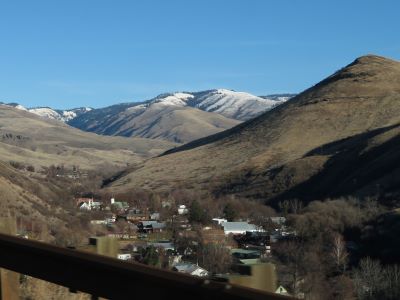
The White Bird Hill Summit is a dramatic mountain pass in north central Idaho, traversed by U.S. Highway 95. Rising to an elevation of 4,245 feet, the summit marks the divide between the Salmon River Canyon and the Camas Prairie. The route features a steep grade, scenic overlooks, and interpretive signs that highlight the area's natural beauty and historical significance. The summit is a key point along the Nez Perce National Historic Trail and offers panoramic views of the surrounding wilderness.
The summit is named after Chief White Bird, a leader of the Nez Perce tribe, and lies near the site of the 1877 Battle of White Bird Canyon. The original road, completed in 1921, was a winding route with numerous switchbacks, while the modern highway offers a more direct and safer ascent. Today, White Bird Hill Summit is a popular stop for travelers seeking a glimpse into Idaho’s rugged terrain and storied past.
This article uses material from the Wikipedia articles and official tourism pages for the White Bird Hill Summit, which are released under the https://creativecommons.org/licenses/by-sa/3.0/.
