Paved 73-mile recreational trail winding through forests, wetlands, and historic towns along northern Idaho’s scenic corridor.
General Information
Trailheads and rest areas may have seasonal access
Parking fees may apply at some trailheads
How to Get There
From Coeur d'Alene, ID (28 mi): Take I-90 E to access multiple trailheads including Cataldo, Kellogg, or Wallace, depending on your preferred starting point.
Overview
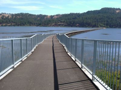
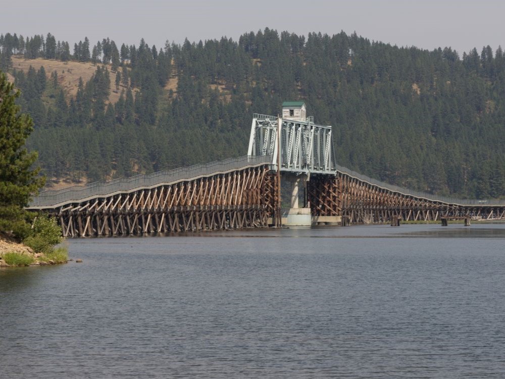
The Trail of the Coeur d'Alenes is a 73-mile paved rail-trail stretching across northern Idaho from Mullan to Plummer. This scenic corridor follows the Coeur d'Alene River and skirts the shores of Lake Coeur d'Alene, offering breathtaking views and abundant opportunities for wildlife viewing, cycling, skating, and cross-country skiing. With 20 developed trailheads and numerous rest stops, the trail is accessible for all skill levels and mobility types.
Developed through a partnership between the Coeur d'Alene Tribe, Union Pacific Railroad, and state and federal agencies, the trail is a model of environmental restoration and recreational planning. Interpretive signs along the route highlight the region’s mining history, tribal heritage, and ecological significance. Whether you're planning a multi-day ride or a leisurely stroll, the Trail of the Coeur d'Alenes is a must-visit for outdoor enthusiasts and history buffs alike.
This article uses material from the Wikipedia articles and official tourism pages for the Trail of the Coeur d'Alenes, which are released under the https://creativecommons.org/licenses/by-sa/3.0/.
-1000.jpg)