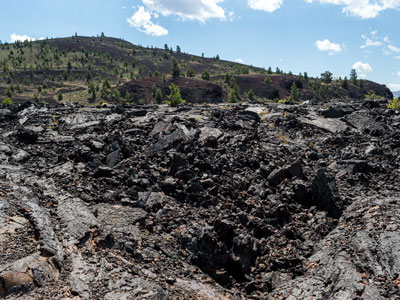
Monument and preserve includes volcanic features and represent one of the best-preserved flood basalt areas in the continental United States
General Information
Summer hours May 28 to September 5 Open daily 9am to 6pm
Winter hours December 1 to April 30 Open daily 9am to 4:40pm
Motorcycle $15.00
Walk in/ Bicycle $10.00
15 and under free
7 day passes, fee covers driver and any passengers
From Salt Lake City, UT (263 miles): Get on I-15 N. Follow I-15 N to I-15BL S in Blackfoot. Take exit 93 from I-15 N. Follow US-26 W to Loop Rd in Butte County.
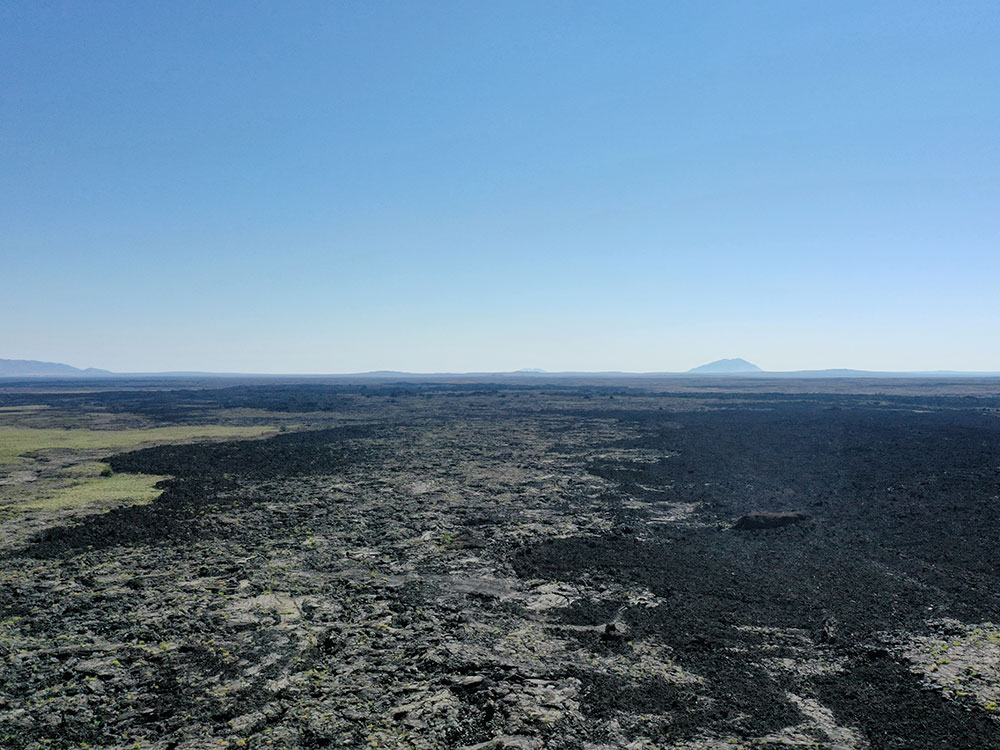
Craters of the Moon National Monument and Preserve is a monument and preserve in the Snake River Plain in central Idaho. It is along US 20 (concurrent with US 93 and US 26), between the small towns of Arco and Carey, at an average elevation of 5,900 feet (1,800 m) above sea level. The protected area's features are volcanic and represent one of the best-preserved flood basalt areas in the continental United States.
-1000.jpg)
The Monument was established on May 2, 1924. In November 2000, a presidential proclamation by President Clinton greatly expanded the Monument area. The 410,000-acre National Park Service portions of the expanded Monument were designated as Craters of the Moon National Preserve in August 2002.
The Monument and Preserve encompass three major lava fields and about 400 square miles (1,000 km2) of sagebrush steppe grasslands to cover a total area of 1,117 square miles (2,893 km2). The Monument alone covers 343,000 acres (139,000 ha). All three lava fields lie along the Great Rift of Idaho, with some of the best examples of open rift cracks in the world, including the deepest known on Earth at 800 feet (240 m). There are excellent examples of almost every variety of basaltic lava, as well as tree molds (cavities left by lava-incinerated trees), lava tubes (a type of cave), and many other volcanic features.
Craters of the Moon is in south-central Idaho, midway between Boise and Yellowstone National Park. The lava field reaches southeastward from the Pioneer Mountains. Combined U.S. Highway 20-26-93 cuts through the northwestern part of the monument and provides access to it. However, the rugged landscape of the monument itself remains remote and undeveloped, with only one paved road across the northern end.
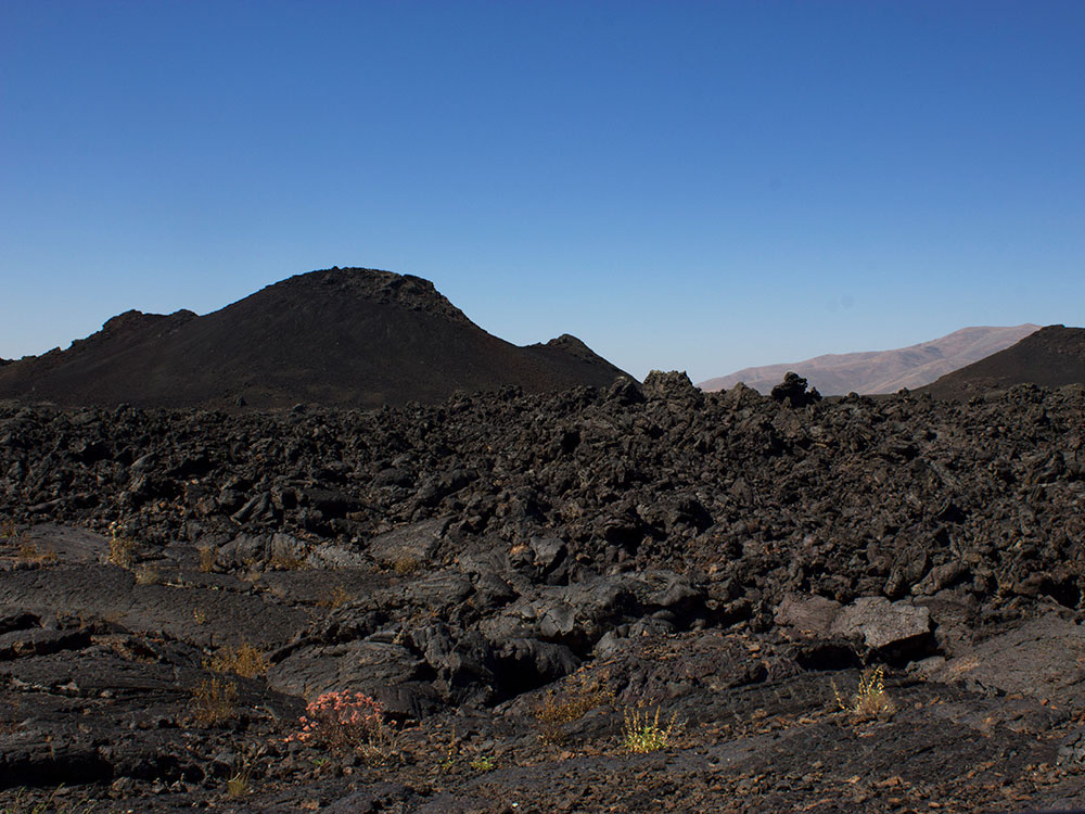
The Craters of the Moon Lava Field spreads across 618 square miles (1,601 km2) and is the largest mostly Holocene-aged basaltic lava field in the contiguous United States. The Monument and Preserve contain more than 25 volcanic cones, including outstanding examples of spatter cones. The 60 distinct solidified lava flows that form the Craters of the Moon Lava Field range in age from 15,000 to just 2,000 years. The Kings Bowl and Wapi lava fields, both about 2,200 years old, are part of the National Preserve.
This lava field is the largest of several large beds of lava that erupted from the 53-mile (85 km) south-east to north-west trending Great Rift volcanic zone, a line of weakness in the Earth's crust. Together with fields from other fissures they make up the Lava Beds of Idaho, which in turn are in the much larger Snake River Plain volcanic province. The Great Rift extends across almost the entire Snake River Plain.
Elevation at the visitor center is 5,900 feet (1,800 m) above sea level.
Total average precipitation in the Craters of the Moon area is between 15-20 inches (380-510 mm) per year. Most of this is lost in cracks in the basalt, only to emerge later in springs and seeps in the walls of the Snake River Canyon. Older lava fields on the plain have been invaded by drought-resistant plants such as sagebrush, while younger fields, such as Craters of the Moon, only have a seasonal and very sparse cover of vegetation. From a distance this cover disappears almost entirely, giving an impression of utter black desolation. Repeated lava flows over the last 15,000 years have raised the land surface enough to expose it to the prevailing southwesterly winds, which help to keep the area dry. Together these conditions make life on the lava field difficult.
A series of fissure vents, cinder cones, spatter cones, rafted blocks, and overlapping lava flows are accessible from the Loop Drive, 7 miles (11 km) long. Wildflowers, shrubs, trees, and wild animals can be seen by hiking on one of the many trails in the monument or by just pulling over into one of the turn-offs. More rugged hiking opportunities are available in the Craters of the Moon Wilderness Area and Backcountry Area, the roadless southern and major part of the monument.
The Visitor Center is near the monument's only entrance. Various displays and publications along with a short film about the geology of the area help to orient visitors. Ranger-led walks are available in summer and cover topics such as wildlife, flowers, plants, or geology. Self-guiding tours and displays are available year-round and are easily accessible from the Loop Drive.
A paved trail less than 1/4 mile (400 m) long at North Crater Flow (photo) crosses the North Crater Lava Flow, which formed about 2200 years ago, making it one of the youngest lava flows on the Craters of the Moon Lava Field.[44] This lava is named for the purplish-blue tint that tiny pieces of obsidian (volcanic glass) on its surface exhibit. Good examples of pahoehoe (ropey), aa (jagged), and some block lava are readily visible along with large rafted crater wall fragments. The rafted crater wall fragments seen on the flow were once part of this cinder cone but were torn away when the volcano's lava-filled crater was breached. A 1.8-mile-long trail (2.9 km) includes the 1/2 mile (800 m) overlook trail but continues on through the crater and to the Big Craters/Spatter Cones parking lot.
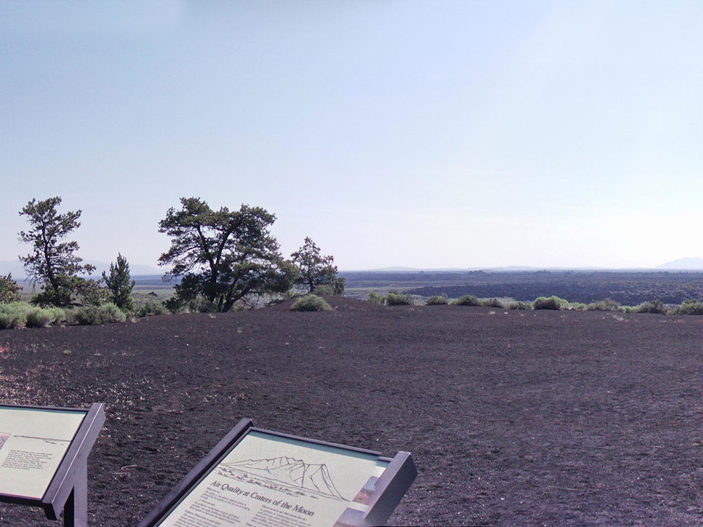
Devils Orchard (photo) is a group of lava-transported cinder cone fragments (also called monoliths or cinder crags) that stand in cinders. Like the blocks at stop 2 they were once part of the North Crater cinder cone but broke off during an eruption of lava. A 1/2 mile-long (800 m) paved loop trial through the formations and trees of the "orchard" is available. The interpretive displays on the trail emphasize human impacts to the area.
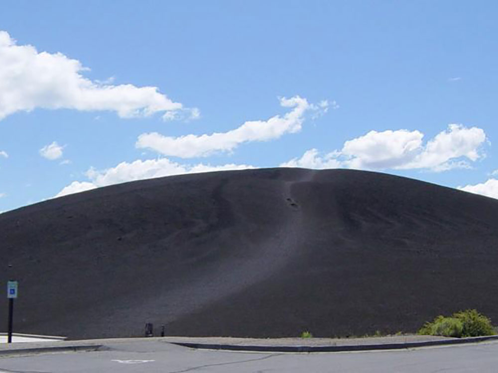
Inferno Cone Viewpoint (photo) is on top of Inferno Cone cinder cone. A short but steep trail up the cinder cone leads to an overlook of the entire monument. From there the Spatter Cones can be seen just to the south along with a large part of the Great Rift. In the distance is the over 700-foot-tall (>200 m) Big Cinder Butte, one of the world's largest, purely basaltic, cinder cones. Further away are the Pioneer Mountains (behind the Visitor Center) and beyond the monument are the White Knob Mountains, the Lost River Range, and the Lemhi Range.
Big Craters and Spatter Cones (photo) sit directly along the local part of the Great Rift fissure. Spatter cones are created by accumulations of pasty gas-poor lava as they erupt from a vent. Big Craters is a cinder cone complex less than 300 feet (91 m) up a steep foot trail.
Tree Molds (photo) is an area within the Craters of the Moon Wilderness where lava flows overran part of a forest. The trees were incinerated but as some of them burned they released enough water to cool the lava to form a cast. Some of these casts survived the eruption and mark the exact location and shape of the burning trees in the lava. Both holes and horizontal molds were left, some still showing shapes indicative of bark. The actual Tree Molds area is a mile (1.6 km) from the Tree Molds parking lot and picnic area off a moderately difficult wilderness trail.[44] The Wilderness trail also leaves from this parking lot, and extends nearly 6 miles (9.7 km) into the wilderness area before gradually disappearing near The Sentinel cinder cone. The 1.8 miles (2.9 km) Broken Top loop trail encircles the youngest cinder cone in the monument and can be done separately or as part of a longer trek on the Wilderness trail. A pull off on the spur road leading to the Tree Molds area presents the Lava Cascades, a frozen river of Blue Dragon Flow lava that temporarily pooled in the Big Sink.
Cave Area is the final stop on Loop Drive and, as the name indicates, has a collection of lava tube caves. Formed from the Blue Dragon Flow, the caves are a half-mile (800 m) from the parking lot and include, Dewdrop Cave, Boy Scout Cave, Beauty Cave, and Indian Tunnel. The caves are open to visitors but flashlights are needed except in Indian Tunnel and some form of head protection is highly recommended when exploring any of the caves. Lava tubes are created when the sides and surface of a lava flow hardens. If the fluid interior flows away a cave is left behind. Entering caves requires a free permit.
Craters of the Moon Campground has 51 sites - none of which can be reserved in advance. Camping facilities are basic but do include water, restrooms, charcoal grills, and trash containers. National Park Service rangers present evening programs at the campground amphitheater in the summer. Camping enables visitors to enjoy the park during the evening and morning, when the heat, glare and wind are far less.
Backcountry hiking is available in the Craters of the Moon Wilderness and the much larger Backcountry Area beyond (added in 2000). Only two trails enter the wilderness area and even those stop after a few miles or kilometers. From there most hikers follow the Great Rift and explore its series of seldom-visited volcanic features. All overnight backcountry hikes require registration with a ranger. No drinking water is available in the backcountry and the dry climate quickly dehydrates hikers. Avoiding summer heat and winter cold are therefore recommended by rangers. Pets, camp fires, and all mechanized vehicles, including bicycles, are not allowed in the wilderness area.
Skiing is allowed on the Loop Drive after it is closed to traffic in late November because of snow drifts. Typically there are 20 inches (51 cm) of snow by January and 25 in (64 cm) by February. Cross-country skiing off Loop Drive is allowed but may be dangerous owing to sharp lava and hidden holes under the snow. Blizzards and other inclement weather may occur.
This article uses material from the Wikipedia article "Craters of the Moon National Monument and Preserve", which is released under the Creative Commons Attribution-Share-Alike License 3.0
Featured Locations and Trails

Jeff P from Berkeley, CA, USA, CC BY 2.0, via Wikimedia Commons; Image Size Adjusted
Craters of the Moon Scenic Loop Drive
9.9 miles loop, 672 feet

Jeff P from Berkeley, CA, USA, CC BY 2.0, via Wikimedia Commons; Image Size Adjusted
Devil's Orchard
0.5 mile loop, 3 feet

Jeff P from Berkeley, CA, USA, CC BY 2.0, via Wikimedia Commons; Image Size Adjusted

Jeff P from Berkeley, CA, USA, CC BY 2.0, via Wikimedia Commons; Image Size Adjusted
North Crater Trail
3.5 miles round-trip, 666 feet
-1000.jpg)
Cropped and Image Size Adjusted
-1000.jpg)
-1000.jpg)
-1000.jpg)
