.jpg)
General Information
How to Get There
Overview
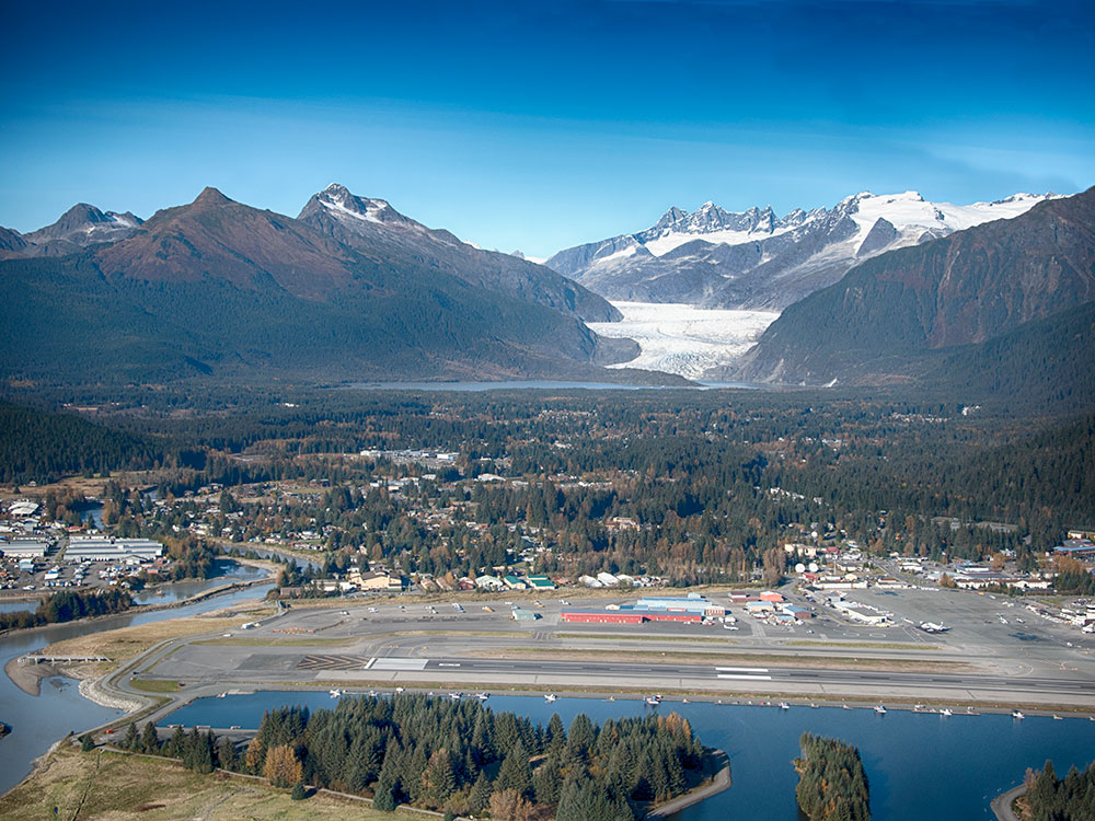
Mendenhall Glacier (also Sitaantaagu or Áak'w T'áak Sít') is a glacier about 13.6 miles (21.9 km) long located in Mendenhall Valley, about 12 miles (19 km) from downtown Juneau in the southeast area of the U.S. state of Alaska. The glacier and surrounding landscape is protected as part of the 5,815 acres (2,353 ha) Mendenhall Glacier Recreation Area, a federally designated unit of the Tongass National Forest.
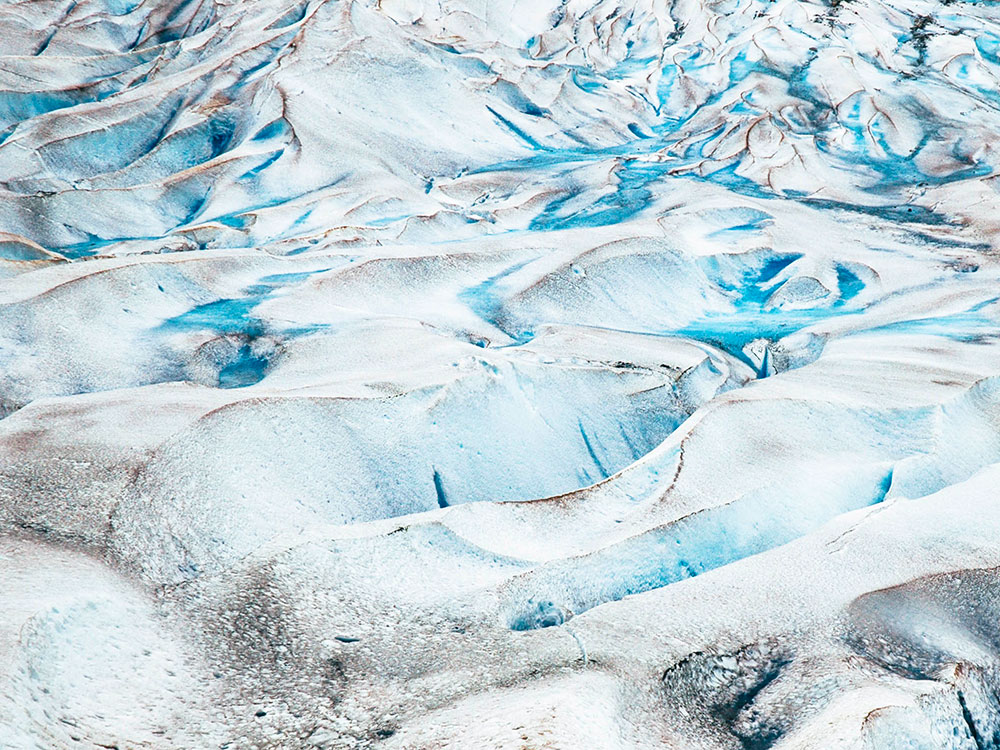
The Juneau Icefield Research Program has monitored the outlet glaciers of the Juneau Icefield since 1942, including Mendenhall Glacier. The glacier has also retreated 1.75 miles (2.82 km) since 1929, when Mendenhall Lake was created, and over 2.5 miles (4.0 km) since 1500. The end of the glacier currently has a negative glacier mass balance and will continue to retreat in the foreseeable future.
It was originally known as Sitaantaago ("the Glacier Behind the Town") or Aak'wtaaksit ("the Glacier Behind the Little Lake"), also Latinized as Aakwtaaksit, by the Tlingit. The glacier was named Auke (Auk) Glacier by naturalist John Muir for the Tlingit Auk Kwaan (or Aak'w Kwaan) band in 1879. In 1891 it was renamed in honor of Thomas Corwin Mendenhall. It extends from the Juneau Icefield, its source, to Mendenhall Lake.
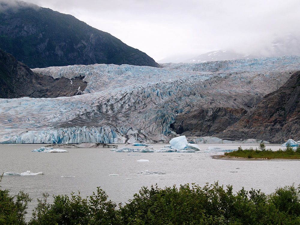
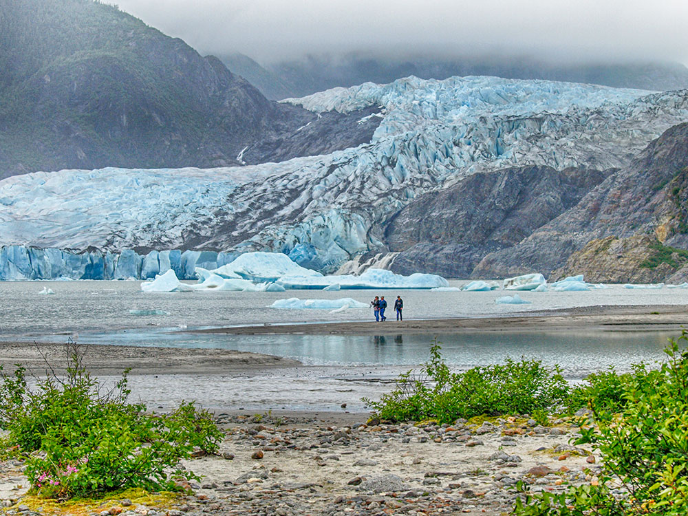
The United States Forest Service operates the Mendenhall Glacier Visitor Center as part of the Tongass National Forest, offering interpretive programs throughout the year for children and adults. The Mendenhall Glacier Visitor Center and surrounding area offer stunning views of a lake-terminating, calving glacier. The center is open year-round and receives close to 500,000 visitors each year, many coming by cruise ship in summer. There are two accessible entrances - an upper entrance with a ramp and a lower entrance with elevators.
Exhibits in the center cover the history of Mendenhall Glacier, showing how it covered the valley at the time when Joseph Whidbey, master of HMS Discovery during George Vancouver's 1791-95 expedition, explored the area in 1794. This is contrasted with current conditions today, related to climate change. The exhibits also depict the variety of wildlife in the area including mountain goats, black bears, and salmon in the nearby streams. Rangers provide interpretive information and children's nature programs, point out wildlife, and answer questions about the area.
The two small parking lots have access to several trails in the area. Photo Point Trail and the Steep Creek Trail are easy and accessible trails. Elevated boardwalks above Steep Creek provide salmon and bear viewing opportunities. Visitors can hike via the East Glacier Loop to an overlook within 1 mile (1,600 m) of the glacier. Two routes traverse a series of wooden steps and a gradual elevation gain of 500 feet (150 m) on this trail. The Trail of Time, which connects to East Glacier Loop, includes historical signs and handicapped accessibility. The 0.8 miles (1,300 m) Nugget Falls Trail leads visitors to Nugget Falls, closer to the face of the glacier. Access to the outside area and trails is free. The West Glacier trail offers access to the glacier itself and the chance to view ice caves beneath it. This trail is located across the lake from the Visitor Center.
From May through September, a pass is required to view the exhibits and audio-visual presentations inside the center, and to use certain outside infrastructure, such as the Steep Creek trail, the Pavilion, the restrooms, and Photo Point trail. There is no fee in the winter.
This article uses material from the Wikipedia article "Mendenhall Glacier", which is released under the Creative Commons Attribution-Share-Alike License 3.0
-1000.jpg)
.jpeg)