
.jpg)
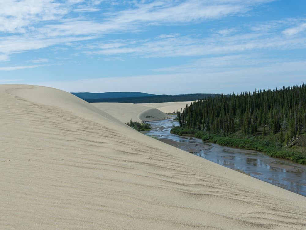
National park in the Arctic region of northwestern Alaska, located about 25 miles (40 km) north of the Arctic Circle, was designated to preserve the 100 ft (30 m) high Great Kobuk Sand Dunes and the surrounding area which includes caribou migration routes
General Information
How to Get There
From Fairbanks, AK (~430 mi by air): Fly Alaska Airlines from Fairbanks International Airport to Kotzebue's Ralph Wien Memorial Airport (OTZ), then charter an air taxi approximately 100 miles east to the Kobuk River area, as no roads lead into the park.
Overview
Kobuk Valley National Park in northwest Alaska, about 25 miles north of the Arctic Circle, has the Great Kobuk Sand Dunes (dunes up to 100 feet high) and the migration of the Western Arctic caribou herd across the Kobuk River each fall. It has no roads: visitors arrive by chartered air taxi from Kotzebue, Bettles, or Ambler. The park's headquarters are in Kotzebue's Northwest Arctic Heritage Center.
Highlights
- Sand dunes: the Great Kobuk, Little Kobuk, and Hunt River dunes on the south side of the river
- Caribou migration: hundreds of thousands cross the river in fall
- Kobuk River: canoe and raft trips of 75 or more miles
Getting to the park
Kobuk Valley National Park is one of the least accessible parks in the U.S. National Park System, located entirely above the Arctic Circle in northwestern Alaska. Like its neighbor Gates of the Arctic, it has no roads, trails, or visitor facilities, so reaching it requires flying into small bush communities and continuing on by air, river, or foot.
- By Air (Bush Plane) — The primary way into the park is via chartered small aircraft flying from regional hubs such as Kotzebue, Bettles, or the village of Ambler. These planes can land on gravel bars, the park's famous sand dunes, or nearby lakes, since there are no established runways inside the park.
- Flying to Kotzebue First — Most visitors first fly commercially into Kotzebue, a regional hub reachable by scheduled flights from Anchorage. From there, smaller air taxi operators provide charter flights into or near the park.
- By River — The Kobuk River runs directly through the park and is a popular route for visitors traveling by canoe, kayak, or raft. Many trips combine a bush plane drop-off upstream with a multi-day float down the river through the park, including past the Great Kobuk Sand Dunes.
- On Foot — As with most Arctic parks, there are no maintained trails, so all hiking is cross-country. Visitors typically hike in from a river put-in point or an air taxi drop-off, using topographic maps and backcountry navigation skills.
Because of the park's remoteness, most trips are arranged through local air taxi operators or guiding services based in Kotzebue, Bettles, or Ambler, who can help coordinate flights, river logistics, and safety planning. Weather in the region can shift quickly, so it's wise to build flexibility into any travel schedule in case flights are delayed.
Things to Do
Explore One of America's Most Remote National Parks
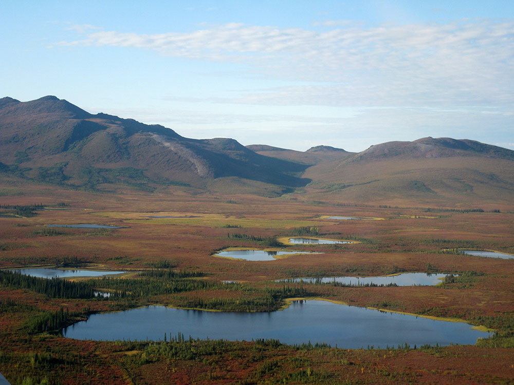
Kobuk Valley National Park protects more than 1.7 million acres of wilderness in northwestern Alaska. Located entirely above the Arctic Circle, the park is famous for its massive sand dunes, wild rivers, caribou migrations, and pristine Arctic ecosystems. With no roads, developed campgrounds, or trails, visitors experience a true wilderness adventure in one of the least visited national parks in the United States.
Visit the Great Kobuk Sand Dunes
The Great Kobuk Sand Dunes are the park's most famous attraction. Rising nearly 100 feet above the surrounding tundra, these dunes cover approximately 25 square miles and create a striking desert-like landscape in the middle of the Arctic. Visitors can hike across the dunes, photograph the dramatic scenery, and experience one of the most unusual geological features in North America.
Explore the Little Kobuk and Hunt River Sand Dunes
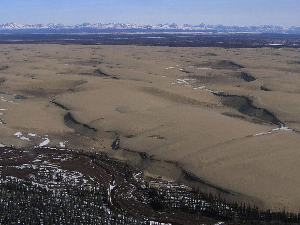
In addition to the Great Kobuk Sand Dunes, the park contains two other major dune fields: the Little Kobuk Sand Dunes and the Hunt River Sand Dunes. Together, these dune systems form the largest active sand dune fields in the Arctic and provide unique opportunities for exploration and photography.
Witness the Caribou Migration
One of the park's most remarkable natural events is the migration of the Western Arctic Caribou Herd. Hundreds of thousands of caribou move across the region each year, frequently crossing the Kobuk River and surrounding landscapes during seasonal migrations.
Float the Kobuk River
The Kobuk River flows for hundreds of miles through the Brooks Range and across the park. Multi-day rafting and canoeing trips allow visitors to experience remote wilderness, observe wildlife, and enjoy spectacular scenery that ranges from mountains to tundra and sand dunes.
Explore Onion Portage
Onion Portage is one of Alaska's most significant archaeological sites. Humans have used this important caribou crossing area for thousands of years, and archaeological discoveries have revealed evidence of numerous cultures that depended on the migration route for survival.
Observe Arctic Wildlife
Wildlife viewing opportunities include caribou, moose, black bears, grizzly bears, wolves, foxes, beavers, wolverines, and numerous bird species. The untouched landscape supports healthy wildlife populations throughout the region.
Experience the Midnight Sun
During summer, the sun remains above the horizon for extended periods, providing visitors with nearly continuous daylight for hiking, camping, fishing, photography, and wildlife viewing.
Top Routes and Backcountry Areas
Great Kobuk Sand Dunes Route
Length: Varies from 1 to 10+ miles
Elevation Gain: Minimal to Moderate
Difficulty: Easy to Moderate
The dunes have no established trails, allowing visitors to explore freely across rolling sand ridges, tundra edges, and open landscapes. This is the park's most popular backcountry destination and provides exceptional photography opportunities.
Onion Portage Route
Length: Varies by itinerary
Elevation Gain: Minimal
Difficulty: Easy to Moderate
Visitors exploring the Onion Portage area can experience important archaeological landscapes, view caribou migration routes, and enjoy scenic views of the Kobuk River and surrounding wilderness.
Kobuk River Float Trip
Length: Typically 30 to 100+ miles depending on itinerary
Elevation Gain: Minimal while floating
Difficulty: Moderate
The Kobuk River offers one of Alaska's premier wilderness paddling experiences. Float trips pass through mountain valleys, boreal forests, tundra habitats, and areas frequented by migratory caribou and other wildlife.
Salmon River Backcountry Route
Length: Varies by itinerary
Elevation Gain: Moderate
Difficulty: Moderate to Strenuous
The Salmon River area near the southern portion of the park provides opportunities for wilderness backpacking, wildlife viewing, and access to spectacular Brooks Range scenery.
Hunt River Sand Dunes Exploration Area
Length: Varies by route
Elevation Gain: Minimal
Difficulty: Easy to Moderate
Less frequently visited than the Great Kobuk Sand Dunes, this dune field offers solitude, unique Arctic desert scenery, and opportunities to experience some of the most remote landscapes within the park.
This article uses material from the Wikipedia article and official pages for nps.gov, Kobuk Valley National Park, released under the Creative Commons Attribution-Share-Alike License 3.0.


-1000.jpg)
.jpg)

-1000.jpg)