highest peak in the Northeastern United States at 6,288.2 ft. with a cog railway, toll road and the Appalachian Trail crossing the summit
General Information
How to Get There
Overview
Mount Washington, called Agiocochook by some Native American tribes, is the highest peak in the Northeastern United States at 6,288.2 ft.
The mountain is located in the Presidential Range of the White Mountains, in New Hampshire. While nearly the whole mountain is in the White Mountain National Forest, an area of 60.3 acres surrounding and including the summit is occupied by Mount Washington State Park.
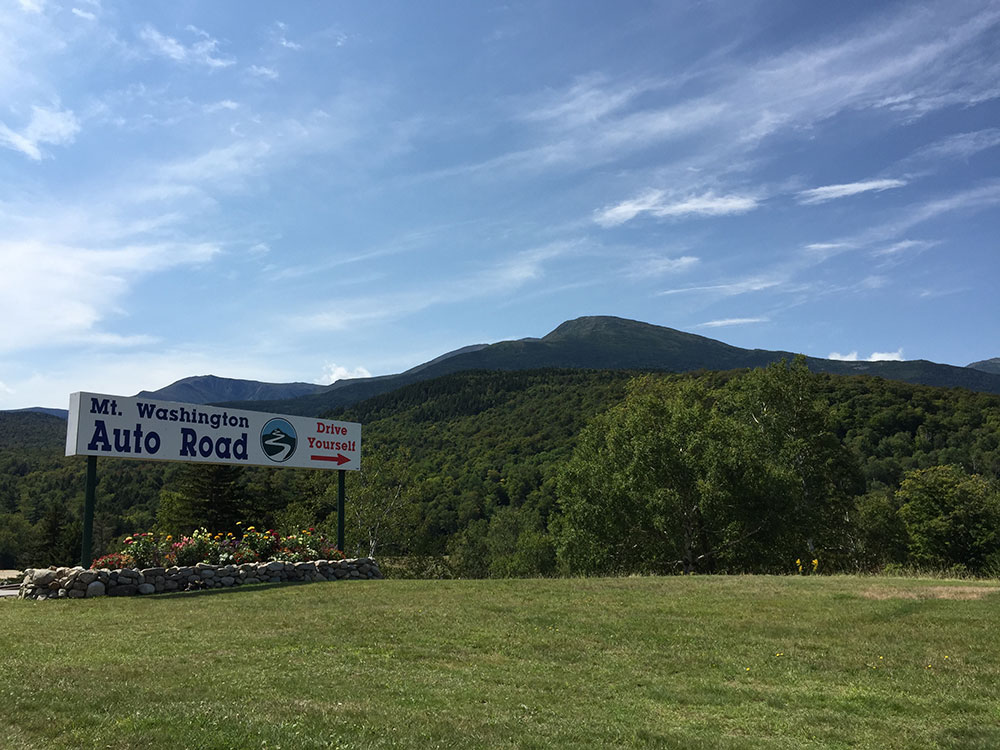
The Mount Washington Cog Railway ascends the western slope of the mountain, and the Mount Washington Auto Road climbs to the summit from the east. The mountain is visited by hikers, and the Appalachian Trail crosses the summit. Other common activities include glider flying, backcountry skiing, and annual cycle and running races such as the Auto Road Bicycle Hillclimb and Road Race.
Before European settlers arrived in the region, the mountain was known by various indigenous peoples as Kodaak Wadjo ("the top is so hidden" or "summit of the highest mountain") or Agiochook or Agiocochook ("the place of the Great Spirit" or "the place of the Concealed One").The Algonquians called it Waumbik, "white rocks". The Abenaki people inhabiting the region at the time of European contact believed that the tops of mountains were the dwelling place of the gods, and so among other reasons did not climb them out of religious deference to their sanctity.
The first European to mention the mountain was Giovanni da Verrazzano. Viewing it from the Atlantic Ocean in 1524, he described what he saw as "high interior mountains". Darby Field claimed to have made the first ascent of Mount Washington in 1642. Field climbed the mountain in June of that year to demonstrate to the Abenaki chief Passaconaway that the Europeans bargaining for tribal land were not subject to the gods believed to inhabit the summit, a primarily political move that facilitated colonists' northern expansion. Field again summited Agiocochook in October 1642 on an early surveying expedition that created maps of land as far as Maine, maps that assisted the delegations from the Massachusetts colony seeking to acquire the more arable coastal regions.
A geology party, headed by Manasseh Cutler, named the mountain in 1784. The Crawford Path, the oldest continuously maintained hiking path in the United States,[ was laid out in 1819 from Crawford Notch to the summit and has been in use ever since. Ethan Allen Crawford built a house on the summit in 1821, which lasted until a storm in 1826.
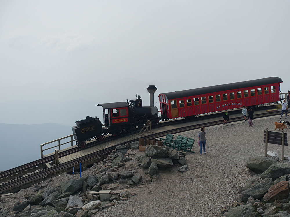
Little occurred on the summit itself until the mid-19th century, when it was developed into one of the first tourist destinations in the nation, with construction of more bridle paths and two hotels. The Summit House opened in 1852, a 64-foot-long (20 m) stone hotel anchored by four heavy chains over its roof. In 1853, the Tip-Top House was erected to compete. Rebuilt of wood with 91 rooms in 1872–1873, the Summit House burned in 1908, then was replaced in granite in 1915. The Tip-Top House alone survived the fire; today it is a state historic site, recently renovated for exhibits. Other Victorian era tourist attractions include a coach road (1861)—now the Mount Washington Auto Road—and the Mount Washington Cog Railway (1869), both of which are still in operation.
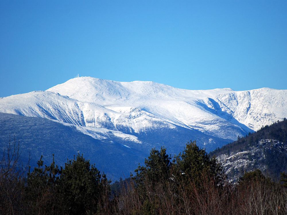
The weather of Mount Washington is notoriously erratic. This is partly due to the convergence of several storm tracks, mainly from the Atlantic to the south, the Gulf region and the Pacific Northwest. The vertical rise of the Presidential Range, combined with its north-south orientation, makes it a significant barrier to westerly winds. Low-pressure areas are more favorable to develop along the coastline in the winter due to the relative temperature differences between the northeastern United States and the Atlantic Ocean. With these factors combined, hurricane-force wind gusts are observed from the summit of the mountain on average of 110 days per year.
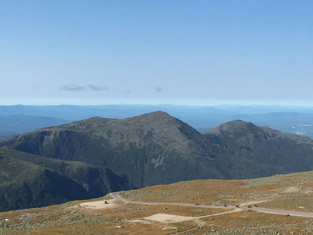
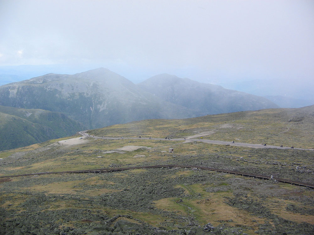
Although the western slope that the Cog Railway ascends is straightforward from base to summit, the mountain's other sides are more complex. On the north side, Great Gulf—the mountain's largest glacial cirque—forms an amphitheater surrounded by the Northern Presidentials: Mounts Clay, Jefferson, Adams and Madison. These connected peaks reach well into the treeless alpine zone. Massive Chandler Ridge extends northeast from the summit of Washington to form the amphitheater's southern wall and the incline is ascended by the Mount Washington Auto Road.
East of the summit, a plateau known as the Alpine Gardens extends south from Chandler Ridge at about 5,200 feet (1,600 m) elevation. It is notable for plant species either endemic to alpine meadows in the White Mountains or outliers of larger populations in arctic regions far to the north. Alpine Gardens drops off precipitously into two prominent glacial cirques. Craggy Huntington Ravine offers rock and ice climbing in an alpine setting. More rounded Tuckerman Ravine is New England's premier venue for spring back-country skiing as late as June and then a scenic hiking route.
South of the summit lies a second and larger alpine plateau, Bigelow Lawn, at 5,000 feet (1,500 m) to 5,500 feet (1,700 m) elevation. Satellite summit Boott Spur and then the Montalban Ridge including Mount Isolation and Mount Davis extend south from it, while the higher Southern Presidentials—Mounts Monroe, Franklin, Eisenhower, Pierce, Jackson and Webster—extend southwest to Crawford Notch. Oakes Gulf separates the two high ridges.
The mountain is part of a popular hiking area, with the Appalachian Trail crossing the summit and one of the Appalachian Mountain Club's eight mountain huts, the Lakes of the Clouds Hut, located on one of the mountain's shoulders. Winter recreation includes Tuckerman Ravine, famous for its Memorial Day skiing and its 50-degree slopes.
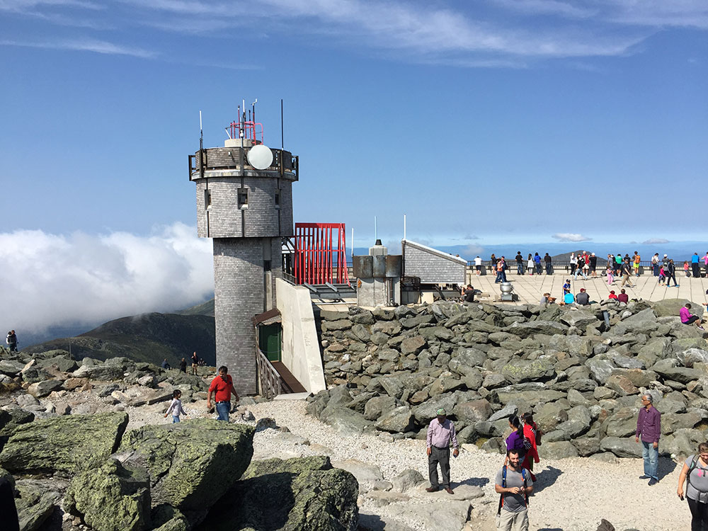
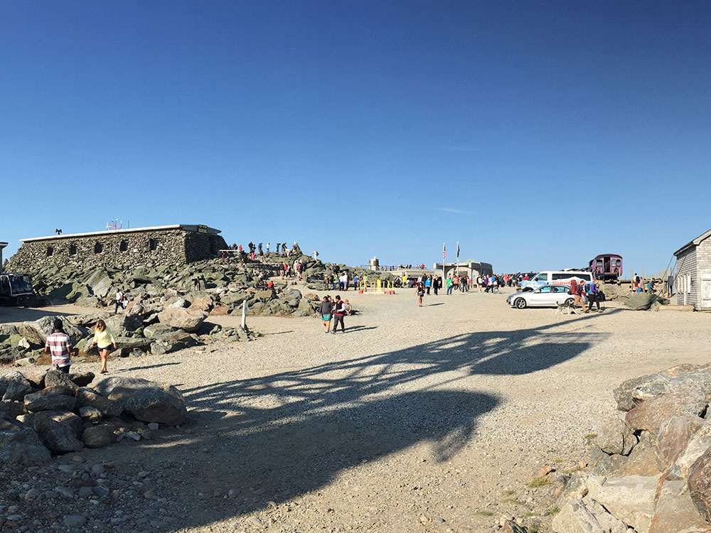
The most common hiking trail approach to the summit is via the 4.1-mile Tuckerman Ravine Trail. It starts at the Pinkham Notch camp area and gains 4,280 feet, leading straight up the bowl of Tuckerman Ravine via a series of steep rock steps that afford views of the ravine and across the notch to Wildcat Mountain. At the summit is a center with a museum, gift shop, observation area, cafeteria, and the Mount Washington Observatory. Other routes up the eastern slopes of the mountain include the Lion Head, Boott Spur, Huntington Ravine and Nelson Crag trails, as well as the Great Gulf Trail ascending from the northeast. Routes from the western slopes include the Ammonoosuc Ravine and Jewell trails and the Crawford Path and Gulfside Trail (coincident with the Appalachian Trail from the southwest and from the north, respectively).
There are many differences between climbing Mount Washington in summer and climbing it in winter. There are no public facilities on the summit in winter. In the winter months, the most common route is the Lion Head Winter Route, which begins on the Tuckerman Ravine Trail but then turns north to ascend up to Lion Head at elevation 5,033 feet (1,534 m). The winter route variation is recommended to help climbers avoid avalanche danger. Exactly where the route turns from the Tuckerman Ravine Trail depends on the snow conditions. If the amount of snowfall has not been significant, the Lion Head Summer Route may be open. After hiking 2.3 miles (3.7 km) from the visitor center in Pinkham Notch, the trail will take a right turn onto the Lion Head Summer Route. If there has been enough snow accumulation on the summer Lion Head Trail, the Forest Service will open the Lion Head Winter Route, which turns off after approximately 1.7 miles (2.7 km).
Since 1869, the Mount Washington Cog Railway has provided tourists with a train journey to the summit of Mount Washington.
Every June, the mountain is the site of the Mount Washington Road Race, an event that attracts hundreds of runners. In August the Mount Washington Auto Road Bicycle Hillclimb, a bicycle race, takes place along the same route as the road race. The hillclimb's notable contestants include former Tour de France contender Tyler Hamilton.
This article uses material from the Wikipedia article "Mount Washington", which is released under the Creative Commons Attribution-Share-Alike License 3.0
_end_of_the_Mount_Washington_Auto_Road_in_Green%27s_Grant_Township,_Coos_County,_New_Hampshire.jpg)