Largest lake in New Hampshire, located in the Lakes Region at the foothills of the White Mountains
General Information
How to Get There
Overview
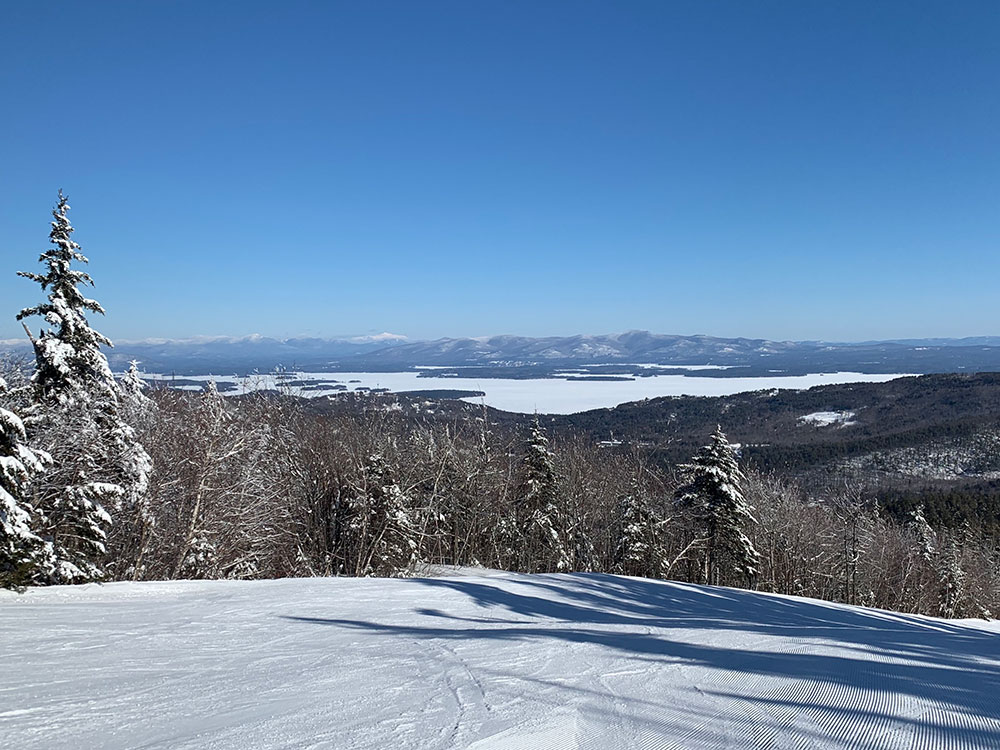
Lake Winnipesaukee is the largest lake in New Hampshire, located in the Lakes Region at the foothills of the White Mountains. It is approximately 21 miles (34 km) long (northwest-southeast) and from 1 to 9 miles (1.6 to 14.5 km) wide (northeast-southwest), covering 69 square miles (179 km2)—71 square miles (184 km2) when Paugus Bay is included—with a maximum depth of 180 feet (55 m). The center area of the lake is called The Broads.
The lake contains at least 264 islands, half of which are less than a quarter-acre in size, and is indented by several peninsulas, yielding a total shoreline of approximately 288 miles (463 km). The driving distance around the lake is 63 miles (101 km). It is 504 feet (154 m) above sea level. Winnipesaukee is the third-largest lake in New England after Lake Champlain and Moosehead Lake.
Outflow is regulated by the Lakeport Dam in Lakeport, New Hampshire, on the Winnipesaukee River.
The Broads are a wide portion of Lake Winnipesaukee largely in Belknap County and extending slightly into Carroll County. It is a large island-free zone occupying the center of the lake.
Running along the main axis of the lake, the northwestern tip of the Broads is at the town of Center Harbor, while the southeastern end lies between the towns of Alton and Wolfeboro.
Meredith Bay lies at the western edge of Winnipesaukee. At the northern tip of Meredith Bay is the main village of the town of Meredith. Paugus Bay branches off to the south of Meredith Bay at Weirs Beach, near to where Meredith Bay joins the main body of the lake. Meredith Bay is separated from the Broads by a relatively narrow strait bordered by Governors Island to the south and Stonedam Island to the north. The northeastern shore of Meredith Bay is a long peninsula known as Meredith Neck.
Formerly a hydrologically distinct lake, Paugus Bay became joined to Winnipesaukee when the dam at Lakeport was constructed, raising the surface of Paugus Bay to be contiguous with Winnipesaukee. Paugus Bay joins the main lake in Meredith Bay, running south from a narrow channel connecting it to Meredith Bay. At the northern end of Paugus Bay, where it joins the main lake, is Weirs Beach, the largest and most visited public beach on the lake. At the other end is the village of Lakeport. Both Weirs Beach and Lakeport are villages within the city of Laconia. The eastern shore of the bay is closely followed by U.S. Route 3, and has numerous motels, hotels, inns, and bungalow complexes. The western shore is much less developed.
Alton Bay is a narrow bay which runs due south from the southern corner of the main lake. It lies entirely within the town of Alton. The village of Alton Bay lies at the extreme southern tip.
Wolfeboro Bay is a relatively small wide bay lying in the town of Wolfeboro, creating a small northerly bulge in the shoreline to the eastern edge of Winnipesaukee. A series of smaller lakes and streams connects Wolfeboro Bay to Lake Wentworth.
Winter Harbor is a Y-shaped bay with two branches, separated from the Broads by Wolfeboro Neck and Tuftonboro Neck. Winter Harbor is surrounded by many quiet resort communities in the towns of Wolfeboro and Tuftonboro. It also has panoramic views of the Belknap Mountains and looks out toward Rattlesnake Island.
The longest bay on Winnipesaukee is Moultonborough Bay. It is connected to the Broads by some narrow straits running between a cluster of islands including Long Island (the largest island in the lake), Cow Island, Little Bear Island, Sandy Island, and dozens of smaller islands and islets. The 7-mile-long (11 km) Moultonborough Neck separates the length of the bay from the main axis of the lake, and the Suissevale development in the town of Moultonborough is at the northern tip of the bay. Melvin Village, the main lakeside village of the town of Tuftonboro lies along the northeastern shore of the bay, closer to where it joins the Broads.
This article uses material from the Wikipedia article "Lake Winnipesaukee", which is released under the Creative Commons Attribution-Share-Alike License 3.0
Featured Locations
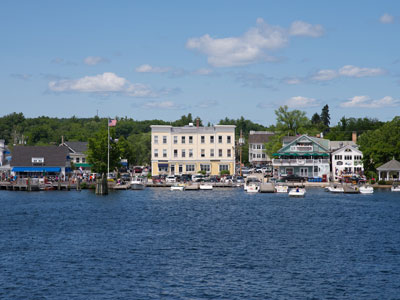
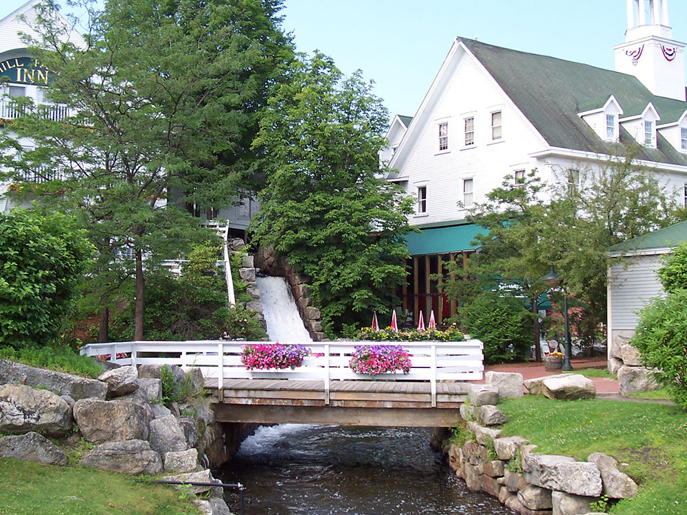
Wolfeboro, NH
Town and resort area situated beside Lake Winnipesaukee, and includes the village of Wolfeboro Falls
-1000.jpg)
.jpg)