_(11849596434).jpg)
Recreation area and nature preserve that straddles eight miles through Franconia Notch, a mountain pass between the Kinsman Range and Franconia Range in the White Mountains
General Information
How to Get There
Overview
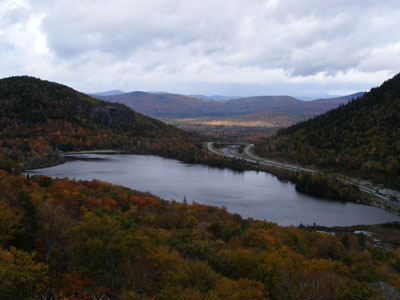
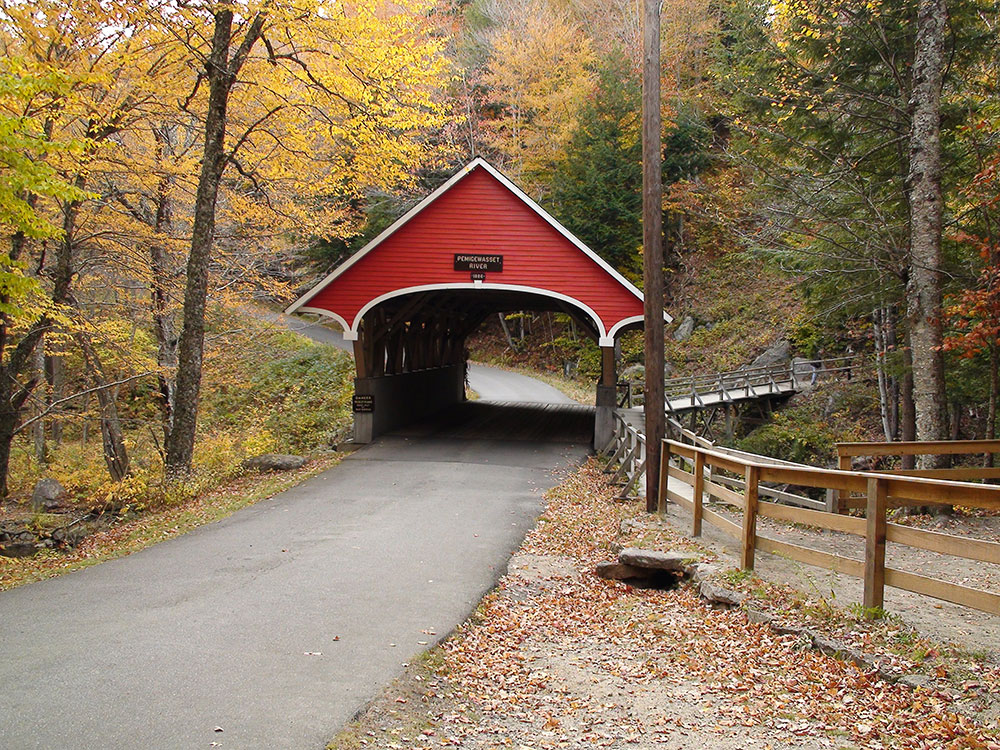
Franconia Notch State Park is a public recreation area and nature preserve that straddles eight miles (13 km) of Interstate 93 as it passes through Franconia Notch, a mountain pass between the Kinsman Range and Franconia Range in the White Mountains of northern New Hampshire. The northern part of the park, including Cannon Mountain and Echo and Profile lakes, is in the town of Franconia, and the southern part, including Lonesome Lake and the Flume, is in Lincoln. Attractions in the state park include the Flume Gorge and visitor center, the Old Man of the Mountain historical site, fishing in Echo Lake and Profile Lake, and miles of hiking, biking and ski trails.
The park is home to Cannon Mountain, a state-owned ski resort started in the 1930s. The mountain is named for a rock formation in the shape of a cannon found on the summit, but the "Old Man of the Mountain" formation was by far the more famous; it collapsed in May 2003. Cannon is also famous for being one of the most challenging hills in New England. It boasts an aerial tram, which runs year-round, ferrying sightseers to the summit in the summer time and skiers in the winter. At the base of the tramway is the New England Ski Museum, with exhibits on the history of alpine skiing in New England and America.
On the west side of the notch, halfway up the side of Cannon Mountain, is Lonesome Lake, an easy day hike up the Lonesome Lake Trail from the state park's Lafayette Place campground. The Lonesome Lake Hut, one of numerous well-kept huts throughout the White Mountains that are maintained by the Appalachian Mountain Club, is found at the southwest end of the lake, near its outlet. Huts offer meals and lodging.
Opposite Cannon Mountain, on the east side of the notch, are the Eagle Cliffs, so named for the eagles that sometimes roost there. The Greenleaf Trail, a hiking trail, winds around the south side of the cliff and up to Greenleaf Hut, another AMC hut. East of Greenleaf Hut and outside the state park is the 5,249-foot (1,600 m) summit of Mount Lafayette and the Franconia Ridge Trail (also the Appalachian Trail). The Appalachian Trail continues north to Mount Washington and eventually to Mount Katahdin in Maine.
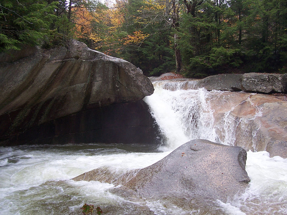
Beneath a waterfall in the Pemigewasset River is a granite pothole about 20 feet (6 m) across known simply as "the Basin". It was scrubbed out by stones dragged (and eventually deposited) by the retreating North American ice sheet, and since made smooth by 15 millennia of rapidly whirling pebbles and grit. Below the Basin is "Old Man's Foot", a distinctively shaped rock formation, also the natural result of Pemigewasset's erosive energy.
Franconia Notch (elev. 1,950 feet/590 m) is a major mountain pass through the White Mountains of New Hampshire. Dominated by Cannon Mountain to the west and Mount Lafayette to the east, it lies principally within Franconia Notch State Park and is traversed by the Franconia Notch Parkway (Interstate 93 and U.S. Route 3).
The notch was home to the Old Man of the Mountain, a rock formation which collapsed in 2003 but whose profile remains a symbol of the state of New Hampshire.
The notch is located primarily in the town of Franconia but extends south into Lincoln. It is bordered to the east by Franconia Ridge, comprising Mount Lafayette (5,249 feet/1,600 m), Mount Lincoln (5,089 feet/1,551 m), and Little Haystack Mountain (4,780 feet/1,460 m), and to the west by 4,080-foot (1,240 m) Cannon Mountain and the sheer face of Cannon Cliff. The notch's height of land is located near its northern end, at the base of Cannon Mountain. Echo Lake lies just north of the high point of the notch, with an outlet that flows into Lafayette Brook, then the Gale River, the Ammonoosuc River, and finally the Connecticut River, which enters Long Island Sound at Old Saybrook, Connecticut. Just south of the height of land, Profile Lake lies beneath the cliff that once held the Old Man of the Mountain. Profile Lake is the source of the Pemigewasset River, the primary tributary of the Merrimack River, which flows to the Gulf of Maine at Newburyport, Massachusetts.
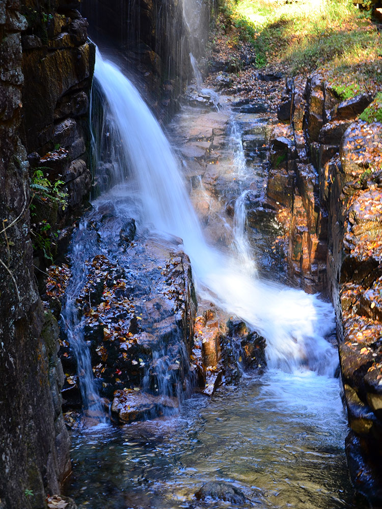
Nearly 200 million years ago in the Jurassic period, the Conway granite that forms the walls of the Flume was deeply buried molten rock. As it cooled, the granite was broken by closely spaced vertical fractures that lay nearly parallel in a northeasterly direction. Sometime after the fractures were formed, small dikes of basalt were forced up along the fractures. The basalt came from deep within the earth as a fluid material, and because of pressure, was able to force the Conway granite aside. The basalt crystallized quickly against the relatively cold granite. Because of this quick cooling, the basalt is a fine-grained rock. Had this material ever reached the surface, it would have become lava flows.
Erosion gradually lowered the earth's surface and exposed the dikes. As the overlying rock was worn away, pressure was relieved and horizontal cracks developed, allowing water to get into the rock layers. The basalt dikes eroded faster than the surrounding Conway granite, creating a deepening valley where the gorge is now. The gorge was covered by glaciers during the Ice Age, but the ice sheet did not greatly change the surface. It partially filled the valley with glacial debris and removed soil and weathered rock from the vicinity. After the Ice Age, Flume Brook began to flow through the valley again.
The highly fractured granite and basalt have been eroded by frost action and by the brook's water. As one walks through the Flume Gorge, at the floor one may notice remnants of the main basalt dike, and that small trees are growing on the walls of the gorge. Erosion is still occurring.
The Flume was discovered in 1808 by 93-year-old "Aunt" Jess Guernsey when she accidentally came upon it while fishing. She had trouble convincing her family of the marvelous discovery, but eventually persuaded others to come and see for themselves. At that time, a huge, egg-shaped boulder hung suspended between the walls. The rock was 10 ft (3.0 m) high and 12 ft (3.7 m) long. A heavy rainstorm in June 1883 started a landslide that swept the boulder from its place. The boulder has never been found. The same storm deepened the gorge and formed Avalanche Falls.
This article uses material from the Wikipedia article "Franconia Notch State Park", and "Franconia Notch", which is released under the Creative Commons Attribution-Share-Alike License 3.0
Featured Locations
BIYM at English Wikipedia, CC BY-SA 3.0, via Wikimedia Commons; Image Size Adjusted
_(11849374783)-750.jpg)
_(11849374783).jpg)
_(11849925826)-750.jpg)
_(11849925826).jpg)
_(11849239245)-750.jpg)
_(11849239245).jpg)
-750.jpg)