3,489 feet (1,063 m) mountain located in the northwest corner of Massachusetts and is the highest point in the state
General Information
Visitor Center: 9:00 a.m. to 4:00 p.m. (closed major holidays)
Auto road and summit facilities open seasonally (mid-May through late October)
Camping: ~$8 MA residents / $20 non-residents per night
How to Get There
From North Adams, MA (6 mi): Take MA‑2 W to Notch Rd, then follow Rockwell Rd south into Mount Greylock State Reservation and continue to the Visitor Center and trailheads
Overview
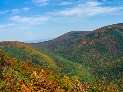
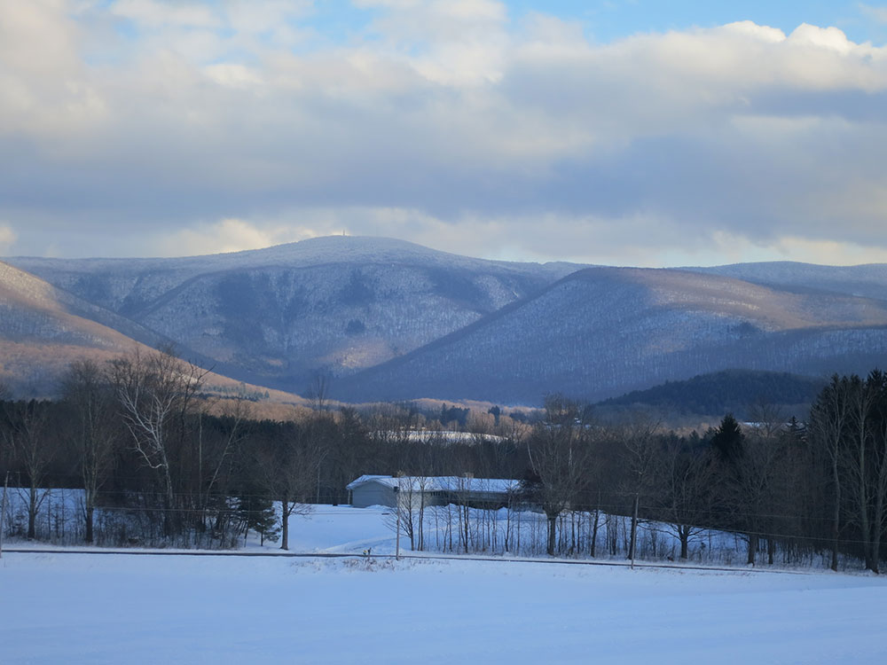
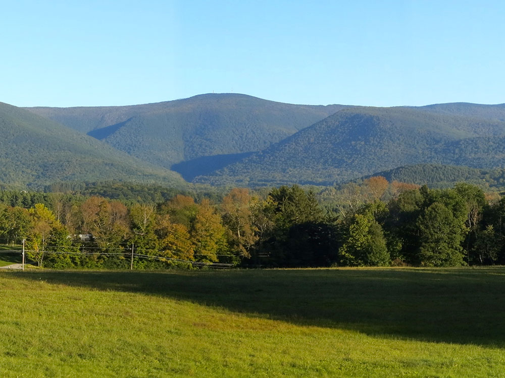
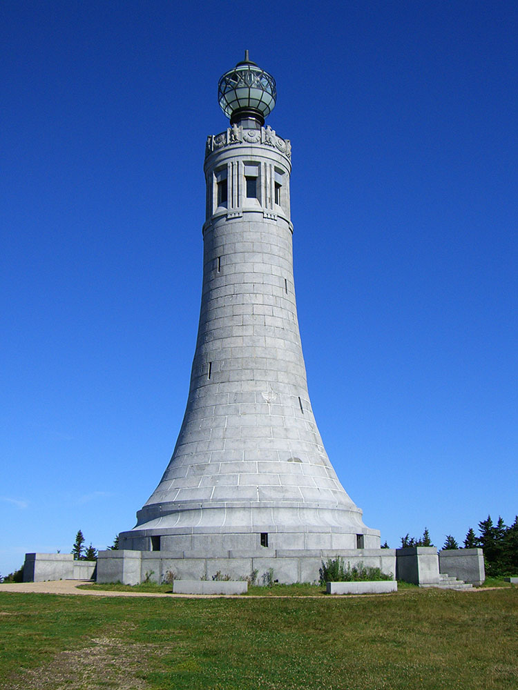
Mount Greylock is a 3,489 feet (1,063 m) mountain located in the northwest corner of Massachusetts and is the highest point in the state. Its summit is in the western part of the town of Adams (near its border with Williamstown) in Berkshire County. Although technically it is geologically part of the Taconic Mountains, Mount Greylock is commonly associated with the abutting Berkshire Mountains to the east. The mountain is known for its expansive views encompassing five states and the only taiga-boreal forest in the state. A seasonal autotive road (open annually from late May through November 1) climbs to the summit, topped by a 93-foot-high (28 m) lighthouse-like Massachusetts Veterans War Memorial Tower. A network of hiking trails traverse the mountain, including the Appalachian Trail. Mount Greylock State Reservation was created in 1898 as Massachusetts' first public land for the purpose of forest preservation.
Geography
Geographically, Mount Greylock is part of an 11-mile-long (18 km) by 4.5-mile-wide (7.2 km) island-like range that runs north-south between the Hoosac Range to the east, the Green Mountains to the north, the Berkshires to both the south and east, and the Taconic Mountains to the west with which it is geologically associated; all ranges are associated with the Appalachian mountain chain. The summit of Mount Greylock is located in Adams, Massachusetts, but the mountain also extends into Cheshire, Lanesborough, New Ashford, North Adams and Williamstown. The range includes peaks with elevation less than Greylock, such as Saddle Ball Mountain and Mount Fitch.
On average, Mount Greylock rises 2,000 ft (610 m) above surrounding river valleys and 1,000 ft (300 m) above the Berkshires and Taconic Mountains. From the summit, views of up to 72 mi (116 km) are possible into five different states: Massachusetts, New York, Connecticut, Vermont, and New Hampshire.
Mount Greylock and the neighboring Taconic Mountains are comprised predominantly of Ordovician phyllite, a metamorphic rock, overlain on younger layers of metamorphized sedimentary rock, especially marble. Mount Greylock is the product of thrust faulting, a tectonic process by which older rock is thrust up and above younger rock during periods of intense mountain building. The younger, underlying marble bedrock layers have been quarried in the lower foothills of the mountain in nearby Adams and North Adams, Massachusetts.
During the 19th century, much of the mountain was denuded by logging, fires, and grazing. Forests have since reclaimed the mountain. Several forest communities exist on Mount Greylock. Lower slopes are inhabited by northern hardwood forest species while upper summits are dominated by boreal balsam fir and red spruce. The ridgeline of Greylock, between Mount Fitch on the north and Saddle Ball on the south, is the only place in Massachusetts where a taiga-boreal or sub-alpine forest flourishes. Researchers have identified 555 acres (2.25 km2) of old growth forest on the mountain. The steep western slopes (which include The Hopper) contain northern hardwood forest biome species up to 350 years old, including a 120-foot-tall (37 m) red spruce. Because of its extensive stands of red spruce old growth, The Hopper has been designated a National Natural Landmark.
Mount Greylock is designated as an important bird area (IBA). There are a number of species of birds that breed in the taiga or boreal forests at the higher altitudes of the mountain, which are not normally found breeding in Massachusetts. These species include the blackpoll warbler and Bicknell's thrush. eBird has records of 132 species of birds on Mount Greylock.
Today, the 12,500-acre (5,100 ha) Mount Greylock State Reservation is managed and operated by the Massachusetts Department of Conservation and Recreation, Division of State Parks and Recreation.
Mount Greylock has over 70 miles of designated trails for hiking, mountain biking, back-country skiing, snowshoeing and snowmobiling, including an 11.5 mile section of the Appalachian National Scenic Trail. A primitive camping experience is available for backpackers at either the Mount Greylock Campground or 5 remote trailside backpacker shelters; the campground is only accessible by foot, as are the backpacker shelters.
The staffed visitors center in Lanesborough is open year-round (1.5 miles off Route 7) and provides orientation, trail maps, informational brochures, exhibits, and accessible rest rooms.
This article uses material from the Wikipedia article "Mount Greylock", which is released under the Creative Commons Attribution-Share-Alike License 3.0