Highest natural point in South Dakota, with a 7 mile round-trip trail to the summit
General Information
Black Elk Peak via Little Devil's Tower Trailhead (Trail #4): 6.4 mi round-trip
Black Elk Peak Loop: 7.1 mi loop
Black Elk Peak via Little Devil's Tower Trailhead: 1,276 ft
Black Elk Peak Loop: 1,469 ft
From Rapid City (37 mi): Take US-16 W to SD-87 S in West Pennington. Follow SD-87 S to destination in East Custer
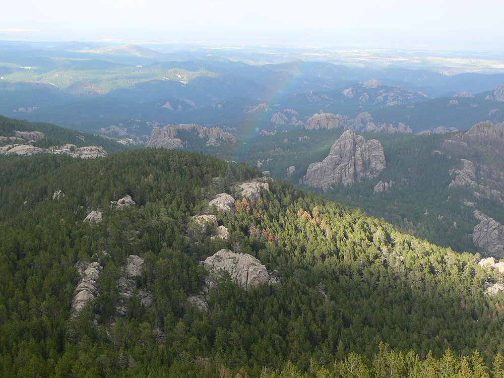
Black Elk Peak is the highest natural point in South Dakota. It lies in the Black Elk Wilderness area, in southern Pennington County, in the Black Hills National Forest. The peak lies 3.7 mi (6.0 km) west-southwest of Mount Rushmore. At 7,244 feet (2,208 m), it has been described by the Board on Geographical Names as the highest summit in the United States east of the Rocky Mountains. Though part of the North American Cordillera, it is generally considered to be geologically separate from the Rocky Mountains.

It is also known as Hiŋháŋ Káǧa ('owl-maker' in Lakota) and Heȟáka Sápa ('elk black').
The U.S. Board on Geographic Names, which has jurisdiction in federal lands, officially changed the mountain's name from Harney Peak to Black Elk Peak on August 11, 2016, honoring Black Elk, the noted Lakota Sioux medicine man for whom the Wilderness Area is named.
This peak was called Hiŋháŋ Káǧa, or, "Owl maker," after rock formations that look like owls (and the association of owls with impending death by the Lakota Sioux). They dominated this region and occupied the territory at the time of European colonization. They considered it a sacred site within the Black Hills, which they call Pahá Sápa and Ȟé Sápa.
The mountain was named Harney Peak in 1855 by American Lieutenant Gouverneur K. Warren in honor of US General William S. Harney, his commander in a regional military expedition. The U.S. Board on Geographic Names officially changed the mountain's name from "Harney Peak" to "Black Elk Peak" on August 11, 2016.
American settlers used Black Elk Peak as a fire lookout tower in 1911, with a wood crate placed at the summit for a seat. In 1920, a 12'x12' wood structure was built, and it was expanded to 16'x16' the following year. The federal Civilian Conservation Corps enlisted local men and completed construction of a stone fire tower in 1938, one of numerous projects in the state during the Great Depression. The Harney Peak fire tower was last staffed in 1967.
The summit can be reached from Sylvan Lake, Camp Remington, Highway 244, Palmer Creek Rd., Mount Rushmore, or Horse Thief Lake. From the trailhead at Sylvan Lake in Custer State Park, to the summit and back is about 7 miles (11 km). This is the shortest, least strenuous, and most popular route. No permit is required for use of the first portion of the trail. However, the United States Forest Service requires hikers to obtain a permit at a self-service kiosk located at the entrance to the Black Elk Wilderness area en route to the summit.
An old stone tower, once used as a fire lookout tower, is located at the summit.
This article uses material from the Wikipedia article "Black Elk Peak", which is released under the Creative Commons Attribution-Share-Alike License 3.0
