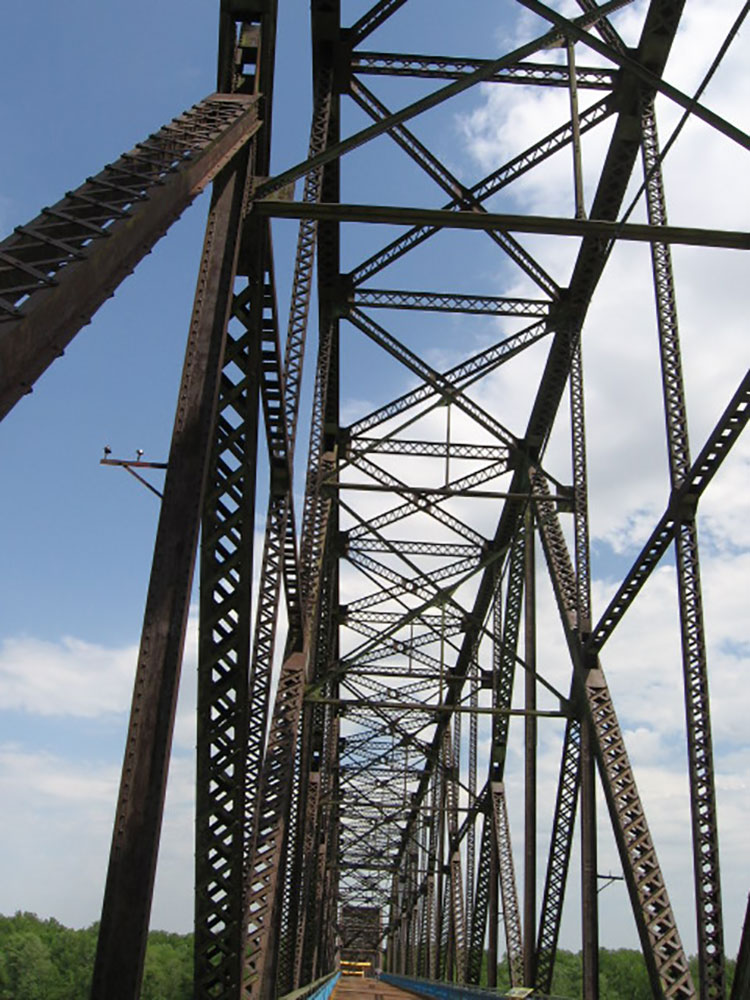
Bridge spans the Mississippi River on the north edge of St. Louis with a 22-degree bend occurring at the middle of the crossing
General Information
Friday and Saturday: 9 a.m. to 9 p.m.
Sunday: 10 a.m. to 5 p.m.
Closed Monday and Tuesday
Children ages 2 and under: Free
How to Get There
From St. Louis (1 mi): Take I-64 west to the 14th Street exit and continue north to reach the museum near Washington Avenue and downtown attractions.
The old Chain of Rocks Bridge spans the Mississippi River on the north edge of St. Louis, Missouri. The eastern end of the bridge is on Chouteau Island (part of Madison, Illinois), while the western end is on the Missouri shoreline. Its most notable feature is a 22-degree bend occurring at the middle of the crossing.
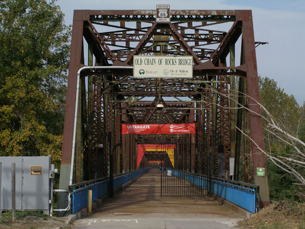
Originally a motor route, the bridge was for a time the route used by U.S. Route 66 (US 66) to cross over the Mississippi, but the bridge now carries only walking and biking trails over the river; the New Chain of Rocks Bridge carries vehicular traffic to the north.
The old route to the bridge is now called Chain of Rocks Road and ends near Roman Road. Parking is available at the start of the now-pedestrian route. The bridge was added to the National Register of Historic Places in 2006.
The bridge's name comes from a large shoal, or rocky rapids, called the Chain of Rocks, which made that stretch of the Mississippi extremely dangerous to navigate. Because of a low-water dam built by the Corps of Engineers in the 1960s, little of the Chain of Rocks is visible today except during extreme low water conditions. After 1940, only a single impediment prevented the maintenance of a safe and reliable 9-foot (2.7 m) navigation channel on the Mississippi River from St. Paul, Minnesota, to New Orleans.
This impediment, known as the Chain of Rocks Reach, was a 17-mile (27 km) series of rock ledges that began just north of St. Louis and was extremely difficult and dangerous to navigate. In the late 1940s and early 1950s the U.S. Army Corps of Engineers built a 8.4-mile-long (13.5 km) canal to bypass this treacherous reach. To ensure adequate depths in the pool below the old Lock and Dam 26, a non-movable, low water dam was constructed just downstream of the old bridge and a lock was installed at the south end of the canal. Known respectively as Dam No. 27, also called Chain of Rocks Dam, and Locks No. 27, or Chain of Rocks Lock.
From the Illinois side of the bridge, signs marked "HISTORIC ROUTE 66 SPUR" take travelers to the Illinois side of the bridge and a "HISTORIC ROUTE 66" sign marks the Missouri side of the bridge. The Gateway Arch is visible downriver, and immediately downstream from the bridge, two water intakes for the St. Louis Waterworks are visible.
This article uses material from the Wikipedia article "Chain of Rocks Bridge", which is released under the Creative Commons Attribution-Share-Alike License 3.0