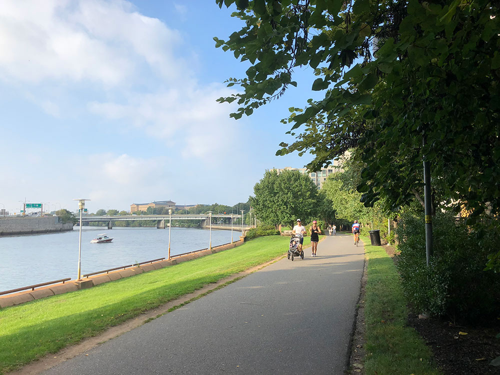
Multi-use trail along the banks of the Schuylkill River in southeastern Pennsylvania
General Information
How to Get There
Take S Penn Square and John F Kennedy Blvd to Arch St. Turn left at the 2nd cross street onto Arch St. Turn right onto N 22nd St. Take N 23rd St to Race St.
Overview
The Schuylkill River Trail is a multi-use trail along the banks of the Schuylkill River in southeastern Pennsylvania. Partially complete as of 2018, the trail is ultimately planned to run about 140 miles (230 km) from the river's headwaters in Schuylkill County to Fort Mifflin in Philadelphia.
Completed portions of the trail include a section from Auburn to Hamburg, a 19.5-mile (31.4 km) portion from Reading to Pottstown, and a 23.2-mile (37.3 km) portion from Oaks to South Street in Center City, Philadelphia.
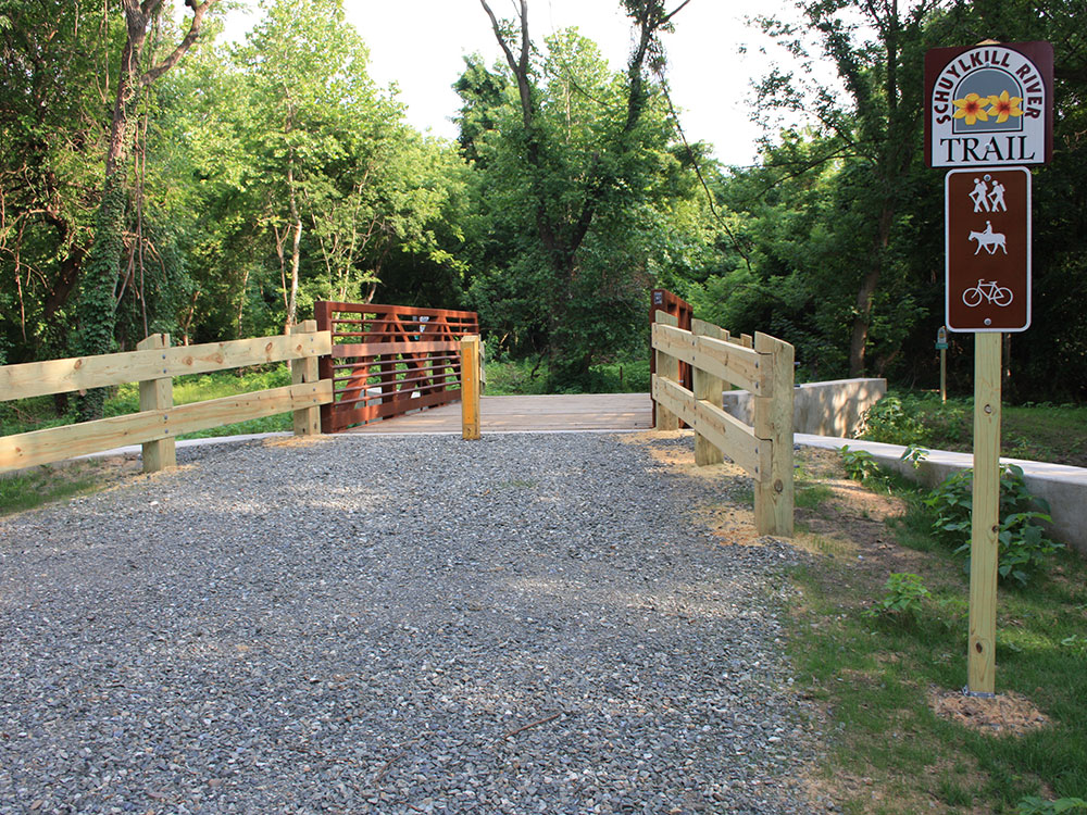
Large stretches of the trail are rail trails. Parts of it belong to the East Coast Greenway, a 3,000-mile trail system connecting Maine to Florida.
The Schuylkill River Trail begins at a trailhead at the Kernsville Dam in Auburn just above Hamburg. The trail runs through Reading to Pottstown until it reaches the Riverfront Park on College Drive near the Reading Railroad Pottstown Station. This section passes through the Schuylkill River National and State Heritage Area, an area generally known for recreational fishing.
In lower Berks County, the trail follows the existing Thun Trail, named for industrialist Ferdinand Thun, who founded the Textile Machine Works in Reading in 1892 (later moved to the borough of Wyomissing, a suburb of Reading, in 1896). Plans are underway for a connection from Reading, north to Hamburg. The current northern edge links the trail with the Union Canal towpath.
The trail begins in North Reading, along Riverview Drive, then quickly crosses an old railroad bridge into West Reading. It then continues as a mixed-surface path of macadam, gravel, coarse stone, and chalk to Gibraltar where it becomes a poorly marked on-road bicycle route following Old River Road and Schuylkill Road to Birdsboro. From there, the trail follows the old concrete industrial collector, Armorcrast Road, to the rear entrance of a ballfield. The trail then goes off-road as a gravel path to the county line where it meets the paved Schuylkill River Trail, which currently terminates in Pottstown.
The stretch of trail from Mont Clare to the Perkiomen Creek near Oaks opened in the spring of 2008. In the first phase of construction the southern section of the trail between Longford Road at the present watered end of the Oakes Reach of the Schuylkill Canal and the Oaks intersection with the Perkiomen Trail was constructed. This section follows much of the filled portion of the Oakes Reach and is paved except for a gravel segment of about half a mile (which also includes a short trail detour). To cross the three streams in this section, two new culverts were constructed and the trail temporarily routed over a historical aqueduct from the Canal at Crossman's Run. A new bridge was built across Crossman's Run for the trail and the paving was completed.
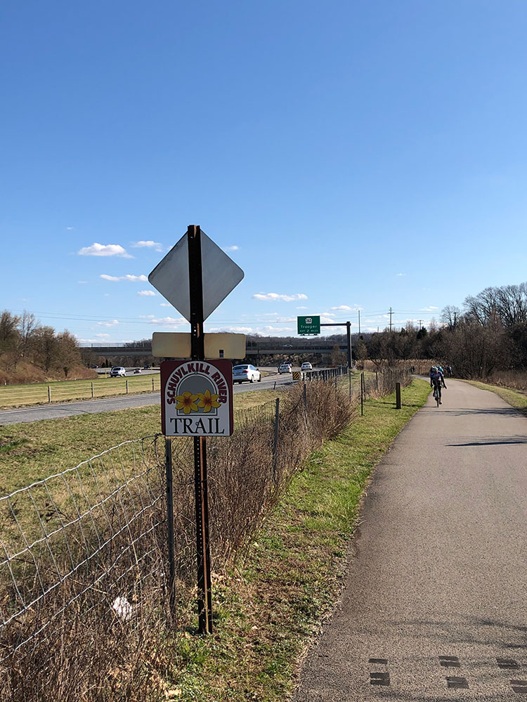
The next segment of the trail begins in Oaks at the southern end of the Perkiomen Trail and a trailhead at Pawlings Road. This paved segment runs along the abandoned trackbed of the former Schuylkill Branch of the Pennsylvania Railroad. It runs beside U.S. Route 422 for a short distance, then runs through Valley Forge National Historical Park. After leaving the park at Betzwood, it continues along the river to Norristown, where it crosses over U.S. Route 202 and runs through the middle of the Norristown Transportation Center.
The trail continues eastwards, now parallel to the SEPTA Manayunk/Norristown rail line. On entering Conshohocken, it passes through industrial areas, under Interstate 476, and intersects the local Cross County Trail.
Shortly after crossing into Philadelphia, trail traffic is briefly directed onto Nixon and Shawmont Streets, crossing the SEPTA Manayunk/Norristown Line's tracks at the decommissioned Shawmont station.
The trail continues southeastward, unpaved, along the former Manayunk Canal Towpath of the Schuylkill Navigation System, passing through the neighborhood of Manayunk to the end of the towpath at Lock Street. Trail traffic is then directed onto the street or sidewalks of Main Street and Ridge Avenue toward Fairmount Park, where the trail meets the southern end of the Wissahickon Trail. Trail traffic continues on the road or sidewalk over the historic Ridge Avenue Bridge (NRHP) crossing the Wissahickon Creek, and turning right onto the paved multi-use trail beside Kelly Drive through east Fairmount Park.
The trail then winds along the east bank of the Schuylkill River through the park, first passing by the Falls Bridge, then passing under many railroad and highway bridges, past several monuments and Laurel Hill Cemetery. It runs beside Boathouse Row and the Azalea Garden behind the Philadelphia Museum of Art and next to the Fairmount Water Works. After passing under the Spring Garden Street Bridge and West River Drive Bridge, the trail runs along the riverbank on the west edge of Center City, Philadelphia as a waterfront park named Schuylkill Banks. At Locust Street the trail splits with a bridge carrying the trail over CSX-owned railroad tracks to terminate in Schuylkill River Park, while a 2,000 ft (610 m) boardwalk opened in 2014 extends over the river and continues to South Street, ending at the south side of the South Street Bridge. The bridge deck is reached by a ramp to the north side of the bridge or by a staircase with a bike trough up to the south side of the bridge.
This article uses material from the Wikipedia article "Schuylkill River Trail", which is released under the Creative Commons Attribution-Share-Alike License 3.0
