Highest point in Pennsylvania, the summit of may be ascended by car or a number of hiking trails
General Information
How to Get There
From Pittsburgh (93 miles): Get on I-579 S. Get on I-376 E from Boulevard of the Allies. Follow I-376 E, I-76 and US-219 S to US-219 BUS S in Summit Township. Take the exit toward Meyersdale/Garrett from US-219 S. Drive to Mt Davis Rd in Elk Lick Township.
Overview
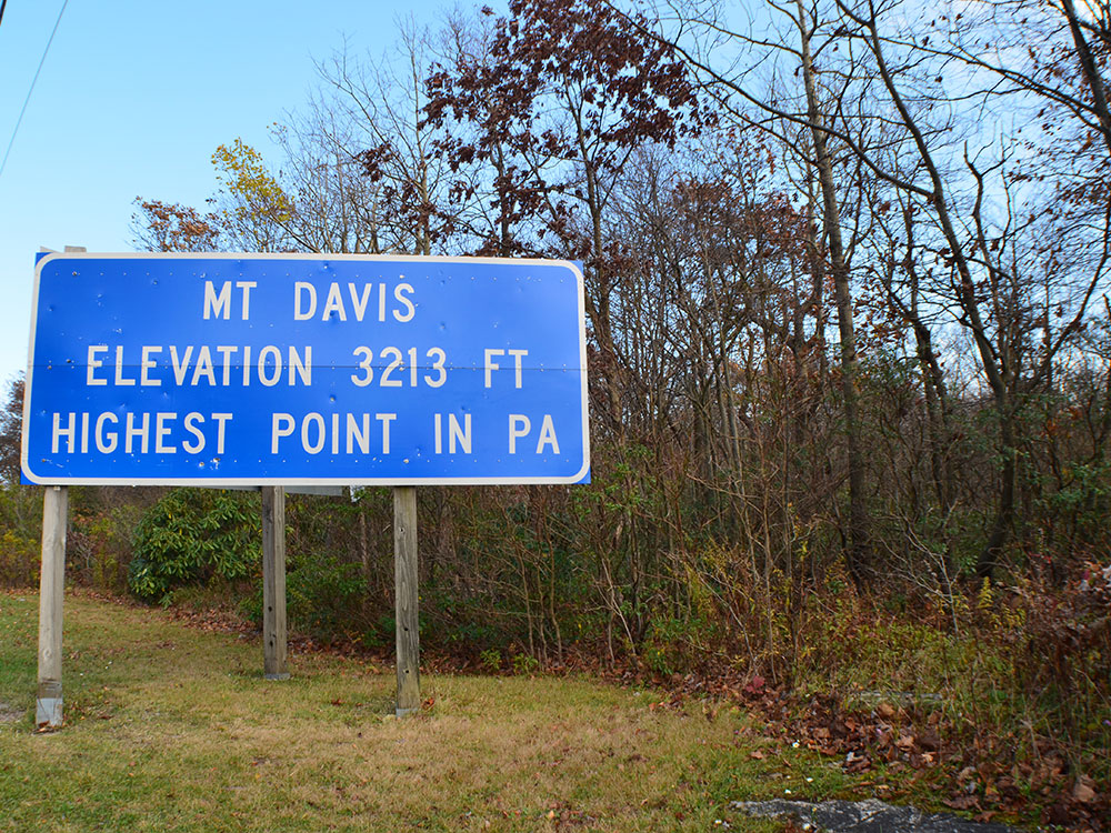
Mount Davis (3,213 ft or 979 m) is the highest point in Pennsylvania. Located in the 5,685-acre (2,301 ha) Forbes State Forest near the hamlet of Markleton in Elk Lick Township, Somerset County; it lies on a gentle crest of a 30-mile (50 km) ridge line extending from central Somerset County southward into Garrett County, Maryland.
Description
The high point was named for John Nelson Davis, an early settler, American Civil War veteran, surveyor, and naturalist known for his studies of the mountain's flora and fauna. During the Civil War, Davis served in Company E, 102nd Pennsylvania Infantry.
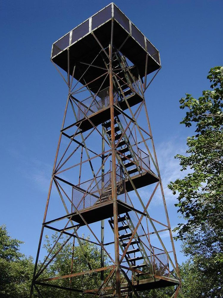
The summit of Mt. Davis may be ascended by car or a number of hiking trails. Its surroundings are noted for their patterns of unusual circular stone formed by periglacial action. A metal observation tower with a relief map of the region stands near the true high point.
Trails in the park include:
- High Point Trail: 0.8 miles (1.3 km)
- Mt. Davis Trail: 0.1 miles (0.2 km)
- Shelter Rock Trail: 1 mile (1.6 km)
- Tub Mill Run Trail: 2.8 miles (4.5 km)
- Timberslide Trail: 0.5 miles (0.8 km)
- Laurel Run Trail: 1.9 miles (3.1 km)
- Wolf Rock Trail: 0.8 miles (1.3 km)
- Shelter Rock Road: 1.6 miles (2.6 km)
- Livengood Trail: 1.1 miles (1.8 km)
This article uses material from the Wikipedia article "Mount Davis (Pennsylvania)", which is released under the Creative Commons Attribution-Share-Alike License 3.0