National park commemorating the voyageurs—French-Canadian fur traders who were the first European settlers to frequently travel through the area and is notable for its outstanding water resources, and is popular with canoeists, kayakers, other boaters, and fishermen
General Information
How to Get There
Overview
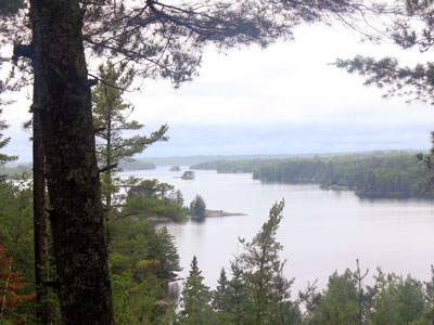
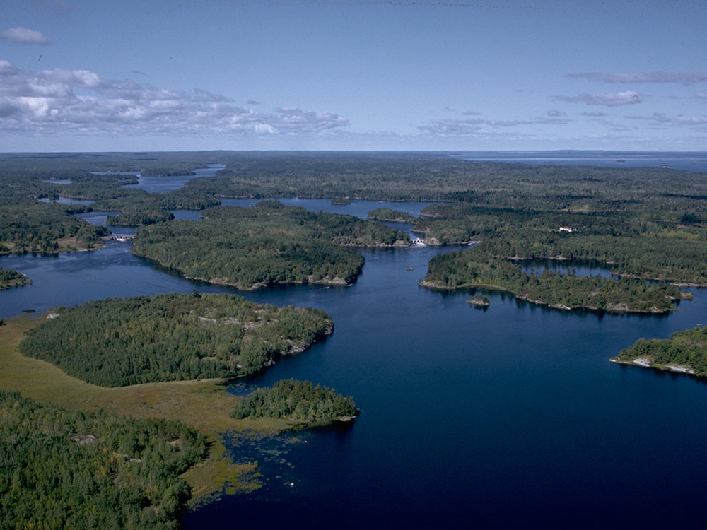
Voyageurs National Park is a national park in northern Minnesota near the city of International Falls established in 1975. The park's name commemorates the voyageurs—French-Canadian fur traders who were the first European settlers to frequently travel through the area. Notable for its outstanding water resources, the park is popular with canoeists, kayakers, other boaters, and fishermen. The Kabetogama Peninsula, which lies entirely within the park and makes up most of its land area, is accessible only by boat. To the east of the park lies the Boundary Waters Canoe Area Wilderness.
The park has several boat ramps and visitor centers on its periphery, though the main body of the park is only accessible by boat or, in the winter, by snowmobile, ski, or snowshoe.
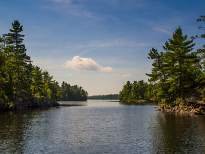
The largest city near Voyageurs National Park is International Falls, Minnesota. Unlike many other national parks, where the main access to the park is by motor vehicle, bicycle or foot, the primary access to Voyageurs is via water. Many visitors travel by kayaks and canoes, while others rent houseboats or take a guided tour boat.
The park encompasses all or part of four major lakes:
- Rainy Lake - 60 miles (97 km) long, 929 miles (1,495 km) of shoreline, 227,604 acres (921.1 km2), 161 feet (49 m) max depth
- Kabetogama Lake - 15 miles (24 km) long, 78 miles (126 km) of shoreline, 25,760 acres (104.2 km2), 80 feet (24 m) max depth
- Namakan Lake - 16 miles (26 km) long, 146 miles (235 km) of shoreline, 25,130 acres (101.7 km2), 150 feet (46 m) max depth
- Sand Point Lake - 8 miles (13 km) long, 92 miles (148 km) of shoreline, 5,179 acres (21.0 km2), 184 feet (56 m) max depth
Of these, Namakan, Rainy and Sand Point lakes straddle the United States-Canada border. Lake Namakan and Sand Point Lake are accessible only by boat except in the winter. The southern boundary of the park is the northern shore of Crane Lake. The park has many smaller lakes, especially on the Kabetogama peninsula. The most popular of these are on the Locator Lakes trail.
Campsites are maintained by the National Park Service and are accessible only by water. The 282 sites are classified as frontcountry or backcountry tent, houseboat, or day-use sites; all are designated by signs.
The major lakes in the park are home to Walleye, Northern pike, Muskellunge, Smallmouth bass, and Crappie. In the minor lakes that dot the park, Largemouth bass, Lake trout, Bluegill and other small sunfish and Yellow Perch are also found, although not every lake has every species. . Shoepack and Root (Little Shoepack) lakes in the center of the park's peninsula are home to the Shoepack strain of Muskellunge, distinctly different from the Mississippi strain (or Leech Lake strain) found throughout southern Minnesota and Wisconsin. Lake Whitefish are also a popular quarry via sport netting in the fall when they move into shallow water to spawn.
Visitors travel and explore the park's lakes and islands with canoes, kayaks and motorboats. The park's interior peninsula is only accessible by boat except when frozen lakes provide outer routes. The park has a system of canoes and boats available for rental at interior lakes. During summer months, the park also offers shuttle service to an interior lake, as well as ranger-led boat tours that explore the park's natural features and history.
The park has over 50 miles (80 km) of hiking trails. While some trails are located on the mainland, the majority traverse the park's interior peninsula, including long-distance backcountry trails.
The Voyageurs Forest Overlook, Beaver Pond Overlook, and the Kettle Falls Dam area are all popular stargazing locations in the park.
The park is snow-covered from late November until early April. An ice road on Rainy Lake is plowed and marked from the visitor center's boat ramp, heading toward Cranberry Bay or around Dryweed Island, depending on ice conditions. Available activities include lake driving, snowmobiling, cross-country skiing, winter camping, ice fishing and snowshoe hiking. Snowmobiling is limited to the frozen lake surfaces and the Chain of Lakes Scenic Trail through the center of the Kabetogama Peninsula.
Rainy Lake Trail is 28 miles (45 km) long running from Black Bay (the Rainy Lake Visitor Center) to Kettle Falls. It runs along the northern shore of the Kabetogama Peninsula, running inside the off shore islands. As it nears Kettle Falls, it turns south up a deep bay and then overland to avoid the soft ice along the narrows.
The Kettle Falls Trail is 7.4 miles (12 km) runs overland along the narrows, avoiding the soft and fractured ice of the narrows, until reaching the western end of Namakan Lake.
The Rudder Bay Trail is a short connecting trail acround the north side of the western Namakan Lake and Voyageur narrows, to the Ash River Visitor Center. Here, it joins into the Voyageur Trail.
Kettle Falls is located between Lake Namakan and Rainy Lake, and is the location of the Kettle Falls Hotel. The hotel was constructed in 1910 by timber baron Ed Rose and operated as a hotel and resort to this day. It was placed on the National Register of Historic Places in 1976. Kettle Falls can only be reached by boat in the summer months.
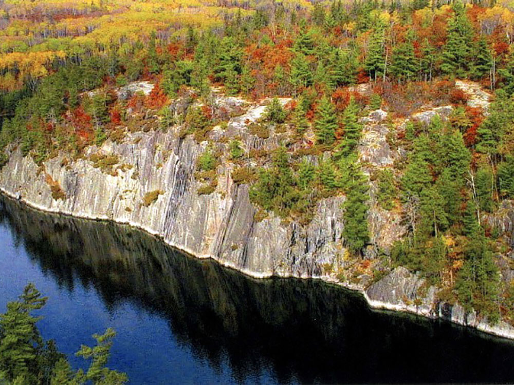
The bluffs of the Bay rise 80 feet (20 m) above the water. From the top, there are views of the bay and Rainy Lake. Anderson Bay is the northern trailhead for the Cruiser Lake Trail system. From the landing, a loop trail goes to the top of the bluffs. Anderson Bay is two-thirds of the way from Rainy Lake Visitor Center to Kettle Point. It is on the north side of the Kabetogama Peninsula.
Surveyor's Island is on the east end of Rainy Lake marking the entry to the American Channel to Kettle Falls. Here the boundary surveyors had a campsite during the early 1900s. Voyageurs would use this island as a stop before they entered the open waters of Rainy Lake.
Little American Island is on Rainy Lake just north of the mainland. It is the furthest western island in the park. It was the site of gold discovery in 1893. The island has been upgraded to provide an accessible trail, a comfort station and dock.
The Gardens was an enchanting sculpture once filled with flowers. Ellsworth created his garden as a part of the families summer home. Boat tours from Kabetogama Visitor Center visit this site on the northern shore of Kabetogama Lake.
Here visitors may visit several wetlands, the Gold Portage, Woodenfrog family residence and other sites related to Ojibwe history.
Hoist Bay has been an area of logging and seasonal recreation. The area is set up for day use. The bay is located on the southern shore of Namakan Lake, east of Ash River and the visitor center.
This article uses material from the Wikipedia article "Voyageurs National Park", which is released under the Creative Commons Attribution-Share-Alike License 3.0
Featured Trails
Yinan Chen, Public Domain, via Wikimedia Commons; Image Size Adjusted
Jeffkantor, CC BY-SA 4.0, via Wikimedia Commons; Image Size Adjusted