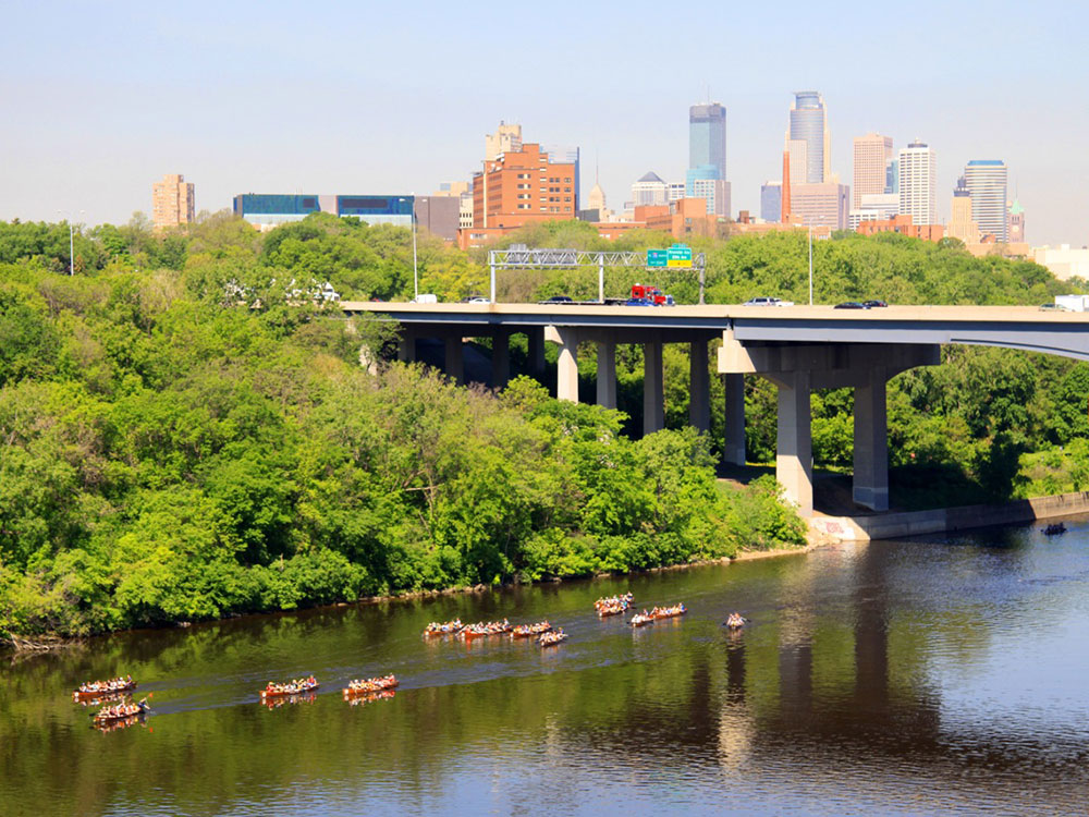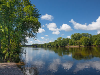
72-mile protected corridor along the Mississippi River includes natural, historical, recreational, cultural, scenic, scientific, and economic resources of national significance
General Information
How to Get There
From Minneapolis, MN: The recreation area runs through the heart of the Minneapolis-Saint Paul metro; access the river corridor from Boom Island Park at 724 Sibley St NE in Minneapolis or from any of the numerous river access points along the 72-mile corridor.
Overview
The Mississippi National River and Recreation Area is a 72-mile (116 km) and 54,000-acre (22,000 ha) protected corridor along the Mississippi River through the Minneapolis-Saint Paul metro in Minnesota, from the cities of Dayton and Ramsey, to just downstream of Hastings. This stretch of the upper Mississippi River includes natural, historical, recreational, cultural, scenic, scientific, and economic resources of national significance. This area is the only national park site dedicated exclusively to the Mississippi River.
Things to Do
Discover the Only National Park Dedicated to the Mississippi River
Mississippi National River and Recreation Area is a unique unit of the National Park System that protects a 72-mile corridor of the Mississippi River flowing through the Minneapolis-Saint Paul metropolitan region. The park preserves one of the nation's most important waterways while providing opportunities to explore natural habitats, historic sites, riverfront parks, cultural landmarks, and recreational areas in the heart of Minnesota.
Visit St. Anthony Falls
St. Anthony Falls is the only major natural waterfall on the Mississippi River and played a crucial role in the development of Minneapolis. Visitors can explore interpretive exhibits, observation platforms, riverfront pathways, and historic milling districts while learning about the river's geological and industrial history.
Explore the Mississippi River Visitor Center
Located in downtown St. Paul, the visitor center provides exhibits, maps, educational programs, and information about the river's ecology, history, recreation opportunities, and cultural significance. It serves as an excellent starting point for exploring the park.
Enjoy Boating, Paddling, and River Recreation
The Mississippi corridor offers opportunities for canoeing, kayaking, boating, fishing, birdwatching, photography, and wildlife observation. Visitors can experience the river from both the water and numerous scenic overlooks located throughout the park.
Observe Wildlife Along the Mississippi Flyway
The recreation area lies within the Mississippi Flyway, one of North America's most important migratory bird corridors. Bald eagles, herons, egrets, waterfowl, songbirds, and numerous other species can be observed throughout the year. The river's forests, wetlands, islands, and backwaters support a rich diversity of wildlife and plant communities.
Top Trails
Grand Rounds Scenic Byway Trail System
Length: More than 50 miles of interconnected trails
Elevation Gain: Minimal to Moderate
Difficulty: Easy
This extensive urban trail network connects many of the river's most scenic areas, parks, and historic sites within Minneapolis. Visitors enjoy river views, parklands, lakes, and access to numerous attractions along the Mississippi corridor.
St. Anthony Falls Heritage Trail
Length: Approximately 2 miles loop
Elevation Gain: Minimal
Difficulty: Easy
This popular walking route explores the historic milling district, Stone Arch Bridge, riverfront overlooks, and interpretive sites associated with the growth of Minneapolis. It provides an excellent overview of the area's natural and industrial heritage.
Mississippi River Trail (MRT)
Length: Variable distances available
Elevation Gain: Minimal to Moderate
Difficulty: Easy
Part of a long-distance bicycle route following the Mississippi River, the MRT passes through the recreation area and offers exceptional opportunities for cycling, sightseeing, and enjoying riverfront scenery throughout the Twin Cities region.
Pike Island Trail
Length: Approximately 3 miles loop
Elevation Gain: Minimal
Difficulty: Easy
Located within Fort Snelling State Park, this scenic trail explores the confluence of the Mississippi and Minnesota Rivers. Visitors enjoy forested landscapes, river views, birdwatching opportunities, and important cultural and historical sites.
Sources: National Park Service official Mississippi National River and Recreation Area information, including details on the Mississippi River corridor, St. Anthony Falls, visitor centers, recreation opportunities, wildlife viewing, and educational programs. https://www.nps.gov/miss
Additional information verified through National Park Service resources covering the Mississippi River Trail, St. Anthony Falls Heritage Area, Pike Island, river ecology, and recreational opportunities throughout the Twin Cities river corridor. https://www.nps.gov/miss/planyourvisit
Sections
The Mississippi National River and Recreation Area is between River Miles 879 and 806. The National Park Service categorizes it into five approximate sections.
The Wild and Scenic River (River Mile 879 to 863) — North of the Twin Cities the river is a state wild and scenic river, slowing as it reaches the Coon Rapids Dam. This segment begins at the confluence of Crow River and the Mississippi near Ramsey and Dayton and flows to Banfil Island at Brooklyn Park and Fridley.
The River of the Falls/The Urban River (River Mile 862 to 852) — From Brooklyn Center the river approaches several falls, beginning with Saint Anthony, and enters the historic Milling District near downtown Minneapolis.
The Gorge/Where the Rivers Meet (River Mile 852 to 843) — After the Milling District, the river enters the Mississippi gorge that extends past Fort Snelling State Park to its confluence with the Minnesota River.
The Working River (River Mile 840 to 833) — From near downtown Saint Paul, the river begins to feature tow boats and barge traffic as it winds to the Pig's Eye Lake Scientific and Natural Area.
The Forested Floodplain (River Mile 833 to 806) — From South Saint Paul, the river widens further with numerous backwaters and the bluffs are higher. Past Hastings and toward the Vermillion River, the Mississippi becomes wilder again.
This article uses material from the Wikipedia article "Mississippi National River and Recreation Area", which is released under the Creative Commons Attribution-Share-Alike License 3.0
-1000.jpg)
.JPG)