.jpg)
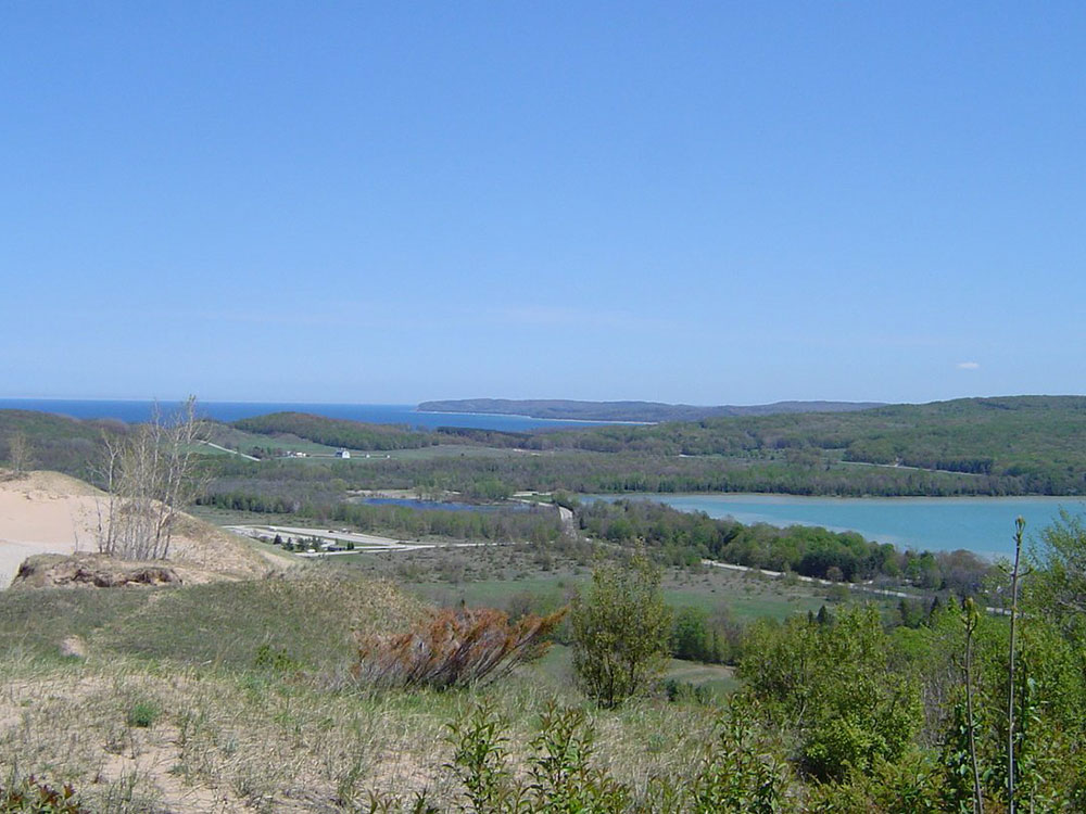
Scenic route within Sleeping Bear Dunes National Lakeshore runs for 7.4 miles through forest and dunes areas, providing access to scenic overlooks of the Lake Michigan shoreline
General Information
Scenic Drive open to vehicles seasonally, generally late May through late October
During seasonal closure, the drive is open for hiking and walk-in recreation
Sleeping Bear Dunes Annual Pass: $45
America the Beautiful Annual Pass: $80
Valid national park passes accepted
How to Get There
From Empire, MI (2 mi): Take M-22 north from Empire, turn left onto M-109, continue approximately 2 miles, and follow signs to Pierce Stocking Scenic Drive at Sleeping Bear Dunes National Lakeshore.
Overview
The Pierce Stocking Scenic Drive is a scenic route within Sleeping Bear Dunes National Lakeshore. The roadway, with its "scenic vistas and gentle curves", is located off state highway M-109 between Empire and Glen Arbor. It runs for 7.4 miles (11.9 km) through forest and dunes areas, providing access to scenic overlooks of the Lake Michigan shoreline and the surrounding park land.
The road was built in the 1960s and finished in 1967 by Pierce Stocking. A lumberman with road-building experience, he wanted to share the beauty of the area with others. He operated the facility until his death in 1976; afterwards it was purchased by the National Park Service and added to the park. In the 1980s, a two-year program reconstructed the roadway and added a number of features for visiting tourists.
The road is a 7.4-mile (11.9 km) loop that can be driven or bicycled. Hiking the roadway is permitted, but not encouraged because of the traffic. The roadway starts at an entrance off M-109 (DH Day Highway) south of Glen Lake. There is a parking lot inside the entrance for visitors who wish to bike or hike the road. From there, the drive continues as a two-way road to the entrance gate before turning northward as a one-way road. There are 12 numbered locations along the road that are listed in the drive's interpretive brochure. The first of these is a covered bridge. After this point, the drive ascends a steep hill to an overlook of Glen Lake. The next stop is the Dune Overlook and Picnic Mountain picnic area. From this vantage point, tourists can view both North and South Manitou islands, also part of the park, as well as Pyramid Point and Sleeping Bear Bay. As the drive approaches this stop and the fourth, the Cottonwood Trail, it emerges from the forest into the sandy dune area next to Lake Michigan. Several more stops are noted in the guide before Pierce Stocking Scenic Drive heads back inland through the beech and maple forest.
The roadway turns back to the shore and two overlooks next to the lake. Overlook 9 is next to the bluff on Lake Michigan, 450 feet (140 m) above the water, and overlook 10 is for views of the Sleeping Bear Dune. From overlook 9, visitors can see Platte Bay some nine miles (14.5 km) to the south on a clear day. These two locations are considered especially hazardous because of the heights involved. The penultimate stop along the drive is the North Bar Overlook and Picnic Area, which provides vistas of North Bar Lake. After this stop, the drive descends into maple and pine forests before coming back to the starting point. This area follows an old logging road under the forest canopy.
The road is open to cars generally from the middle of April into November. After late December, the drive is used as a cross-country ski trail. The park service combines the unplowed roadway with the Shauger Hill Trail to form an eight-mile (13 km) system of trails of various ratings.
This article uses material from the Wikipedia article "Pierce Stocking Scenic Drive", which is released under the Creative Commons Attribution-Share-Alike License 3.0