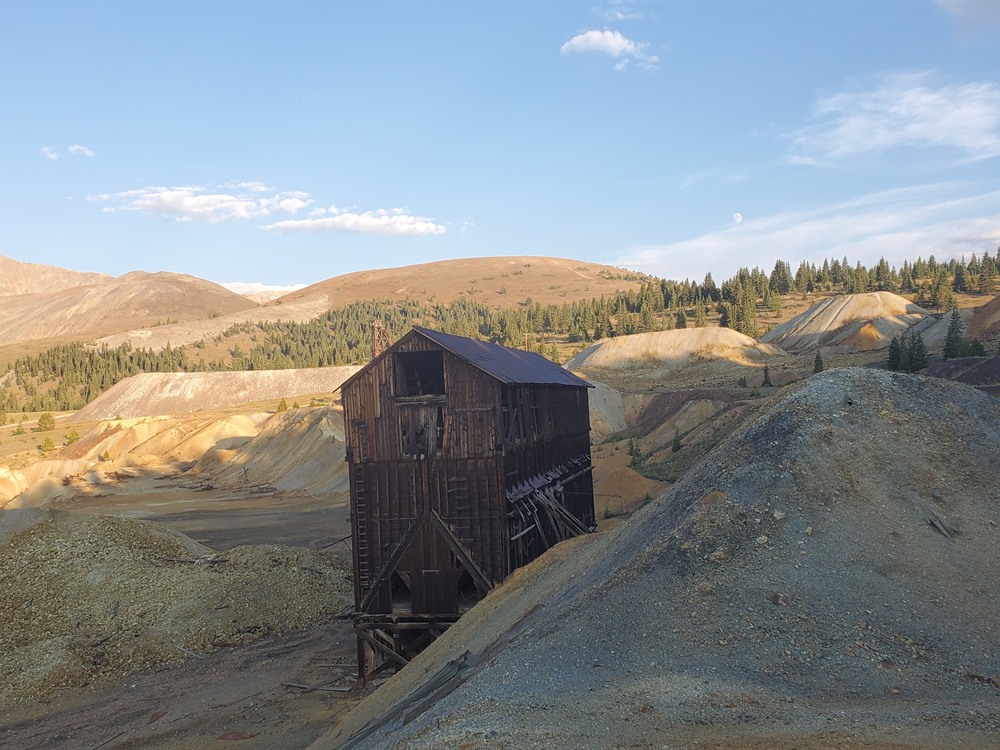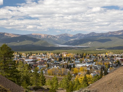

High-elevation former mining community featuring preserved historic architecture, scenic mountain surroundings, and access to outdoor activities including hiking, fishing, and alpine exploration.
General Information
Most shops and museums typically open 10:00am – 5:00pm
Museum and attraction fees typically range from $5–$20
Salida (60 mi)
Frisco (45 mi)
How to Get There
From Denver (100 mi): Take I-70 west to Exit 195 at Copper Mountain, then follow CO-91 south to US-24 and continue into the town center.
Overview
Leadville is the highest incorporated city in the U.S. at 10,158 feet, surrounded by Mount Elbert and Mount Massive, Colorado's two highest peaks. It boomed with silver in the 1870s and 1880s, and its Victorian Historic District is a National Historic Landmark. Famous residents included "Unsinkable" Molly Brown and Doc Holliday, and the Tabor Opera House (1879) is still open. Today it hosts the Leadville 100 endurance races, and it is a base for hiking, skiing at Ski Cooper, and the Leadville, Colorado & Southern Railroad train.
Things to Do
Explore Colorado's Highest Incorporated City
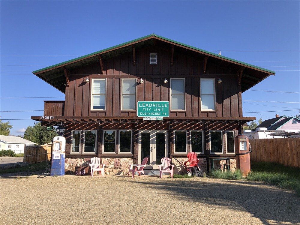
Leadville sits at an elevation of approximately 10,152 feet, making it the highest incorporated city in North America. Nestled between the Sawatch Range and the Mosquito Range, this historic mountain community is renowned for its rich silver-mining heritage, Victorian architecture, outdoor recreation, and easy access to some of Colorado's highest peaks. Visitors can experience a unique blend of Wild West history and Rocky Mountain adventure throughout the year.
Discover Leadville's Mining History
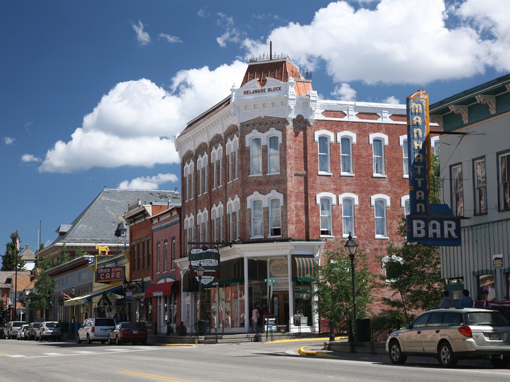
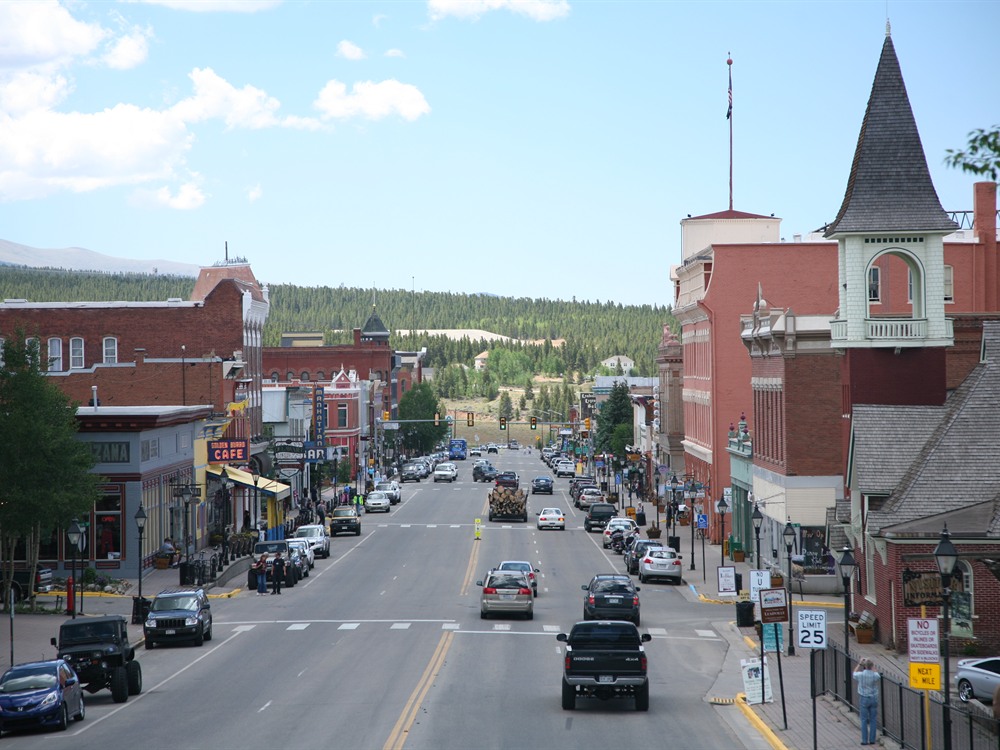
During the late nineteenth century, Leadville became one of the world's most important silver mining centers. Visitors can explore the National Mining Hall of Fame and Museum, tour historic mines, and walk through downtown streets lined with preserved Victorian-era buildings that reflect the city's boomtown past.
Ride the Leadville Railroad
The Leadville Railroad offers scenic excursions through the Arkansas River Valley, providing spectacular views of the surrounding mountains, forests, and historic mining districts. The journey combines beautiful Rocky Mountain scenery with stories of the region's railroad and mining heritage.
Experience Turquoise Lake
Just west of town, Turquoise Lake is a popular destination for boating, fishing, kayaking, camping, paddleboarding, hiking, and photography. Surrounded by mountain peaks, the lake offers stunning scenery and year-round recreational opportunities.
Access Colorado's Fourteeners
Leadville serves as a gateway to several of Colorado's famous fourteeners, including Mount Elbert, the highest peak in Colorado, and Mount Massive, the state's second-highest mountain. The area attracts hikers, climbers, trail runners, and outdoor enthusiasts from around the world.
Top Trails
Mount Elbert Trail
Length: Approximately 9 miles round trip
Elevation Gain: About 4,500 feet
Difficulty: Strenuous
This popular route leads to the summit of Mount Elbert, Colorado's highest peak at 14,440 feet. Hikers are rewarded with breathtaking views across the Rocky Mountains and the Arkansas River Valley.
Mount Massive Trail
Length: Approximately 14 miles round trip
Elevation Gain: About 4,500 feet
Difficulty: Strenuous
This challenging trail reaches the summit of Mount Massive, the second-highest peak in Colorado. The route traverses alpine terrain and offers expansive mountain vistas.
Mineral Belt Trail
Length: Approximately 11.6 miles loop
Elevation Gain: Moderate
Difficulty: Easy to Moderate
A favorite among walkers, runners, and cyclists, this paved trail circles Leadville and passes historic mining sites, scenic overlooks, and beautiful mountain landscapes while providing insight into the city's mining heritage.
Turquoise Lake Trail
Length: Variable distances available
Elevation Gain: Minimal to Moderate
Difficulty: Easy to Moderate
This scenic shoreline trail system offers beautiful views of Turquoise Lake and surrounding peaks. Visitors enjoy hiking, wildlife viewing, photography, and access to picnic and recreation areas around the reservoir.
Geography
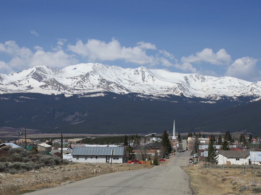
Leadville lies in a valley at the headwaters of the Arkansas River which flows through the southern Rocky Mountains and eventually empties into the Mississippi River. It is situated between two mountain ranges, the Mosquito Range to the east and the Sawatch Range to the west, both of which include several nearby peaks with elevations above 14,000 feet (4,300 m), the so-called fourteeners. Mount Elbert, 12 miles (19 km) southwest of Leadville, is the highest summit of the Rocky Mountains of North America and the highest point in the Colorado and the entire Mississippi River drainage basin. An ultra-prominent 14,440-foot (4,401 m) fourteener, Mount Elbert is the highest summit of the Sawatch Range and the second-highest summit in the contiguous United States after Mount Whitney in California. Mount Massive, 10.6 mi (17.1 km) west-southwest of Leadville, at 14,428 ft (4,398 m) is the second highest summit in the Rocky Mountains and state of Colorado, and the third highest in the contiguous United States.
Turquoise Lake lies on the western outskirts of Leadville. Recreation is managed by the Forest Service for the Bureau of Reclamation as part of San Isabel National Forest.
Historic sites and districts
The Leadville Historic District was designated a National Historic Landmark District in 1961. The district encompasses 67 mines east of the city up to the 12,000-foot (3,700 m) elevation, and a defined portion of the village area, with specific exclusions for various buildings. The principal historic buildings are the Tabor Grand Hotel, St George's Church, Temple Israel, African Methodist Episcopal Church (est. 1881)African Methodist Episcopal Church (est. 1881), the Annunciation Church, Tabor Opera House, City Hall, Healy House, Dexter Cabin, Engelbach House, Tabor House, and the Golden Burro Cafe and Lounge, as well as mining structures and small homes.
The National Mining Hall of Fame on West 9th Street is dedicated to commemorating the work of miners and people that work with natural resources. It is listed on the National Register of Historic Places. Major exhibits include an elaborate model railroad, a walk-through replica of an underground hardrock mine, the Gold Rush Room with specimens of native gold, a large collection of mineral specimens, and a mining art gallery. The site also includes the Matchless Mine and cabin, former home of Baby Doe Tabor.
Some historic sites are linked by the Mineral Belt National Recreation Trail, an 11.6-mile (18.7 km) all-season biking/walking trail that loops around Leadville and through its historic mining district. In part it follows old mining-camp railbeds. Interpretative kiosks recount the history and a photograph of what was on that particular site more than a century ago. The trail is well-marked with interpretive signs and altitude and mileage markers.
Camp Hale is located 15 miles (24 km) north of Leadville in the Eagle River valley north of Tennessee Pass. It was a U.S. Army ski warfare training facility constructed in 1942 for what became the 10th Mountain Division. Some of the nation's finest skiers were employed as instructors. Soldiers were trained in mountain climbing, Alpine and Nordic skiing, and cold-weather survival, as well as various weapons and ordnance. When it was in full operation, approximately 15,000 soldiers were housed there. In 2019, Camp Hale was designated as a National Historic Site offering a self-guiding tour with interpretive signs at ten stops and a larger interpretive site at the main entrance.
Outdoor recreation
Situated within the San Isabel National Forest and surrounded by three wilderness areas, Leadville is popular with hikers and campers. The Mount Massive Wilderness and Buffalo Peaks Wilderness are within 10 miles (16 km) of the city, and the Collegiate Peaks Wilderness is within 20 miles (32 km).
Turquoise Lake lies on the western outskirts of Leadville. Recreation facilities consist of eight campgrounds and two boat-launching ramps. Primary recreation activities include camping and fishing. Fish species include mackinaw trout, rainbow trout, and brook trout. The facilities are closed in winter due to ice and snow, but they remain a popular area for ice fishing.
The Top of the Rockies Byway, designated a National Scenic Byway in 1998, is a highway that travels 75 miles (121 km) starting in Aspen and traveling through Leadville to either Minturn or Copper Mountain. Seldom dropping below 9,000 feet (2,700 m), it drives over three mountain passes that are above 10,000 feet (3,000 m), and there are views of six mountains of over 14,000 feet (4,300 m). The Top of the Rockies Byway runs through three national forests: Pike, Arapaho, and White River. The Camp Hale Memorial is located along the byway. The road passes through the Arkansas Headwaters Recreation Area and Arkansas River Headwaters State Park.
Mosquito Pass is located east of Leadville. It can be traversed only on foot, an off-road motorcycle, or with a proper four-wheel drive vehicle. It is typically passable only during the summer months.
This article uses material from the Wikipedia article and official pages for leadvilletwinlakes.com, fs.usda.gov, Leadville, Colorado, released under the Creative Commons Attribution-Share-Alike License 3.0.