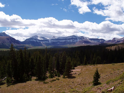

Highest point in Utah, located just south of the spine of the central Uinta Mountains, is generally regarded as the hardest state highpoint that can be climbed without specialist rock climbing skills and/or guiding
General Information
Length:
25 mi round trip
Elevation Gain:
4,202 ft
Hours:
24/7
Fees:
No entrance fee or hiking permit required for standard access to Kings Peak via the High Uintas Wilderness
Pet Policy:
Pets allowed
Seasons:
All year
Closest cities with hotels:
Evanston, Wy, 67 mi
Trailhead
Website:
How to Get There
From Salt Lake City (42 miles): Get on I-15 N. Follow I-15 N to UT-108 N/W 2000 N/Antelope Dr in Layton. Take exit 332 from I-15 N. Follow UT-108 N, W 1700 S and Antelope Island Rd to White Rocks Loop Rd.
Overview
Kings Peak (13,528 feet) is the highest point in Utah, in the Uinta Mountains in Ashley National Forest, south of the spine of the range in Duchesne County. It is a long, strenuous but non-technical hike, usually done as a multi-day backpack, and one of the more challenging state high points to reach.
Top Trail
| Route | Length | Elevation Gain | Highlights |
|---|---|---|---|
| Henrys Fork Trail (from Henrys Fork trailhead) | About 28 miles round trip | About 4,000 feet | The classic route, past Dollar Lake and Gunsight Pass; a class 2 scramble to the top; most people take two or three days |
This article uses material from the Wikipedia article "Kings Peak (Utah)", which is released under the Creative Commons Attribution-Share-Alike License 3.0


