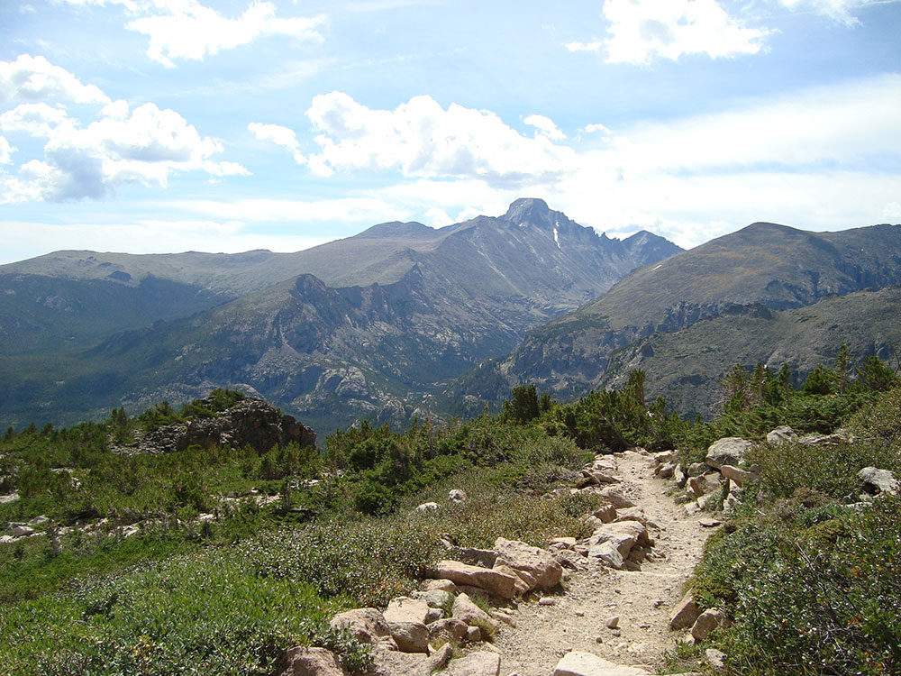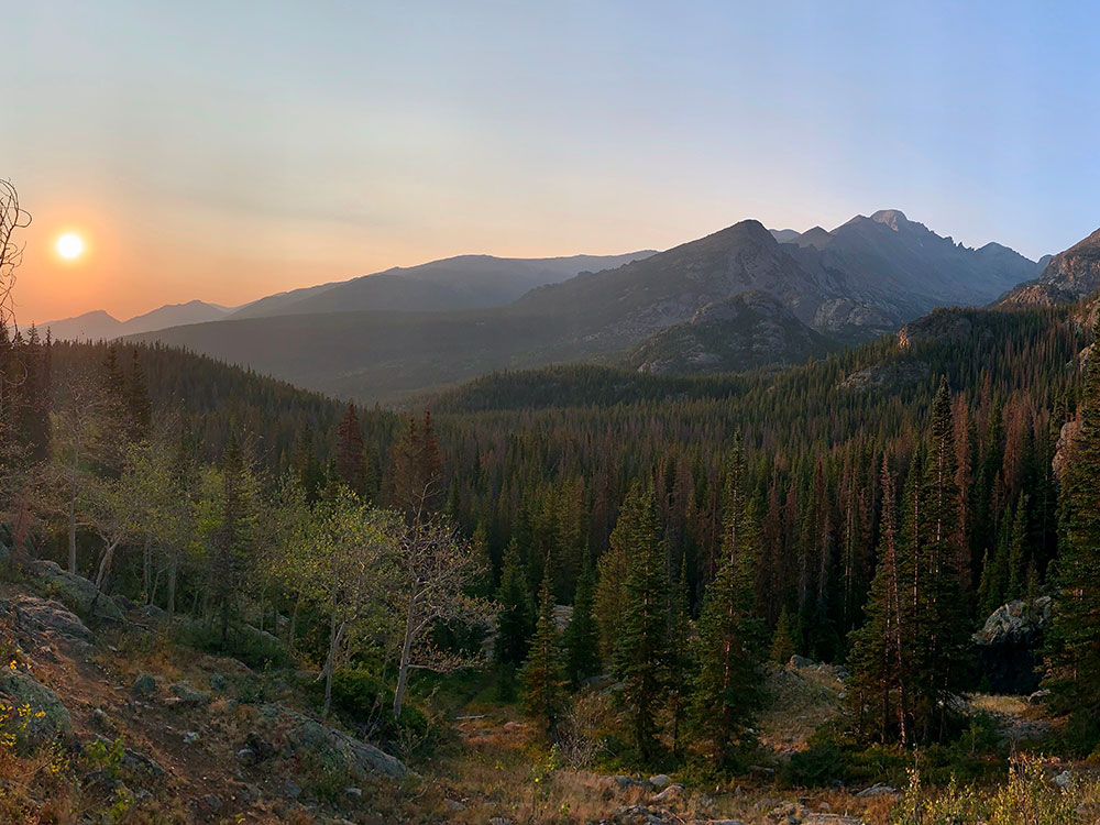

14,259-foot (4346 m) fourteener is located in the Rocky Mountain National Park Wilderness, is the northernmost fourteener in the Rocky Mountains
From Estes Park (10 mi): Take CO-7 S (the Peak to Peak Highway) about 9 miles to the Longs Peak Ranger Station and trailhead on the right.
Overview
Longs Peak (14,259 feet) is the highest peak in Rocky Mountain National Park and a popular fourteener, a flat-topped summit seen from almost anywhere in the park. Its one remaining glacier, Mills Glacier, is at the base of the east face above Chasm Lake. The standard route, the Keyhole Route, is not a hike but a climb: after the Boulder Field, it crosses a ledge system with sheer drops and requires scrambling. It is a long day (10 to 15 hours), so start well before dawn.
Keyhole Route
| Item | Detail |
|---|---|
| Distance | About 15 miles round trip (7.5 to the summit) |
| Elevation gain | About 5,100 feet |
| Time | 10 to 15 hours; start at the trailhead before sunrise (around 3 a.m.) to be below treeline by early afternoon |
| Trail | The maintained trail ends at the Boulder Field, about 5 miles from the trailhead; the last 1.5 miles are a scramble with exposed ledges |
| Best season | Mid-July through mid-September; other times need winter mountaineering skills |
| Hazards | Lightning, afternoon storms, and altitude; turn back if the weather changes |
Climbing Longs Peak
Trails that ascend Longs Peak include the East Longs Peak Trail, the Longs Peak Trail, the Keyhole Route, Clark's Arrow and the Shelf Trail. Only some technical climbing is required to reach the summit of Longs Peak during the summer season, which typically runs from mid July through early September. Outside of this window the popular "Keyhole" route is still open; however, its rating is upgraded to all "technical" as treacherous ice formation and snow fall necessitates the use of specialized climbing equipment including, at a minimum, crampons and an ice axe. It is one of the most difficult Class 3 fourteener scrambles in Colorado. The hike from the trailhead to the summit is 8.4 miles (13.5 km) each way, with a total elevation gain of 4,875 feet. Most hikers begin before dawn in order to reach the summit and return below the tree line before frequent afternoon thunderstorms bring a risk of lightning strikes. The most difficult portion of the hike begins at the Boulder Field, 6.4 miles (10 km) into the hike. After scrambling over the boulders, hikers reach the Keyhole at 6.7 miles (10.5 km).
The following quarter of a mile involves a scramble along narrow ledges, many of which may have nearly sheer cliffs of 1,000 feet (305 m) or more just off the edge. The next portion of the hike includes climbing over 600 vertical feet (183 m) up the Trough before reaching the most exposed section of the hike, the Narrows. Just beyond the Narrows, the Notch signifies the beginning of the Homestretch, a steep climb to the football field-sized, flat summit. It is possible to camp out overnight in the Boulder Field (permit required) which makes for a less arduous two-day hike, although this is fairly exposed to the elements. Fifty-eight people have died climbing or hiking Longs Peak. According to the National Park Service, two people, on average, die every year attempting to climb the mountain. Less experienced mountaineers are encouraged to use a guide for this summit to mitigate risk and increase the probability of a summit.
Keyhole Route
In the summertime, when conditions allow, thousands climb to Longs' summit via the Keyhole Route. The Keyhole Route is not a hike. It is a climb that crosses enormous sheer vertical rock faces, often with falling rocks, requiring scrambling, where an unroped fall would likely be fatal. The route has narrow ledges, loose rock, and steep cliffs.
For most of the year, climbing Longs Peak is in winter conditions, which requires winter mountaineering experience and the knowledge and use of specialized equipment. Disregard for the mountain environment any time of year has meant danger, injury and even death.
The Keyhole Route can experience winter-like conditions at any time, requiring greater skill and judgment. Be prepared to turn back during sudden, drastic weather changes.
Longs Peak-Keyhole Route: Frequently Asked Questions
Is the Keyhole Route a hike or a climb?
This is not a “walk in the park.” This is much more than a hike. This is a climb, a classic mountaineering route that should not be underestimated. The Keyhole Route crosses enormous vertical rock faces, is exposed to falling rock, and requires scrambling on all fours. The route has narrow ledges, loose rock, and steep cliffs. Depending upon conditions, you might encounter snow and ice any time of the year. The terrain requires route finding skills and the ability to assess and adjust to unexpected or changing weather conditions. A slip, trip or fall could be fatal.
Summiting Longs Peak is an incredible experience and most people who do so do it safely. However, the difficulty of this route is often underestimated. As with any high altitude mountaineering route you will encounter hazards along the way. Be sure to adequately plan, prepare for, and manage your climb - don't take it lightly.
Attempting the summit in the afternoon greatly increases your risk - the round-trip from the Longs Peak Trailhead averages 10 to 15 hours. Increased risk factors include: weather, eventual darkness, and a decline in the ability to see others on the route or to successfully navigate in the late afternoon light.
Yes. Time for the 15 mile round- trip averages 10 to 15 hours. Much of this route is above tree-line so give yourself plenty of time to be back below tree-line before afternoon thunderstorms and lightning develop. Of course, thunderstorms have been known to appear early in the day as well! At these elevations storms often produce snow, sleet and hail.
Is the “trail” to the summit of Longs Peak easy to find?
There is no “trail” to the summit of Longs Peak. The designated, maintained hiking trail ends at the Boulder Field, about five miles from the trailhead. From here you walk and scramble over boulders toward the Keyhole feature. Once at the Keyhole, the best route follows red and yellow bull's-eyes painted on the rocks. If you lose the bull's eyes you are likely off-route and will encounter more difficult climbing with potentially severe consequences. It is important to retrace your steps back to the bull's-eyes before continuing. Keep in mind if the route is in “winter- like” conditions sections of the bull's-eyes will not be visible. Do not rely on GPS systems or other technology to “show” you the route.
From the Longs Peak Trailhead to the summit of Longs Peak along the Keyhole Route is 7.5 miles. The actual Keyhole Route begins after the Boulder Field. The last 1.5 miles is by far the most difficult, exposed and hazardous portion of the route.
At 14,259 feet (4,345 meters), Longs Peak is one of the most popular “Fourteeners” in Colorado. It is common to see hundreds of people along the route and on the summit. In 2002, a research survey showed over 9,500 people reached the summit of Longs Peak; thousands more turned around at the Boulder Field. But….do not rely on the presence of others if you need help. Preparedness and self-reliance are essential.
In general, the most snow-free and ice-free time of year to climb Longs Peak is mid-July through mid-September.
This article uses material from the Wikipedia article and official pages for Longs Peak, Rocky Mountain National Park, released under the Creative Commons Attribution-Share-Alike License 3.0.