Southeastern California Travel Guide
Southeastern region of California centering aorund the Sonoran Desert, and features the city of Palm Springs, Joshua Tree National Park, and the Salton Sea
Map of Southeastern California
Places to See in Southeastern California
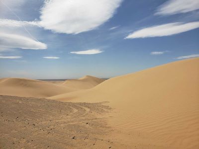
Algodones Dunes
Largest mass of sand dunes in the state
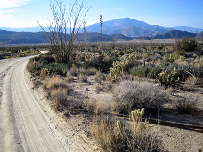
Wasquewhat, CC BY-SA 4.0, via Wikimedia Commons; Image Size Adjusted
Anza-Borrego Desert State Park
Vast desert preserve featuring rugged badlands, palm oases, wildflower blooms, and expansive wilderness landscapes that support diverse wildlife and outdoor recreation.
Chris English, CC BY-SA 3.0, via Wikimedia Commons; Image Size Adjusted
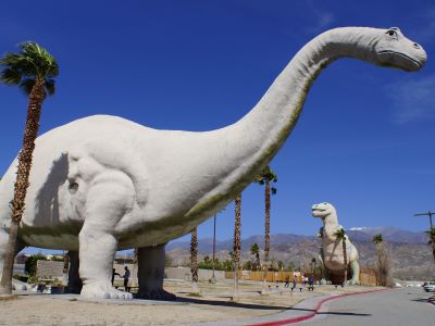
Cabazon Dinosaurs
Roadside attraction in Cabazon, California, featuring two enormous, steel-and-concrete dinosaurs best known for their appearance in the film Pee-wee's Big Adventure

inkknife_2000 (7.5 million views +), CC BY-SA 2.0, via Wikimedia Commons; Image Size Adjusted
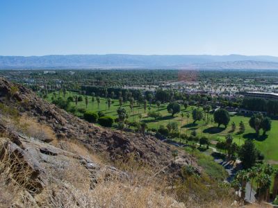
Joshua Tree National Park
Named for the Joshua trees (Yucca brevifolia) native to the Mojave Desert, the park includes parts of two deserts, each an ecosystem whose characteristics are determined primarily by elevation: the higher Mojave Desert and the lower Colorado Desert
Visitor7, CC BY-SA 3.0, via Wikimedia Commons; Image Size Adjusted
Palm Springs
Desert resort city within the Coachella Valley, the city is noted for its mid-century modern architecture, design elements, arts and cultural scene, and recreational activities
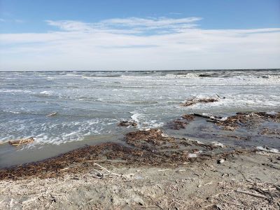
Salton Sea
Shallow, landlocked body of water that has a high concentration of salts, with abandoned structures and surrounds have been reinvented as a destination for desert art and Salton Sea State Recreation Area offers hunting, fishing, swimming, and camping
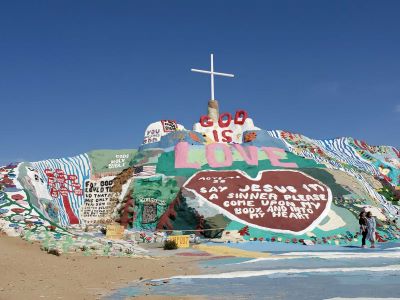
Salvation Mountain
Artwork made of adobe bricks, discarded tires and windows, automobile parts and thousands of gallons of paint encompasses numerous murals and areas painted with Christian sayings and Bible verses
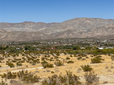


San Bernardino Mountains
Mountain range offering alpine lakes, pine forests, scenic drives, hiking trails, campgrounds, ski resorts, and year-round outdoor recreation opportunities.
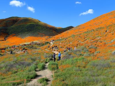
cultivar413, CC BY 2.0, via Wikimedia Commons; Image Size Adjusted

Walker Canyon
Expansive desert canyon featuring rugged trails, seasonal wildflower blooms, and diverse wildlife habitats ideal for hiking and nature observation.
Overview
Southeastern California is a land of extremes and contrasts, where vast desert basins meet rugged mountain ranges under an expansive sky. The region centers on the Sonoran (Colorado) Desert and includes the resort city of Palm Springs, Joshua Tree National Park, and the Salton Sea. It also reaches parts of the Mojave Desert.
Visitors come for mid-century modern architecture, golf and spa resorts, music festivals, desert hiking, rock climbing, and stargazing under some of the darkest skies in Southern California. The area’s isolation and stark beauty have long attracted adventurers, artists, and those seeking solitude.
Geography
The region lies in the low-elevation Colorado Desert, a part of the Sonoran Desert, where rainfall often measures less than 10 inches a year. Plants such as creosote bush and ocotillo thrive, and the Joshua tree grows in the higher Mojave section of Joshua Tree National Park. The Salton Sea sits in a basin about 230 feet below sea level, the Colorado River forms the eastern border, and the San Jacinto and Santa Rosa mountains rise above Palm Springs. The Imperial Sand Dunes are among the largest dune fields in North America.
History
The Cahuilla, Chemehuevi, Quechan, and other peoples have long lived in the desert, and the Agua Caliente Band of Cahuilla still manage the springs and canyons at Palm Springs. Spanish explorer Juan Bautista de Anza crossed the desert in the 1770s. The Salton Sea was formed in 1905, when the Colorado River broke through irrigation works and flooded the basin for about two years. Irrigation turned the Imperial Valley into a major farming region, and Palm Springs became a Hollywood retreat in the 1930s through the 1960s, leaving a legacy of mid-century modern design.
Cities and Towns
Palm Springs is the best-known city, with its aerial tramway, mid-century architecture, and resorts, and nearby Cathedral City, Rancho Mirage, Palm Desert, La Quinta, and Indio form the Coachella Valley. Indio hosts the Coachella and Stagecoach music festivals. Twentynine Palms and Yucca Valley are the main gateways to Joshua Tree, and El Centro and Blythe are the larger communities in the Imperial and Colorado River valleys.
National Protected Areas
Joshua Tree National Park is the area’s most visited protected area, with Joshua tree forests, boulder fields, and desert palm oases. The Santa Rosa and San Jacinto Mountains National Monument protects the mountains above Palm Springs. The Imperial Sand Dunes Recreation Area is managed by the Bureau of Land Management for off-road recreation, and the Sonny Bono Salton Sea National Wildlife Refuge is a key stop for migrating birds.
State Parks and Historic Sites
Anza-Borrego Desert State Park is California’s largest state park, with badlands, palm canyons, and spectacular wildflower blooms in wet springs. Salton Sea State Recreation Area offers camping and birding, and Mount San Jacinto State Park is reached by the Palm Springs Aerial Tramway. Nearby, the Indian Canyons, managed by the Agua Caliente Band of Cahuilla, preserve palm-lined canyons with hiking trails.
Seasons and Best Time to Visit
The best time to visit is from October through April, when daytime temperatures are in the 60s to 80s, and winter is peak season in Palm Springs and Joshua Tree. Spring brings wildflowers after wet winters, often in February and March at Anza-Borrego, and the Coachella festival in April. Summers are extremely hot, with temperatures often above 110°F, so most outdoor activity should be done in the early morning. Cooler months are best for hiking, climbing, stargazing, and birdwatching at the Salton Sea.
This article uses material from the Wikipedia articles and official tourism pages for the Geography of Southern California and Ecology of California, which is released under the Creative Commons Attribution-Share-Alike License 3.0. Additional information is from the National Park Service page for Joshua Tree National Park, the Bureau of Land Management Imperial Sand Dunes page, and California State Parks.