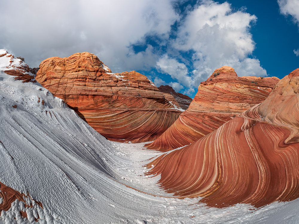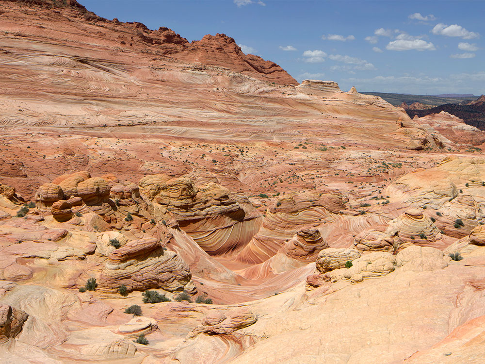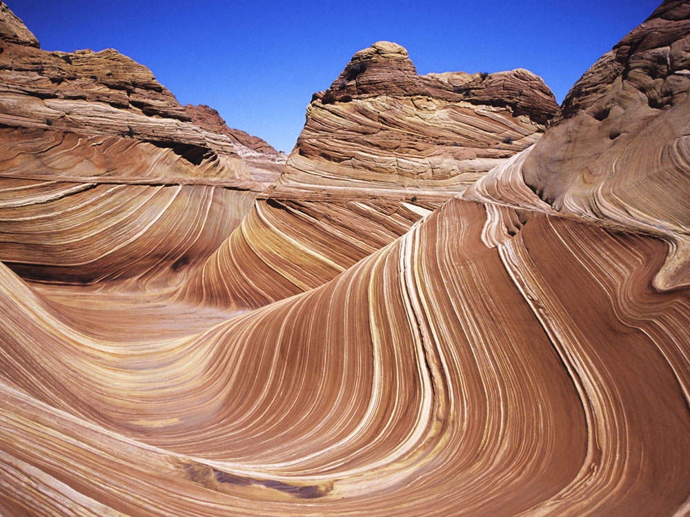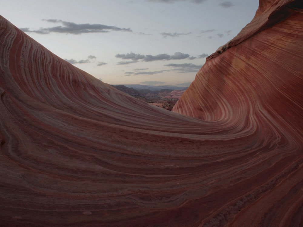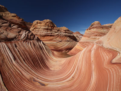
Sandstone rock formation located in Arizona, near border with Utah is well-known among hikers and photographers for its colorful, undulating forms.
General Information
Access is restricted to permitted hikers only
Application fee: about $9 per application
Permit fee: $7 per person per day
Additional $7 fee per dog if included on permit
Page, AZ (50 mi)
How to Get There
From Page (50 mi): Take US‑89 W toward Kanab, then turn onto House Rock Valley Road and continue to the Wire Pass Trailhead where the hike to the formation begins.
Overview
The Wave is a sandstone rock formation located in Arizona, near its northern border with Utah. The formation is situated on the slopes of the Coyote Buttes in the Paria Canyon-Vermilion Cliffs Wilderness of the Colorado Plateau. The area is administered by the Bureau of Land Management (BLM) at the Grand Staircase-Escalante National Monument visitor center in Kanab, Utah.
The formation is well-known among hikers and photographers for its colorful, undulating forms and the difficult hike required to reach it. Due to the fragile nature of the formation and the large number of people wishing to visit it, a daily lottery system is used to dispense only ten next-day permits in person at the Kanab visitor center. Additionally, ten online permits for each date are available four months in advance of a planned trip. A map and information about the hike are supplied to those who have obtained permits.
Geology
The Wave consists of intersecting U-shaped troughs that have been eroded into Navajo Sandstone of Jurassic age. The two major troughs which comprise this rock formation are 62 feet (19 m) wide by 118 feet (36 m) long and 7 feet (2 m) wide by 52 feet (16 m) long. Initially, infrequent runoff eroded these troughs along joints within the Navajo Sandstone. After their formation, the drainage basin, which fed rainwater to these troughs, shrank to the point that the runoff became insufficient to contribute to the cutting of these troughs. As a result, the troughs are now almost exclusively eroded by wind, as indicated by the orientation of erosional steps and risers cut into the sandstone along their steep walls. These erosional steps and risers are oriented relative to the predominant direction of the wind as it is now naturally funneled into and through these troughs.
The Wave exposes large-scale sets of cross-bedded eolian sandstone composed of rhythmic and cyclic alternating grainflow and windripple laminae. The rhythmic and cyclic alternating laminae represent periodic changes in the prevailing winds during the Jurassic period as large sand dunes migrated across a sandy desert. The thin ridges and ribbing seen within the Wave are the result of the differential erosion of rhythmic and cyclic alternating grainflow and windripple laminae within the Navajo Sandstone. These laminae have differing resistance to erosion as they have been differentially cemented according to variations in the grain size of the sand composing them. The soft sandstone is fragile, especially the ridges and ribbing of the Wave. As a result, visitors must walk carefully to avoid breaking the small ridges.
In some areas the Wave exposes deformed laminae within the Navajo Sandstone. These laminae were deformed prior to the lithification of the sand to form sandstone. Judging from their physical characteristics, this deformation likely represents the trampling and churning of these sands by dinosaurs after their deposition. Dinosaur tracks and the fossil burrows of desert-dwelling arthropods, such as beetles and other insects, have been found in the Navajo Sandstone within the North Coyote Buttes Wilderness Area.
An ideal time to photograph the Wave is the few hours around midday when there are no shadows in the center, although early morning and late afternoon shadows can also make for dramatic photos. After a rain storm, numerous pools form which can contain hundreds of tadpole shrimps (Lepidurus apus). These pools can be present for several days.
Above and slightly west of the Wave is what many call "the Second Wave", or "the middle Wave", which has fainter colors but is still of interest to most visitors and photographers.
There are four trailheads which provide access to Paria Canyon and the Wave. However, in an effort to maintain the natural integrity of the region, there are no formal trails or signage to guide hikers to the Wave from any of the trailheads. The White House trailhead is the main entrance, and the one most commonly used. The Buckskin Gulch and Wire Pass trailheads offer more experienced hikers access to Buckskin Gulch, the main tributary of Paria Canyon. The Lee's Ferry trailhead, located at the lower end of Paria Canyon is the normal exit point for hikers traveling the entire length of the canyon.
The shortest hike to the Wave begins at the Wire Pass Trailhead, about 8.3 miles (13.4 km) south of U.S. Route 89 along House Rock Valley Road, a dirt road about 35.4 miles (57.0 km) west of Page, Arizona or 38.6 miles (62.1 km) east of Kanab, Utah that is accessible to most vehicles in good weather. During and after a storm the road may be impassable, even with a four-wheel-drive vehicle. The Wire Pass Trailhead includes a wide parking lot with restrooms, but no water. It is also accessible from the Arizona side by taking U.S. Route 89A from Jacob Lake on the Kaibab Plateau toward Navajo Bridge, turning north onto the House Rock Valley Road, after descending from the Kaibab. This is a longer access route over dirt road than from the Utah side.
From the Wire Pass Trailhead, the Wave can be reached by hiking approximately 3 miles (4.8 km) across open desert, making the round-trip to and from the Wave nearly 6 miles (9.7 km), climbing about 350 feet (110 m) in altitude. Although this is the shortest route, it is also a slightly more challenging hike than several of the other available routes. Temperatures in this area typically climb above 100 °F (38 °C) in the summer, so it is best to start the hike early. Anyone attempting the hike in any season is wise to be prepared for harsh desert conditions, including fierce winds, blowing sand, and little shade.
The Wave can be challenging to locate due to the lack of an established, marked trail. Hikers must choose their own route across the open desert, which requires traversing exposed sandstone, sand dunes, and sandy wash bottoms. A formal guide sheet for navigating to the Wave is now provided to every permitted hiker by the BLM. The guide is designed for use with compass, GPS, or visual navigation. There are six checkpoints each for the outbound hike to the Wave and the return to the trailhead. Each checkpoint includes a marked color photo of the terrain ahead, azimuth, latitude, longitude, UTM, northing, and easting. Visitors are well advised to closely study the guide sheet before starting their hike.
Permit Lottery Process
The permit process for The Wave is carefully controlled to protect one of the most fragile sandstone formations in the Southwest, with access limited to just 64 people per day across the entire permit area. These permits are divided between two lottery systems managed through Recreation.gov, ensuring strict visitor caps and preserving the landscape from overuse. The primary method is an advance online lottery, which distributes 48 permits each day and requires applicants to apply four months ahead of their desired hiking date, selecting preferred dates and group sizes. This system receives extremely high demand, with thousands of applicants competing for a small number of available spots.
A secondary opportunity exists through a daily geofenced lottery, which allocates the remaining 16 permits for those already in the region, requiring applicants to enter via mobile device within a designated area near Kanab or Page two days before their intended hike. Both lotteries limit group sizes and require a fee to apply, with winners receiving a one-day permit tied to a specific date. Successful applicants must confirm their reservation, review safety guidelines, and navigate to the destination using maps and GPS, as no marked trail exists. This dual-lottery system balances accessibility with conservation, ensuring that only a small number of visitors experience the landscape each day while maintaining its long-term preservation. [1](https://permitsnag.com/guides/the-wave-permit)[2](https://www.recreation.gov/permits/4251909)[3](https://www.visitsouthernutah.com/dailylottery/)
This article uses material from the Wikipedia article "The Wave (Arizona)", which is released under the Creative Commons Attribution-Share-Alike License 3.0