
.jpg)
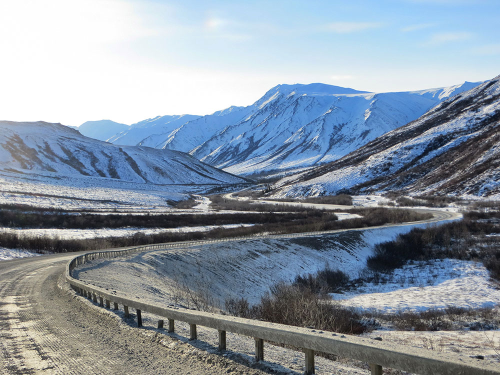
414-mile (666 km) road in Alaska beginning north of Fairbanks, and ending near the Arctic Ocean and the Prudhoe Bay Oil Fields, was built as a supply road to support the Trans-Alaska Pipeline System in 1974
General Information
How to Get There
From Fairbanks, AK (~84 mi to highway start): Take AK-2 N (Elliott Highway) approximately 84 miles north from Fairbanks to the Dalton Highway junction (Mile 0), then continue north on AK-11 (Dalton Highway) for the full 414-mile route ending at Deadhorse near the Arctic Ocean.
Overview
The Dalton Highway (Alaska Route 11) is a 414-mile road from north of Fairbanks to Deadhorse and Prudhoe Bay, next to the Trans-Alaska Pipeline, one of the most isolated and rugged roads in the U.S. It crosses the Arctic Circle and passes through the Brooks Range, with only three towns (Coldfoot, Wiseman, and Deadhorse). The public was allowed access to the whole road in 1994.
Good to Know
- Road: mostly gravel, with 129 paved miles; expect trucks (about 160 a day in summer), dust, flying rocks, and few services
- Preparation: carry two spare tires, fuel, and food, since the nearest medical care may be hundreds of miles away and cell service is very limited
- Sights: the Arctic Circle marker (mile 115), Gates of the Arctic views, and Atigun Pass
- Rentals: most rental car companies forbid the road, but some Fairbanks companies allow it
- Media: featured on the History channel show Ice Road Truckers
Things to Do
Drive One of the Most Remote Roads in North America
The Dalton Highway, also known as the James W. Dalton Highway or the Haul Road, stretches approximately 414 miles from Livengood north to Deadhorse near Prudhoe Bay. Built to support construction and operation of the Trans-Alaska Pipeline, the highway passes through some of Alaska's most remote and spectacular wilderness, making it one of the state's ultimate road-trip adventures.
Cross the Arctic Circle
One of the most popular milestones along the Dalton Highway is reaching the Arctic Circle. Visitors can stop at the Arctic Circle Wayside, take photographs beside the famous sign, and experience the point where summer days can remain sunlit for 24 hours while winter experiences prolonged darkness.
View the Trans-Alaska Pipeline
For much of the journey, the highway parallels the Trans-Alaska Pipeline System. Numerous viewpoints provide opportunities to observe this engineering marvel as it traverses rivers, mountains, permafrost, and Arctic landscapes on its route from Prudhoe Bay to Valdez.
Cross the Yukon River
The Dalton Highway is the only road in Alaska that crosses the Yukon River. The Yukon River Bridge offers visitors an opportunity to view one of North America's great rivers while learning about the transportation and engineering history of Alaska's interior.
Visit Coldfoot
Located near the halfway point of the route, Coldfoot serves as the primary service center along the highway. Visitors can find lodging, fuel, dining, and the nearby Arctic Interagency Visitor Center, which provides exhibits and information about the Arctic environment and surrounding public lands.
Tour the Arctic Interagency Visitor Center
Located in Coldfoot, the Arctic Interagency Visitor Center offers exhibits covering Arctic ecology, geology, wildlife, Indigenous cultures, and recreation opportunities. It serves as an excellent introduction to the landscapes visitors encounter farther north.
Drive Through the Brooks Range
The Dalton Highway traverses the Brooks Range, one of North America's northernmost major mountain ranges. Rugged peaks, alpine valleys, braided rivers, and dramatic mountain scenery create some of the most memorable views found anywhere in Alaska.
Cross Atigun Pass
At approximately 4,800 feet above sea level, Atigun Pass is the highest highway pass in Alaska. The route through the pass offers extraordinary views of mountain landscapes and opportunities to observe Dall sheep on the surrounding slopes.
Explore Gates of the Arctic National Park Vicinity
Several portions of the Dalton Highway provide access to areas adjacent to Gates of the Arctic National Park and Preserve. Visitors can experience wilderness landscapes, hiking opportunities, and stunning views near one of the least-visited national parks in the United States.
View Arctic Wildlife
Wildlife viewing opportunities along the Dalton Highway include moose, caribou, grizzly bears, musk oxen, Arctic foxes, wolves, Arctic ground squirrels, and Dall sheep. Many visitors consider wildlife sightings a highlight of the drive.
Reach Deadhorse and Prudhoe Bay
At the northern terminus of the highway, visitors arrive in Deadhorse, the industrial gateway to Prudhoe Bay. Authorized tours provide access to the Arctic Ocean, allowing travelers to stand at the northern edge of Alaska after completing one of the state's most legendary road journeys.
Top Trails
Arctic Circle Trail
Length: Approximately 0.5 miles round trip
Elevation Gain: Minimal
Difficulty: Easy
A short interpretive walk near the Arctic Circle Wayside provides excellent views of the surrounding wilderness and serves as a popular opportunity to stretch your legs while marking the crossing of the Arctic Circle.
Boreal Forest Nature Trail (Coldfoot)
Length: Approximately 1 mile loop
Elevation Gain: Minimal
Difficulty: Easy
Located near the Arctic Interagency Visitor Center, this interpretive trail introduces visitors to Interior Alaska forests, local wildlife habitats, and Arctic ecosystems while offering a relaxing walk near Coldfoot.
Marion Creek Campground Trails
Length: Approximately 1 to 3 miles depending on route
Elevation Gain: Minimal
Difficulty: Easy
The Marion Creek area contains a network of informal walking paths that provide opportunities for birdwatching, wildlife viewing, and experiencing the northern boreal forest alongside a scenic mountain setting.
Galbraith Lake Backcountry Routes
Length: Varies by route
Elevation Gain: Varies
Difficulty: Moderate to Strenuous
Located north of Atigun Pass, the Galbraith Lake area is a popular destination for backcountry hiking. Visitors can explore tundra landscapes, braided river systems, and expansive Arctic scenery while creating their own wilderness routes.
Slope Mountain Backcountry Route
Length: Varies by itinerary
Elevation Gain: Moderate
Difficulty: Moderate
One of the most accessible Arctic hikes along the Dalton Highway, this area offers sweeping views of the North Slope, opportunities to observe Dall sheep, and dramatic mountain scenery near Atigun Pass.
This article uses material from the Wikipedia article and official pages for dot.alaska.gov, blm.gov, alaska.org, Dalton Highway, released under the Creative Commons Attribution-Share-Alike License 3.0.

-1000.jpg)
.jpg)