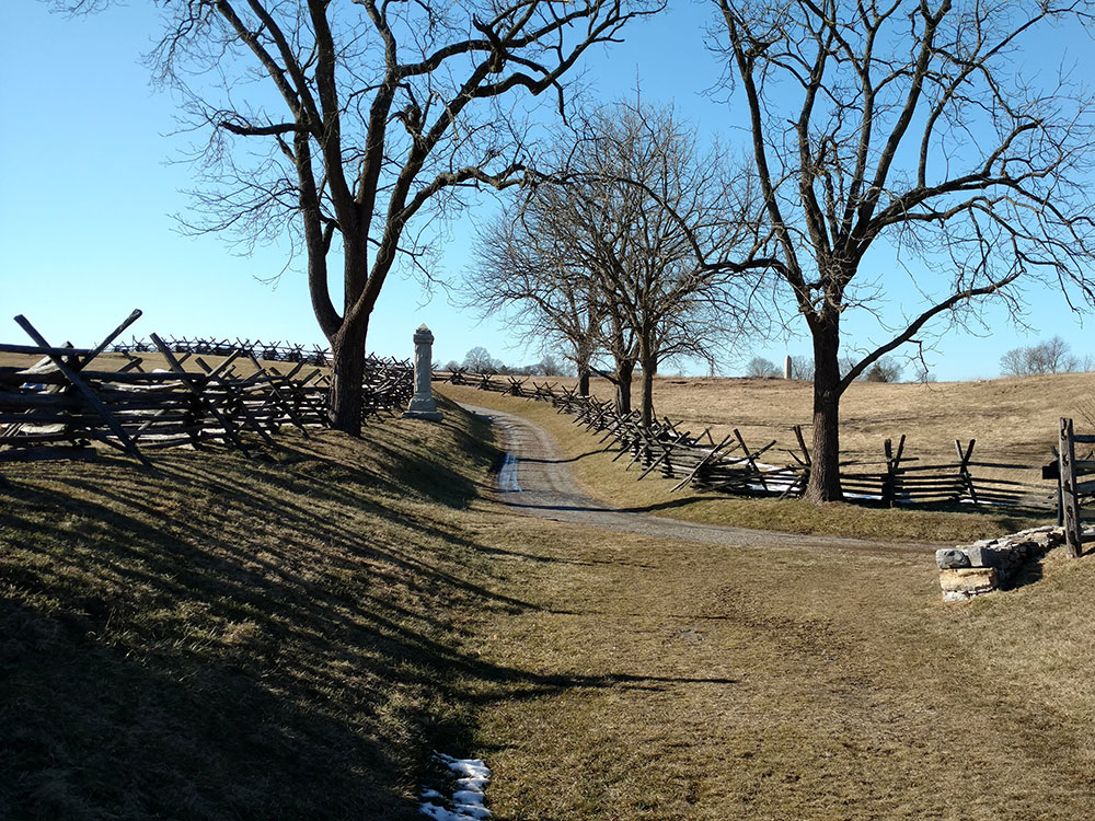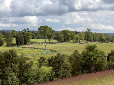
Park commemorating the American Civil War Battle of Antietam that occurred on September 17, 1862
General Information
Visitor Center: Open daily 9:00am–5:00pm
Closed on Thanksgiving, Christmas Day, and New Year's Day
Motorcycle: $15 (valid for 3 days)
Per Person (walk-in/bicycle): $10 (valid for 3 days)
Antietam Annual Pass: $35
How to Get There
From Hagerstown, MD (approximately 12 mi): Take MD-65 south toward Sharpsburg, then follow signs to Antietam National Battlefield and the Visitor Center on Dunker Church Road.
Overview
Antietam National Battlefield is a National Park Service-protected area along Antietam Creek in Sharpsburg, Washington County, northwestern Maryland. It commemorates the American Civil War Battle of Antietam that occurred on September 17, 1862.
The area, situated on fields among the Appalachian foothills near the Potomac River, features the battlefield site and visitor center, a national military cemetery, stone arch Burnside's Bridge, and a field hospital museum.
In the Battle of Antietam, General Robert E. Lee's first invasion of the North ended on this battlefield in 1862. Established as Antietam National Battlefield Site August 30, 1890, the park was transferred from the War Department on August 10, 1933, and redesignated November 10, 1978. Along with all historic areas administered by the National Park Service, the battlefield was listed on the National Register of Historic Places on October 15, 1966.
Antietam National Cemetery, which adjoins the park, covers 11.36 acres (4.60 ha) and contains more than 4,976 interments (1,836 unidentified). The gatehouse at the cemetery entrance was the first building designed by Paul J. Pelz, later architect of the Library of Congress.
The Antietam National Battlefield Visitor Center contains museum exhibits about the battle and the Civil War. Park rangers offer interpretive talks and an audio tour is available for purchase to accompany the self-guided 8.5-mile (13.7 km) driving tour of the battlefield with eleven stops.
The Pry House Field Hospital Museum is located in the house that served as Union Commander General George B. McClellan's headquarters during the battle. Exhibits focus on period medical care of the wounded, as well as information about the Pry House. The museum is sponsored by the National Museum of Civil War Medicine.
Things to Do
Explore the Site of the Bloodiest Single Day in American History
Antietam National Battlefield preserves the battlefield where the Battle of Antietam was fought on September 17, 1862, during the American Civil War. The battle resulted in approximately 23,000 casualties in a single day and remains the bloodiest day in American military history. The Union victory gave President Abraham Lincoln the opportunity to issue the preliminary Emancipation Proclamation, making Antietam one of the most significant battlefields in the nation.
Visit the Antietam Visitor Center
The visitor center features exhibits, artifacts, maps, and an award-winning film that explains the events leading to the battle and its impact on the Civil War. Visitors can gain a deeper understanding of the conflict, military strategies, and the soldiers who fought on the battlefield.
Tour Historic Battlefield Landmarks
Visitors can explore iconic locations such as Dunker Church, the Cornfield, Bloody Lane, Burnside Bridge, and the Pry House Field Hospital Museum. These sites help tell the story of the battle's key moments and provide insight into the experiences of soldiers and civilians during the conflict.
Take the Battlefield Driving Tour
The park's self-guided driving tour includes numerous interpretive stops throughout the battlefield. Visitors can follow the events of the battle while experiencing the preserved landscape much as it appeared in 1862.
Explore Monuments and Memorials
More than a hundred monuments, memorials, and markers are located throughout the battlefield, honoring the soldiers and units who fought at Antietam. These memorials provide historical context and commemorate those who served during the battle.
Top Trails
Antietam Battlefield Trail
Length: Approximately 5 miles of interconnected walking routes
Elevation Gain: Minimal to Moderate
Difficulty: Easy
A network of walking paths allows visitors to explore major battlefield locations, including the Cornfield, Dunker Church, Bloody Lane, and Burnside Bridge. Interpretive signs provide detailed information about troop movements and significant events of the battle.
Bloody Lane Trail
Length: Approximately 0.75 miles round trip
Elevation Gain: Minimal
Difficulty: Easy
This short walk explores one of the most famous locations on the battlefield. Bloody Lane was the site of intense fighting and became one of the defining symbols of the Battle of Antietam.
Burnside Bridge Trail
Length: Approximately 1 mile round trip
Elevation Gain: Minimal
Difficulty: Easy
This trail leads to the historic stone bridge crossed by Union forces under General Ambrose Burnside. The site offers scenic views of Antietam Creek while highlighting one of the battle's most important engagements.
Cornfield and Dunker Church Walk
Length: Approximately 1 mile round trip
Elevation Gain: Minimal
Difficulty: Easy
Visitors can walk through the area where some of the fiercest fighting of the battle took place. The route connects the famous Cornfield and Dunker Church, providing insight into the opening stages of the conflict.
Sources: National Park Service official Antietam National Battlefield information, including details on the Battle of Antietam, visitor center exhibits, battlefield preservation, self-guided tours, historic landmarks, trails, and educational programs. https://www.nps.gov/anti
Additional historical and visitor information verified through National Park Service resources covering Bloody Lane, Burnside Bridge, Dunker Church, the Cornfield, battlefield monuments, and park recreation opportunities. https://www.nps.gov/anti/planyourvisit
This article uses material from the Wikipedia article "Antietam National Battlefield", which is released under the Creative Commons Attribution-Share-Alike License 3.0