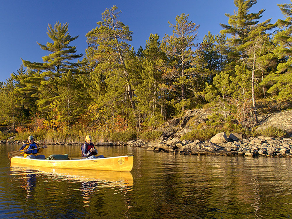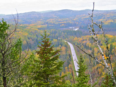

57-mile paved roadway and National Scenic Byway that begins in Grand Marais and ends at Saganaga Lake in the Boundary Waters Canoe Area Wilderness, near the U.S. border with Ontario
General Information
How to Get There
From Duluth, MN (110 mi): Take MN-61 E (North Shore Scenic Drive) northeast from Duluth approximately 110 miles to Grand Marais, then turn left (northwest) onto Cook County Road 12 (Gunflint Trail) to begin the scenic byway.
Overview
County State-Aid Highway 12 (CSAH 12), also known as the Gunflint Trail, or County Road 12 (CR 12), is a 57-mile (92 km) paved roadway and National Scenic Byway in Cook County, Minnesota, that begins in Grand Marais and ends at Saganaga Lake in the Boundary Waters Canoe Area Wilderness (BWCAW), near the U.S. border with Ontario. It provides access to many of the entry points in the BWCAW.
Route description
Originally a footpath for travelers from inland lakes to Lake Superior, the trail was eventually widened into a roadway, and designated as County Road 12 (CR 12). It now serves as a route to lodges, outfitters, hiking trails and the lakes and rivers of the BWCA.
The route begins at Highway 61 in Grand Marais. It travels generally northward until Northern Light Lake, where it turns northwestward, following the Brule River. It crosses the Brule and continues north-northwest along Swamper Creek, gradually arcing westward and running along the northern shore of Poplar Lake. The road continues west past several lakes including Birch, Mayhew, and Loon before reaching the access roads to Gunflint Lake. The route turns north near Round Lake and travels several miles to Sea Gull Lake, where it turns west again to its terminus at Saganaga Lake.
In the summer, the Gunflint Trail community is a hub of activity for campers, canoeists, hikers and fishermen. Several famous establishments can be found along the trail, including the historic Gunflint Lodge, the Trail's End Cafe, and Trail Center restaurant.
Things to Do
Drive One of Minnesota's Most Scenic Roads
The Gunflint Trail is a legendary 57-mile scenic byway that extends from Grand Marais into the wilderness of northeastern Minnesota. Designated as a National Scenic Byway, the route winds through the Superior National Forest and serves as one of the primary gateways to the Boundary Waters Canoe Area Wilderness. Visitors experience pristine forests, sparkling lakes, wildlife viewing opportunities, and some of the most remote and beautiful landscapes in the Midwest.
Access the Boundary Waters Canoe Area Wilderness
The Gunflint Trail provides access to numerous entry points into the Boundary Waters Canoe Area Wilderness. Paddlers, anglers, backpackers, and campers use the trail as a starting point for adventures into one of America's premier wilderness areas, featuring more than one million acres of interconnected lakes and forests.
Observe Wildlife in the North Woods
The Gunflint region is one of the best places in Minnesota to observe wildlife. Visitors may encounter moose, black bears, gray wolves, foxes, beavers, bald eagles, loons, and a variety of migratory birds. The area's remote forests and wetlands provide ideal habitat for many northern species.
Enjoy Year-Round Outdoor Recreation
The Gunflint Trail is a four-season destination offering canoeing, kayaking, fishing, hiking, camping, mountain biking, birdwatching, photography, snowshoeing, cross-country skiing, and dogsledding. Fall colors and opportunities to view the northern lights attract visitors from around the world.
Visit Scenic Lakes and Overlooks
Numerous lakes, including Gunflint Lake, Poplar Lake, Seagull Lake, and Saganaga Lake, are accessible from the trail. Scenic viewpoints offer sweeping views of forests, waterways, and the rugged Canadian Shield landscape that defines northeastern Minnesota.
Top Trails
Magnetic Rock Trail
Length: Approximately 6 miles round trip
Elevation Gain: Moderate
Difficulty: Moderate
One of the most popular hikes along the Gunflint Trail, this route leads to a massive magnetic iron-rich rock formation rising above the forest. The trail offers beautiful wilderness scenery and opportunities to observe wildlife.
Kekekabic Trail
Length: Approximately 39 miles one way
Elevation Gain: Moderate to Strenuous
Difficulty: Strenuous
This remote wilderness trail passes through the heart of the Boundary Waters Canoe Area Wilderness. Backpackers experience rugged terrain, remote lakes, forests, and exceptional solitude while exploring one of Minnesota's premier long-distance hiking routes.
Honeymoon Bluff Trail
Length: Approximately 1 mile round trip
Elevation Gain: Moderate
Difficulty: Easy to Moderate
This short but rewarding trail climbs to a scenic overlook above Hungry Jack Lake. The bluff provides panoramic views of the surrounding lakes and forests and is especially popular at sunrise and during fall color season.
Border Route Trail
Length: Approximately 65 miles one way
Elevation Gain: Moderate to Strenuous
Difficulty: Strenuous
Sections of this acclaimed long-distance trail are accessible from the Gunflint Trail corridor. Hikers enjoy spectacular overlooks, rugged ridges, wilderness lakes, and some of the most dramatic scenery in northeastern Minnesota.
Sources: Gunflint Trail Scenic Byway information, including details on recreation opportunities, wildlife viewing, lakes, hiking trails, and access to the Boundary Waters Canoe Area Wilderness. https://gunflint.com
Additional information verified through Superior National Forest resources covering the Magnetic Rock Trail, Honeymoon Bluff Trail, Kekekabic Trail, Border Route Trail, wilderness access points, and recreational opportunities along the Gunflint Trail corridor. https://www.fs.usda.gov/superior
Grouse, white-tailed deer, black bear, moose, fox, snowshoe hares, wolves, lynx and pine marten inhabit the surrounding forest which comprises spruces, fir, pines, birch and aspen. Lake trout, walleye, northern pike, and bass inhabit the many lakes along the Gunflint Trail.
This article uses material from the Wikipedia article "County State-Aid Highway 12 (Cook County, Minnesota)", which is released under the Creative Commons Attribution-Share-Alike License 3.0
-1000.jpg)
.jpg)
-1000.jpg)
.jpg)