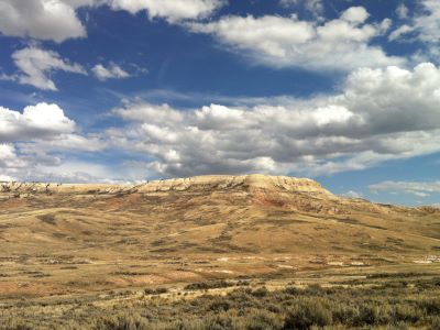

Wyoming's highest summit rises above vast glaciers, rugged alpine basins, and remote wilderness terrain, offering one of the most challenging mountaineering objectives in the contiguous United States.
How to Get There
From Pinedale (55 mi): Take Fremont Lake Road north from Pinedale, continue onto Forest Road 134 to Elkhart Park Trailhead, then follow the Pole Creek, Highline, and Titcomb Basin routes through the Wind River Range before ascending the glaciers and upper slopes leading to Gannett Peak.
Overview
The Gannett Peak region occupies the wild heart of Wyoming's Wind River Range, a landscape dominated by granite summits, sprawling glaciers, and immense roadless wilderness. Standing at 13,804 feet, the mountain is the highest point in the state and rises above some of the largest remaining glaciers in the American Rockies. Reaching its summit requires a demanding journey through alpine meadows, forested valleys, turquoise lakes, and dramatic mountain passes before climbers even reach the glacier-covered approaches that guard the upper mountain.
Unlike many famous western peaks that can be viewed from nearby highways, Gannett Peak remains remarkably remote. Most expeditions require several days of backpacking and mountaineering through the Bridger and Fitzpatrick Wilderness areas, where wildlife sightings may include elk, moose, bighorn sheep, and bears. The combination of isolation, spectacular scenery, and technical alpine terrain has earned the mountain a reputation as one of the most coveted summits in the Lower 48, rewarding successful climbers with sweeping views across hundreds of miles of Wyoming wilderness.
Overview
Gannett Peak is the highest mountain in Wyoming, rising to 13,804 feet in the heart of the remote Wind River Range. Unlike many state highpoints, reaching Gannett Peak requires a true wilderness expedition involving long backpacking approaches, glacier travel, and alpine climbing. Due to its isolation and technical challenges, Gannett is frequently regarded as the second-most difficult U.S. state highpoint after Denali.
The mountain sits deep within one of the largest wilderness areas in the lower 48 states and is surrounded by massive glaciers, rugged granite peaks, alpine lakes, and expansive backcountry terrain. Most climbers spend several days reaching the mountain before beginning the technical summit climb. Despite its relatively modest elevation compared to major international peaks, Gannett's remoteness and complex logistics make it one of the most challenging mountaineering objectives in the continental United States.
Summit Route Options
| Route | Difficulty | Overview |
|---|---|---|
| Gooseneck Route | Strenuous | The standard route involving glacier travel, snow climbing, and Class 3 scrambling near the summit. |
| East Side / Cold Springs Approach | Strenuous | Shorter overall approach with access through the Wind River Reservation. |
| Titcomb Basin Approach | Strenuous | The classic western approach through some of the most scenic terrain in the Wind River Range. |
| Dinwoody Glacier Variations | Advanced | Alternative glacier routes requiring more route-finding and mountaineering experience. |
Typical Gannett Peak Expedition
- Starting Point: Elkhart Park, Glacier Trail, or Cold Springs Trailhead.
- Summit Elevation: 13,804 feet.
- Expedition Length: Typically 5 to 6 days.
- Distance: Approximately 32 to 48 miles round trip depending on approach.
- Terrain: Wilderness trails, alpine basins, glaciers, snowfields, and exposed scrambling.
- Technical Skills: Glacier travel, crampon use, ice axe skills, and rope travel.
Most expeditions begin with multiple days of backpacking through the Wind River Range before establishing a high camp near the glaciers below Gannett Peak. Summit day typically includes travel across the Dinwoody or Gooseneck Glaciers, snow climbing, route finding, and exposed scrambling to reach the summit ridge.
Typical Expedition Itinerary
| Day | Activity |
|---|---|
| Day 1 | Backpack into the Wind River Range and establish first camp. |
| Day 2 | Continue approach toward Titcomb Basin or glacier camp. |
| Day 3 | Move to high camp and prepare for summit day. |
| Day 4 | Summit attempt of Gannett Peak. |
| Day 5 | Begin backpacking return toward trailhead. |
| Day 6 | Weather contingency or final hike out. |
Guided Climb Options
| Experience | Typical Price | Overview |
|---|---|---|
| 5-Day Guided Expedition | Approximately $3,000-$3,500 | The most common guided format for strong and experienced hikers. |
| 6-Day Guided Expedition | Approximately $3,500-$4,500 | Includes an extra weather or acclimatization day to improve summit chances. |
| Private Guided Expedition | $4,500+ | Customized schedule with lower guide-to-client ratios. |
| Porter-Supported Expedition | Additional $1,500-$2,000+ | Reduces pack weight during the long wilderness approach. |
The average cost of a guided Gannett Peak expedition is approximately $3,000-$4,000 per person. Additional costs may include shuttle transportation, tribal permits, porter services, lodging, and travel to Wyoming.
Major Challenges and Hazards
- Long Wilderness Approach requiring multiple days of backpacking.
- Heavy Packs with food, camping gear, and technical equipment.
- Glacier Travel involving crevasses and rope-team movement.
- Variable Weather including snowstorms during summer months.
- Remote Location with limited rescue access and long evacuation times.
- Technical Summit Terrain requiring scrambling and mountaineering skills.
Best Time to Climb
| Season | Conditions |
|---|---|
| Mid-June | Early season snow travel with stronger snow bridges. |
| July | Peak climbing season with favorable glacier conditions. |
| August | Most popular period with generally stable weather. |
| September | Cooler temperatures and fewer crowds but increased weather variability. |
Recommended Experience Level
Gannett Peak is best suited for experienced backpackers and aspiring mountaineers who are comfortable carrying heavy loads over long distances and traveling on snow and glaciers. While some guide services accept climbers without prior technical mountaineering experience, excellent physical fitness is essential due to the length of the expedition and the demanding summit day.
Information in this article is based on expedition descriptions, route information, and pricing published by Wind River Climbing Guides, The Mountain Guides, and Montana Alpine Guides, including information regarding approaches, glacier travel, expedition logistics, and guided climb pricing.
This article uses material from the Wikipedia articles and official public land information pages for Gannett Peak and Bridger-Teton National Forest, which are released under the Creative Commons Attribution-Share-Alike License 3.0.