.jpg)
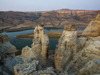
Series of badland areas characterized by rock outcroppings, steep bluffs, and grassy plains
General Information
Multiple Day: Per person, per day, no additional boat fee
$4.00 Adults (16 years and older)
$2.00 Children (7-15 years)
Free Children (under 7 years)
From Billings (223 miles): Follow Montana Ave and I-90BL E/1st Ave N to US-87 N/Hwy 312/Main St. Follow US-87 N to MT-19 N in Fergus County. Continue straight onto MT-19 N. Continue onto US-191 N. Continue on MT-66 N. Take Cow Island Trail to Ervine Ridge Rd in Blaine County.
From Great Falls (148 miles): Take 4th St N and River Dr N to US-87 N. Turn left onto US-87 N. Continue on State Hwy 236/Judith Landing Rd. Take Cow Island Trail to Ervine Ridge Rd in Blaine County.
Overview
Upper Missouri River Breaks National Monument protects 377,000 acres of badlands, cottonwood bottoms, and prairie along a wild 149-mile stretch of the Missouri River in central Montana, established by President Clinton on January 17, 2001. The area looks much as it did to Lewis and Clark in 1805, and Lewis and Clark were the first to document bighorn sheep here. It is a top destination for multi-day canoe trips.
Highlights
- Nez Perce history: the Nez Perce crossed the Missouri here in 1877, and the Cow Island Skirmish was the last fight before their surrender
- Wildlife: at least 60 mammal species and hundreds of bird species
- Landscape: sagebrush and short-grass prairie away from the willow-lined river
Things to Do
Explore the Wild and Scenic Missouri River Breaks
Upper Missouri River Breaks National Monument protects one of the most significant landscapes in the American West. Stretching along approximately 149 miles of the Missouri River in central Montana, the monument features dramatic badlands, towering sandstone cliffs, archaeological sites, wildlife habitat, and landscapes closely associated with the Lewis and Clark Expedition.
Float the Missouri River
One of the monument's most popular activities is floating the Wild and Scenic Missouri River. Visitors can travel through remote canyons, view historic landmarks, observe wildlife, and experience scenery that remains remarkably similar to what Lewis and Clark encountered in the early nineteenth century.
Visit Pompeys Pillar and Historic Landmarks
The monument contains numerous historic and cultural sites associated with Native American history, early exploration, and western settlement. Visitors can explore significant landmarks that helped shape the history of the Missouri River corridor.
Discover Lewis and Clark Expedition Sites
Many locations within the monument were documented by the Lewis and Clark Expedition. Interpretive sites throughout the region help visitors understand the challenges, discoveries, and experiences of the Corps of Discovery as they traveled through Montana.
Enjoy Wildlife Viewing
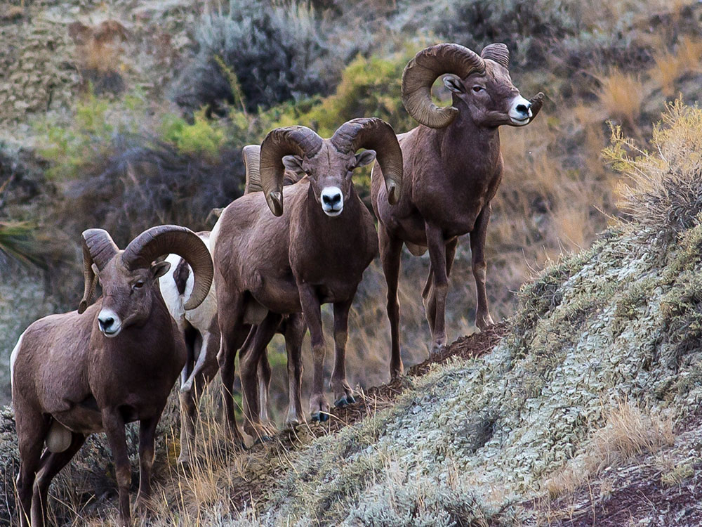
The monument provides habitat for bighorn sheep, elk, mule deer, pronghorn, coyotes, eagles, hawks, and numerous bird species. Wildlife viewing opportunities can be found along river corridors, prairie landscapes, and rugged canyon terrain.
Experience Primitive Camping and Backcountry Exploration
Visitors seeking solitude can enjoy dispersed camping, backcountry hiking, hunting, fishing, and exploring remote portions of the monument. The vast landscape offers exceptional opportunities to experience Montana's open spaces and natural beauty.
Top Trails
Hole-in-the-Wall Trail
Length: Approximately 0.5 miles round trip
Elevation Gain: Minimal
Difficulty: Easy
This short interpretive trail leads visitors to a natural sandstone arch and provides views of the surrounding Missouri River Breaks landscape. Informational signs explain the area's geology and cultural history.
Woodhawk Ridge Trail
Length: Approximately 1 mile round trip
Elevation Gain: Moderate
Difficulty: Easy to Moderate
The trail climbs to a scenic overlook featuring panoramic views of the Upper Missouri River, surrounding badlands, and expansive prairie landscapes.
Decision Point Overlook Trail
Length: Approximately 0.3 miles round trip
Elevation Gain: Minimal
Difficulty: Easy
This short walk leads to an overlook associated with the Lewis and Clark Expedition. Visitors can view the area where the expedition faced important navigational decisions during its journey west.
Slippery Ann Elk Viewing Area Trails
Length: Multiple short walking routes
Elevation Gain: Minimal
Difficulty: Easy
Located within the monument region, these trails provide opportunities to observe elk, especially during the autumn rut season when bugling bulls are often active in the area.
Missouri River Shoreline Routes
Length: Varies by destination
Elevation Gain: Minimal to Moderate
Difficulty: Easy to Moderate
Numerous informal routes along the river corridor allow visitors to explore historic campsites, geological formations, wildlife habitat, and scenic overlooks while experiencing the monument's rugged beauty.
This article uses material from the Wikipedia article and official pages for Upper Missouri River Breaks National Monument, released under the Creative Commons Attribution-Share-Alike License 3.0.
-1000.jpg)
.jpg)
-1000.jpg)
.jpg)
.jpg)
-1000.jpg)
.jpg)
-1000.jpg)
.jpg)
-1000.jpg)
.jpg)
-1000.jpg)
.jpg)
-1000.jpg)
.jpg)