Protected river system offering crystal-clear spring-fed waters, historic sites, and diverse recreational opportunities including canoeing, hiking, and wildlife viewing.
General Information
Visitor Centers: Open seasonally, typically 9am to 5pm
Some facilities may close in winter; check ahead for seasonal schedules
Fees apply for camping and certain guided tours (e.g., Round Spring Cave)
How to Get There
From Springfield, MO (130 mi): Take US-60 E through Mountain View, then follow MO-19 S to Winona and continue east on MO-106 to Van Buren and the park entrance.
Overview
The Ozark National Scenic Riverways is a sanctuary of flowing water and forested hills, preserving the pristine Current and Jacks Fork rivers in southeastern Missouri. Established in 1964 as the first national park dedicated to a river system, the park spans over 80,000 acres and offers a haven for outdoor enthusiasts. Visitors can paddle through spring-fed waters, explore historic mills like Alley Mill, or hike to hidden caves and waterfalls. The park’s geology is shaped by karst formations, resulting in a landscape dotted with springs, sinkholes, and underground streams.
Beyond its natural beauty, the park is rich in cultural history, from Native American sites to 19th-century homesteads. Seasonal ranger programs, cave tours, and interpretive trails provide insight into the region’s ecological and historical significance. Whether you're floating downriver in a canoe, casting a line for smallmouth bass, or camping under the stars, Ozark National Scenic Riverways offers a timeless connection to the rhythms of nature and the heritage of the Ozarks.
Things to Do
Float the Current and Jacks Fork Rivers
Ozark National Scenic Riverways is best known for its crystal-clear rivers, which are among the finest float streams in the Midwest. Visitors can enjoy canoeing, kayaking, tubing, and boating while experiencing towering bluffs, gravel bars, springs, and abundant wildlife along the Current and Jacks Fork rivers.
Visit the Major Springs
The park protects some of Missouri's most impressive natural springs, including Big Spring, Alley Spring, Round Spring, and Blue Spring. These springs produce millions of gallons of water daily and feature scenic overlooks, historic structures, and excellent photography opportunities.
Explore Historic Sites
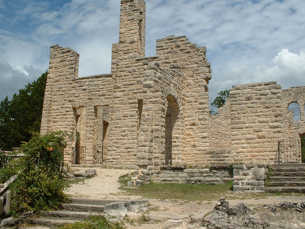
Visitors can tour historic landmarks such as Alley Mill, one of Missouri's most photographed buildings, and learn about the region's cultural history through preserved mills, homesteads, and interpretive exhibits located throughout the park.
Top Trails
Big Spring Trail
Length: Approximately 1.0 mile loop
Elevation Gain: Minimal
Difficulty: Easy
This scenic trail offers views of Big Spring, one of the largest freshwater springs in the United States. Interpretive signs explain the area's geology, history, and ecology while providing beautiful river and spring views.
Round Spring Trail
Length: Approximately 0.8 mile loop
Elevation Gain: Approximately 150 feet
Difficulty: Easy to Moderate
The trail circles the impressive Round Spring, passing through Ozark forest and providing viewpoints of the spring basin and surrounding karst landscape.
Sources: National Park Service official Ozark National Scenic Riverways information, including river recreation, major springs, historic sites, and trail resources. [1](https://www.nps.gov/ozar/index.htm) Additional visitor information, spring highlightsating opportunities, and trail details verified through National Park Service visitor guides and recreation resources. [2](https://www.nps.gov/ozar/planyourvisit/index.htm) [3](https://www.nps.gov/ozar/planyourvisit/hiking.htm)
This article uses material from the Wikipedia articles and official tourism pages for the Ozark National Scenic Riverways, which are released under the Creative Commons Attribution-Share-Alike License 3.0.